HOT style
|
Humanitarian HDM CartoCSS | |
|---|---|

| |
| Authors: | Yohan Boniface,Anne Mattler,Jaakko Helleranta,Will Skora and other contributors |
| Slippy map: | openstreetmap.org |
| Style website: | hotosm/HDM-CartoCSS GitHub |
| Style license: | CC0 1.0 |
|
CartoCSS project focused on the Humanitarian Data Model | |
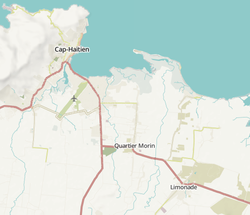
Humanitarian map style is one of the featured tiles available on openstreetmap.org. To see it click on the right icon "Layers" and select "Humanitarian". It can also be browsed at map.hotosm.org . The servers for tile rendering and storage are provided by OpenStreetMap France. The stylesheet was designed by Yohan Boniface and others in the Humanitarian OSM Team, and is available on github with a CC0 license.
This map style is focused on resources useful for humanitarian organizations and citizens in general in emergency situations, highlighting POIs like water resources (water wells, manual pumps, fire hydrants...), light sources, public buildings, social buildings, roads quality, etc. The colors used are light, so people can print them and then draw and write on top of the map easily without getting confused too much (this is a useful feature for humanitarian organizations to update the information on the printed map in situations like a earthquake, for example).
See also
- OSM Humanitarian icons - collection of used icon symbols
External links
- openstreetmap.org OpenStreetMap main site with the layer Humanitarian shown.
- Compare side-by-side Humanitarian style and OpenStreetMap Standard style.
- Announcement of Humanitarian style on the HOT blog
| ||||||||||||||||||||||||||