Status: In progress, recruiting helpers & team members
About
For almost 1000 years, the Holy Roman Empire held together a crazy patchwork of kingdoms, principates, and transformed Europe as we know it. In addition, attempts to map this patchwork have created what are possibly the most intricate boundary maps the world has ever seen.
The primary goal of this project is to create a high temporal and spatial resolution evolution of the Holy Roman Empire. While this will show some expansion and contraction over time, this map will likely show an ever-shifting composition of the empire over time.
A secondary goal of this project is to assemble a team of volunteers to work with a shared purpose and coordination on a large-area, boundary-focused mapping effort.
Humbly ; ), this project is going to build the best, coolest, most zoom-able, linked to open data, most impressive map of the Holy Roman Empire on the web. The list of Holy Roman Empire states has around 1700 rows. If you account for boundary changes requiring multiple relations for each state, it easy to imagine that the entire history of the HRE might involve over 2500 boundary relations. So, if you're into mapping and 1-5,000 piece puzzles, this is the project for you!
Approach
The general strategy here – which is open for discussion and adjustment – is this:
Put up a sample approach and hope that people with more expertise and prior mapping experience on the Holy Roman Empire will correct it.
Email prior mappers and invite them to review this approach.
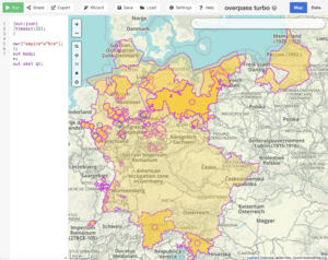
Assume that there already are quite a few HRE relations on OHM.
Agree on shared tagging standards and baseline quality bar for this multi-hierarchy empire.
Identify missing HRE elements and divide the work among interested mappers.
Create chronology relations whereever possible.
Invite others to drill down into detail to map additional elements per HRE entity.
Ensure that all OHM elements – chronology relations - are represented in associated Wikidata entries with OHM relation ID property (P8424) statements.
Team Members & Coordination
Requirements
A desire to learn how to work with borders and border relations.
Willingness to use / learn JOSM for editing in OHM. Nothing against iD, but JOSM is much better suited to work with large-area boundary mapping.
An interest in working with Wikidata.
Patience, patience, patience. We're likely to make mistakes, so we'll need to make many revisions.
Volunteers
To sign up, please just add your name here and start
There's a project tracking Google spreadsheet here. I hope that's ok, as it seemed a bit unwieldy for a Wiki, but we can certainly transfer it somewhere else if it's not workable for the team.
Mapping steps
Sign up for the states they'd like to map
Double-check that the state doesn't already exist in OHM
If so, record the relation link and flag it for validation.
If not, map away, and then record the relation number & link, and flag it for validation by marking "Ready" in the Validation column.
Validation steps
Ensure all tags are on the relation
Verify source tags as being ok for OHM
Double-check dates
Make sure the relation belongs to the chronology relation for that state, as well as appropriate higher-level relations (e.g. circles) as subareas
Mapping Scope
The primary focus of this project, to start, is on mapping the boundaries of the component states of the HRE.
Yes, you can map a birds-eye view!
Even better, however, would be to map the cities of these states. Or, at a minimum, to map one item... like a castle grounds... per state from the era of that state.
UNDER DISCUSSION: Boundary relations, other relations, admin_level, and place
A few things are quite clear: admin_level has its limits and the range of administrative relationships in the HRE extends beyond those limits.
Tagging for the renderer is part of the consideration here. Representing the HRE visually is as challenging as representing it logically/topologically. admin_level is one of the primary tags used by our stylesheets to differentiate labels and may be more so in the future. This is contrary to the rule of "don't tag for the renderer" from OpenStreetMap, but is consistent with the practice of doing exactly that in some cases.
We may want to think very carefully about what relations should have an admin_level and what should be modeled without an admin_level. These non-admin_level relationships can be overlapping to whatever degree is required to show their full range of memberships.
Here is one attempt, as a thought exercise - please think about how the Peace of Westphalia changed things and whether those changes should or should not be reflected in our modeling.
Entities with sovereign territory outside of the HRE: create the relationship for the entire entity, but only include the portion inside the HRE as its member.
Notes:
Certain types of places might exist at different `admin_level` values. The place type is not an assurance of an position in the imperial hierarchy.
Tagging dates: EDTF is your friend
Please be sure to use EDTF date keys, such as `start_date:edtf` and `end_date:edtf`
For example, because of the way our renderer works, and because we do not want 2 shapes to show up on the same day, we may need to do something like this:
end_date=1033-04-19
end_date:edtf=1033-04-20
The first date guarantees that on the actual ending date, this entity will no longer be there.
For uncertain and approximate dates, use a `~` after the date.
In the future, we hope to have this automated so that you'll only need to enter 1 start and 1 end date. For now, we'll need it done this way.
Project-specific tagging
Querying for this tag should yield all of the OHM entities involved with the project.
empire=hre
Source tagging
Appropriately identifying the sources and redistribution policies for OHM-hosted data is critical for its use as a distribution source for consolidated historical GIS information. As such, all ways and relations associated with this import should be marked with the following tags:
Tagging sources
Notes about:
Looking for CC0 maps to trace
Adding appropriate license tags where necessary & where
`license=CC-1.0` uses the SPDX abbreviation for the Creative Commons CC0 "No Rights Reserved" license.
Wikimedia tagging
Linking objects in OHM to related entities in Wikidata and Wikipedia will enhance the richness of the data in both places and make OHM's data part of a wider fabric of Linked Open Data across the internet.
Wherever possible, please tag all objects with appropriate wikimedia tags:
There is a variety of academically-created geodata related to the HRE on the web. Please avoid any viral licenses, such as CC BY-SA or ODbL, and be sure to cite your sources as richly as possible, even if attribution (BY) is not required.
There are plenty of very interesting and detailed maps to be found of Wikimedia Commons. There are two key concerns with these maps that need to be considered when using these as a source for tracing:
Copyright assertions. If you trace a vector map that includes a copyright mark, your derived trace should respect that copyright. You will also, however, need to make an evaluation of whether that stated copyright is valid or respects its sources. For example, a vector map based on an illustration from a book should respect the copyright of that book. Sometimes this is not the case on Wikimedia Commons.
Source assertions. Very often on Wikimedia Commons, there are the following suspicious source claims:
No source cited. Thus, there is no verifiability for the map.
Own work. Thus, you'll find detailed maps of old boundaries with no source references.
Ex-post sourcing. A source added after the creation of the map, sometimes by someone who didn't create the map. Again, it is unclear if this is a valid practice.
Misattribution. Sources that bear no resemblance to the map depicted.
This is a great work and sourced, but is CC BY-SA. Because we can get the same info from other sources, why burden ourselves with a share-alike license?
Incorrect license mark:
Holy Roman Empire at the Golden Bull of 1356: This is a great work, but has a CC BY-SA license, but there are no sources. How is this possible? How could it actually be "own work"? That's not a source we want to cite.


