Puerto Rico Projects/Puerto Rico Legal Boundaries Import
Proposal
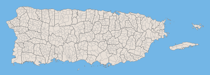
Replace existing coastline and municipios boundaries with official boundaries produced by the PR Planning Board. Also include barrios boundaries. Remove non-legal TIGER sourced administrative boundaries.
Introduction
The municipios (similar to a county) boundaries originally imported into OSM are from the US Census TIGER data. The problem is that these are not the official boundaries for municipios in Puerto Rico and they differ from the official ones. On top of that, there are several municipios missing; reason is unknown.
The legal boundaries in Puerto Rico are produced by the Puerto Rico Planning Board (Junta de Planificación) by Law 68, May 7, 1945. The last edition was released in 2009. These boundaries do not extend further out into the sea as in the case of the current boundaries in OSM's database. Therefore, an import of these official boundaries would mean an import of the island's coastline as well.
The import of the Planning Board's legal boundaries will replace existing municipios and will add barrios which currently are not in OSM's database. Barrios are a smaller legal administrative boundary just below the municipios hierarchy. In OSM, other existing non-legal administrative boundaries introduced from the original TIGER import are to be removed.
Data
The data to be uploaded will be a single .osm file representing a single line layer. It will include lines for municipios and barrios.
License (source data)
The source legal boundaries layer is public domain and it's produced by the Puerto Rico Planning Board (Junta de Planificación de Puerto Rico).
Municipal Boundary Tags
| Key | Value |
|---|---|
| admin_level=* | 6 |
| boundary=* | administrative |
| source=* | Junta de Planificación de Puerto Rico |
| source:en=* | Puerto Rico Planning Board |
Barrios Boundary Tags
| Key | Value |
|---|---|
| admin_level=* | 8 |
| boundary=* | administrative |
| source=* | Junta de Planificación de Puerto Rico |
| source:en=* | Puerto Rico Planning Board |
NOTE: Barrios were imported with admin_level=* of 8, but changed to a value of 9 on the 15th of september 2018.
Import process
The import process involves manual work before and after the actual import of the .osm file containing the legal boundaries.
Pre-Upload workflow
- Manually delete TIGER sourced non-legal administrative boundaries that are not municipios. Use JOSM with its built-in validation.
- Manually delete TIGER sourced municipios boundaries. Use JOSM with its built-in validation.
Upload workflow
- Import fabricated .osm file for municipios and barrios using Bulk_upload.py.
Dedicated user account
The import process outlined above needs to be carried out with a dedicated user account. Follow this pattern for creating a user account name just for this project:
<username>_prboundaries
So for user igeopr, the name for the import account would be:
igeopr_prboundaries
Timeline
- Proposal review. October 10 - October 15, 2014
- Incorporate feedbacks and test import process on the municipio of Culebra. October 16 - October 20, 2014
- Complete the whole import process. January 8, 2015.
- Barrios Boundary Tags were modified from "admin_level=8" to "admin_level=9" to improve compatibility with other US jurisdictions and assumptions made by geocoding services. September 15 2018.
Current status
The import was completed, project was finished on January 8, 2015. Contributors: vramirez122000 ernestocd igeopr
