South East London Mapping Party
South East London Mapping Party is a past event which took place 26th/27th January 2008
TODO: swap this for a little "what happened" description
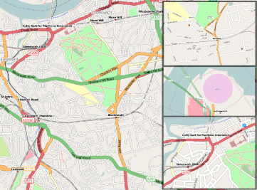
Come map the wide streets of Blackheath, absorb the culture of Lewisham, discover what difference a datum makes in Greenwich - The OpenStreetMap South East London Fill in the Blanks Mapping Party, Saturday 26th January 2008.
Details
South-East London, looks deceptively complete when zoomed out. A lot of streets are tagged highway but without a name, presumably because they've been sketched in from Yahoo! Aerial Imagery (incorrectly). We need to do a proper survey phase to map in the street names and point-of-interest data.
The aim of the SE London Mapping party is to fill in as many road names and descriptions as we can.
Saturday
- When: Saturday 26th January 2008, 10am (or just come to pub after)
- Morning: Cafe Uno (10am), Blackheath, SE3 0BN, map
- Lunch: 13:00 - 14:00 chez nickb, SE3 0EU, provided by ZXV
- Pub: 18:00 Hare and Billet, SE3 0QJ, map
Sunday
- When: Sunday 27th January 2008, 10am, Cafe Uno (10am), Blackheath, SE3 0BN, map - To plan areas to map
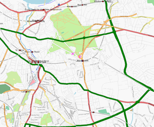
Traces of areas done Sat can be seen at: Sat traces
What to bring?
GPS will not be essential for this mapping party, as a lot of the work will involve filling in details onto existing maps. Digital cameras will be useful for taking photos of street names, which is helpful because it proves that we really mapped the streets ourselves. Printouts of OSM maps that can be annotated with street names will work well. We'll have WiFI at lunch time and for the tagging sprint, so bring along your laptop.
Getting Here
- By train from Blackheath or Waterloo East, about 20 mins.
- By car - limited metered parking is available in Blackheath Village .
Contact
- user:nickb (nick blacksworld.net) 07835054292
Who's coming?
Sat
- user:nickb
- User:Steve Can do sat and sun
- Thomas Wood (Edgemaster) possibly Saturday, no laptop.
- TomH will try and make it if Liverpool Street isn't in too much chaos that weekend
- Alex McLean is based in Brockley and will try to make it -- is there much I could do on foot?
- lots! Steve 14:51, 18 January 2008 (UTC)
- Smsm1 will coach it down Friday night and back home on Saturday night, using magabus.
- steve8 should be there Saturday, possibly Sunday too.
- Nick W possibly, depending on how work goes.
- Jodi Maybe.
- Firefishy
- NickH
- user:SchematicMapper Can make Saturday (am hopefully) and pm and Sunday am, not sure how I will find you since I haven't met anyone yet though! Anything / distinguishing clothing I should look out for? I'd be the one looking lost (how ironic)
Sun
- TomChance (can only do Sunday if anyone's interested)
- User:Steve Can do sat and sun
- TimSC Sunday
- NickH
Planning mapping
Nickb will print out a load of OSM map sheets for the area and bring them along on Saturday morning - then people can pick the areas they would like to map. It would make sense for people on foot to do the areas close to Blackheath Village (the start, middle and end points) and people on bikes to go further afield, into Greenwhich of Lewisham, or even further east.
Harry Wood was fiddling with Kosmos to show unnamed streets as sketchy lines (reminiscent of the old Osmarender unwayed segments rendering) This is useful for printing prior to surveying.


