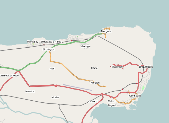
South East Tip
The South-East Tip Mapping Party
The South-east of England includes towns and villages like Canterbury, Ramsgate, Whistable, Dover and Folkestone. As well as being home to some of the UK's most beautiful countryside, this area is a gateway to the UK - hosting the busy ports of Dover and Folkestone.
OSM has some coverage of these areas - but not nearly enough. Come and help make a free map for the far South East of England.
Outcome
When
The weekend of the 12th - 13th May 2007.
Where
We'll be based in Canterbury, a central location from where we can survey the paths and roads of Kent. You can see the area here on the slippy map.
Saturday Morning - Meet in Cafe Nero, 4 High St, Canterbury, Kent, CT1 2SA at 10:00am- here on the slippy map (Its on the main High Street).
Saturday Evening - Meet at Ye Old Beverly at 6pm to review the days progress and sample the local wares
Getting there
By Train - There are regular train services from London Waterloo to Canterbury. Canterbury is only 22 minutes by train from Ashford International, which has connecting services to continental Europe, via Eurostar. There are also regular trains from Dover ferry port.
By Road - Canterbury is less than 45 minutes drive from both the M2 and M20 motorways, and around 1.5 hours drive from London.
Who's Going?
Nick B
Gregoryw (12th only) I can provide cycling advice for the area, if anybody comes down with a bike. I can also offer wired Internet connectivity on the 12th.
TimSC (Primarily on my bike, may do Canterbury on the 12th and near Ashford on 13th). Result: Sat: I did the Ramsgate town centre and some of the residential area of East Cliff. Sun: Mapping and tagging - managed to clear my backlog!
pray4mojo (12th only)
TomH (probably 12th only)
Contact
Contact Nickb for more details
Outreach
http://www.canterbury.co.uk - contacted by nickb
http://www.ramblers.co.uk - Nickb contacted the Kent group
http://kent.lug.org.uk/klug/ - Mailing list contacted by nickb
