Uploads by B-unicycling
Jump to navigation
Jump to search
This special page shows all uploaded files.
| Date | Name | Thumbnail | Size | Description | Versions |
|---|---|---|---|---|---|
| 15:44, 22 May 2024 | Ringfort.svg (file) |  |
29 KB | hashed line, more similar to how they are represented on old maps, less looking like a darts board | 2 |
| 23:49, 23 March 2024 | Mobile-library2.svg (file) |  |
6 KB | required 14x14 size | 2 |
| 13:58, 20 March 2024 | Mobile-library.svg (file) |  |
5 KB | cleaned up | 2 |
| 12:33, 22 February 2024 | Clapper-bridge.png (file) |  |
11 KB | {{Information | description=schematics of a clapper bridge | source=own | date=2024-02-22 | author=b-unicycling | other_versions= }} | 1 |
| 21:59, 7 February 2024 | Permission for NMS Open Data usage in OSM 240206.pdf (file) |  |
24 KB | {{Information | description=Waiver from the National Monuments Service of the Republic of Ireland for OpenStreetMap to use their data | source=National Monuments Service | date=2024-02-06 | author=Gareth John | other_versions= }} | 1 |
| 22:59, 30 January 2024 | Kilvey crannóg Esri.png (file) | 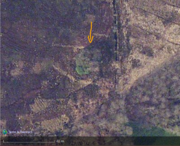 |
537 KB | {{Information | description=Crannóg in Cor Bog on Esri Clarity | source=Esri | date= | author= | other_versions= }} | 1 |
| 22:56, 30 January 2024 | Kilvey crannóg.png (file) | 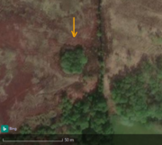 |
228 KB | {{Information | description=Crannóg in Cor Bog, Co. Monaghan | source=Bing | date=2014-2019 | author= | other_versions= }} | 1 |
| 22:53, 30 January 2024 | Annagheane Crannóg.png (file) | 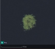 |
79 KB | {{Information | description=Crannóg in Laurel Lough, Co. Monaghan | source=Bing | date= | author= | other_versions= }} | 1 |
| 22:48, 30 January 2024 | Brankill crannóg Esri.png (file) | 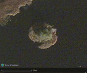 |
315 KB | {{Information | description=Crannóg in Kilconny Lough on Esri | source=Esri | date= | author= | other_versions= }} | 1 |
| 22:46, 30 January 2024 | Brankill crannóg Bing.png (file) | 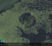 |
349 KB | {{Information | description=Crannóg near the Western shore of Kilconny Lough on Bing imagery | source=Bing | date= | author= | other_versions= }} | 1 |
| 22:40, 30 January 2024 | Parisee crannóg.png (file) | 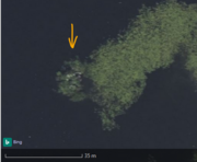 |
154 KB | {{Information | description=Crannóg in Parisee Lough, Co. Cavan | source= Bing | date= | author= | other_versions= }} | 1 |
| 22:35, 30 January 2024 | Drumconlester crannóg.png (file) |  |
118 KB | {{Information | description=Crannóg in the townland of Drumconlester, Co. Cavan | source=Bing | date=2024/01/30 | author= | other_versions= }} | 1 |
| 12:52, 25 April 2023 | Milk churn.svg (file) |  |
4 KB | actual svg, shape fits better into a square | 4 |
| 12:48, 25 April 2023 | Milk churn stand.svg (file) |  |
4 KB | actual svg, shape fits better into a square | 2 |
| 13:41, 10 January 2023 | Smr example Dermot & Grania's bed.png (file) |  |
16 KB | site_type replaced by archaeological_site | 2 |
| 13:38, 10 January 2023 | Garryard enclosure.png (file) | 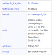 |
12 KB | site_type replaced by archaeological_site | 2 |
| 12:09, 11 October 2022 | Census2015.jpg (file) | 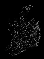 |
30 KB | 1 | |
| 15:29, 11 September 2022 | BWO map Crannoge.png (file) |  |
386 KB | 1 | |
| 22:51, 5 September 2022 | Dog tie-up.png (file) | 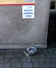 |
4.63 MB | 1 | |
| 08:57, 2 September 2022 | Animal hitch.svg (file) |  |
19 KB | better quality | 2 |
| 10:37, 23 August 2022 | Steps stile Castlefield.png (file) |  |
4.73 MB | 1 | |
| 08:59, 6 August 2022 | Thatcher name Matty Kelly.png (file) |  |
563 KB | 1 | |
| 20:18, 25 July 2022 | Macgiollophadraig.svg (file) |  |
221 KB | {{Information | description=Trailmarker for the MacGhiollaphádraig Way in Ireland | source=created from photograph | date=18-07-2022 | author= | permission= | other_versions= }} | 1 |
| 20:48, 18 July 2022 | MacGiollophadraig Way.png (file) |  |
162 KB | {{Information | description=Trail marker symbol for the MacGiollaphádraig way from Durrow in Co. Laois to Gattabawn in Co. Kilkenny | source=created from photograph | date=2022-07-18 | author=b-unicycling | permission= | other_versions= }} {{Used outside the Wiki|description= <some link> }} Category:Trail markings | 1 |
| 18:49, 27 June 2022 | Baby blue arrow Ireland.svg (file) |  |
21 KB | {{Information | description=Light blue arrow used for hiking trails in Ireland | source=created by author from photograph | date=2022-06-27 | author=b-unicycling | permission= | other_versions= }} {{Used outside the Wiki|description=https://hiking.waymarkedtrails.org}} | 1 |
| 18:15, 27 June 2022 | Trailkilkenny purple arrow.svg (file) |  |
20 KB | {{Information | description=purple arrow used in Co. Kilkenny to mark hiking and walking trails | source=created by author from photograph | date=2022-06-27 | author=b-unicycling | permission= | other_versions= }} {{Used outside the Wiki|description=https://hiking.waymarkedtrails.org}} | 1 |
| 18:12, 27 June 2022 | Trailkilkenny green arrow.svg (file) |  |
20 KB | {{Information | description=green arrow used in Co. Kilkenny to mark walking and hiking trails | source=created by author | date=2022-06-27 | author=b-unicycling | permission= | other_versions= }} {{Used outside the Wiki|description=https://hiking.waymarkedtrails.org}} | 1 |
| 18:03, 27 June 2022 | Trailkilkenny red arrow.svg (file) |  |
21 KB | {{Information | description=red arrow used throughout Co. Kilkenny to mark walking and hiking trails | source=created by author | date= | author=b-unicycling | permission= | other_versions= }} {{Used outside the Wiki}} | 1 |
| 09:03, 20 June 2022 | 2022-06-18 qr-code.png (file) |  |
1.18 MB | 1 | |
| 17:41, 7 June 2022 | Stradbally mass rock walk symbol.svg (file) |  |
102 KB | {{Information | description=one of the two symbols used along the Mass Rock Walk in Ougheval Wood, Co. Laois | source=created by author | date=2022-06-07 | author=b-unicycling | permission=CC-0 | other_versions= }} | 1 |
| 18:14, 29 April 2022 | Molly the puca.png (file) |  |
6 KB | 1 | |
| 18:12, 29 April 2022 | Kilree Round tower.png (file) |  |
13 KB | 1 | |
| 18:03, 29 April 2022 | Smr example holy well Toberbunny.png (file) |  |
10 KB | 1 | |
| 18:02, 29 April 2022 | Toberbunny Dublin Esri.png (file) |  |
939 KB | 1 | |
| 17:59, 29 April 2022 | Historic environment viewer smr record.png (file) |  |
1.03 MB | 1 | |
| 13:21, 13 March 2022 | Opening hours autism.jpg (file) | 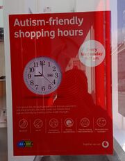 |
635 KB | 1 | |
| 20:01, 23 January 2022 | Laundromat Castlecomer Road.jpg (file) | 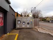 |
397 KB | 1 | |
| 18:28, 23 January 2022 | Rounded.png (file) |  |
8 KB | changed to black and white for better contrast | 2 |
| 18:25, 23 January 2022 | Pointed.png (file) |  |
7 KB | changed to black and white for better contrast | 2 |
| 18:24, 23 January 2022 | Ogee.png (file) |  |
7 KB | changed to black and white for better contrast | 2 |
| 18:22, 23 January 2022 | Double-ogee.png (file) |  |
9 KB | 1 | |
| 18:16, 23 January 2022 | Top-triangle.png (file) |  |
1 KB | 1 | |
| 17:00, 23 January 2022 | Laundromat payment2.jpg (file) |  |
1.73 MB | 1 | |
| 20:48, 12 January 2022 | Octagonal.png (file) |  |
14 KB | 1 | |
| 20:47, 12 January 2022 | Hexagonal.png (file) |  |
11 KB | 1 | |
| 16:16, 11 January 2022 | Circle.png (file) |  |
10 KB | 1 | |
| 16:13, 11 January 2022 | Diamond.png (file) |  |
2 KB | 1 | |
| 16:12, 11 January 2022 | Rectangular.png (file) |  |
1 KB | 1 | |
| 18:57, 6 January 2022 | Cillin in Kilcomeragh, Co. Waterford.png (file) |  |
156 KB | 1 | |
| 18:52, 6 January 2022 | Cillin example Killinny, Co. Clare.png (file) |  |
151 KB | 1 |