Uploads by Dieterdreist
Jump to navigation
Jump to search
This special page shows all uploaded files.
| Date | Name | Thumbnail | Size | Description | Versions |
|---|---|---|---|---|---|
| 10:21, 3 February 2025 | Railway-station-tagging.svg (file) |  |
303 KB | unusued area:railway removed and restored railway=station on the area | 16 |
| 10:58, 8 November 2024 | Share green.jpg (file) |  |
7.93 MB | {{Information | description=A picture of a pedestrian crossing where cars turning right share the green with pedestrians (Via Cristoforo Colombo at Navigatori, Rome, Italy) | source=own work | date=2024-07-06 | author=dieterdreist | other_versions= }} | 1 |
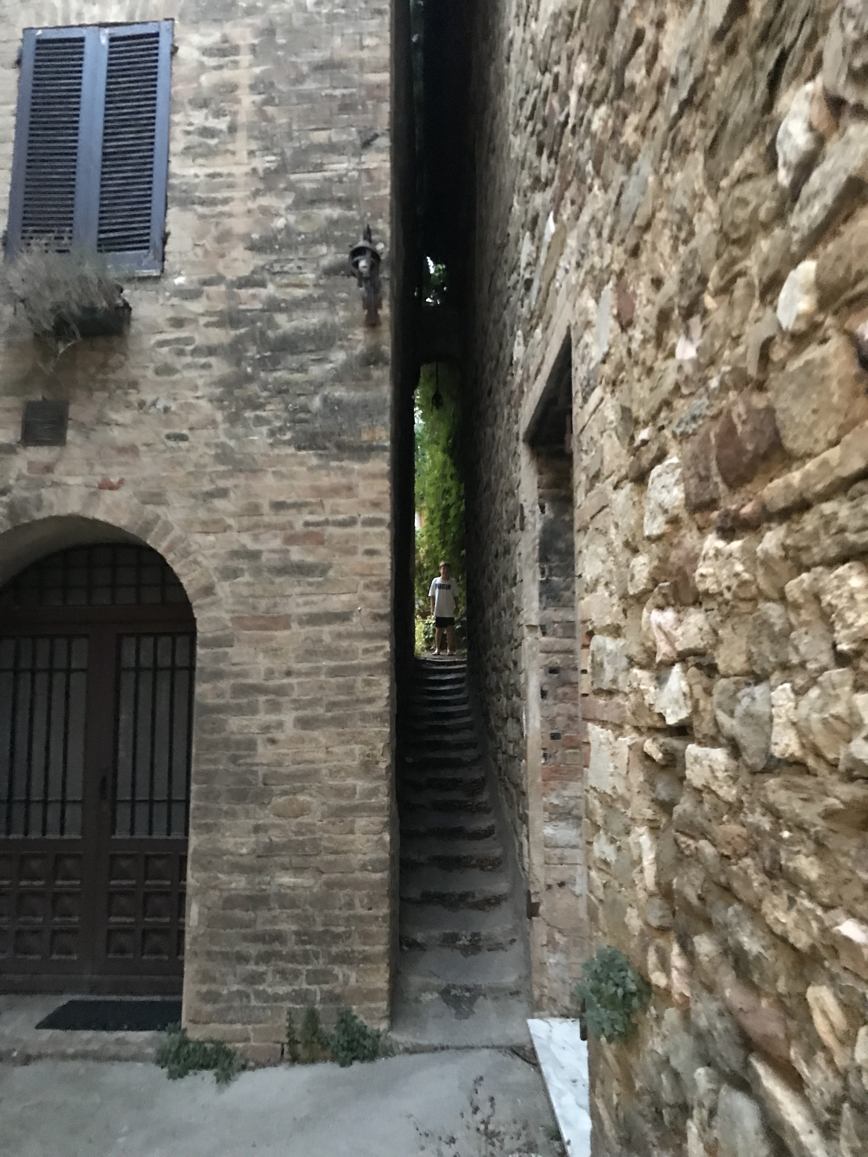
| 13:03, 22 August 2024 | Very narrow public passage between two buildings in Bevagna,Umbria,Italy.jpg (file) |  |
2.21 MB | {{Information | description= | source= | date=2024-08-14 | author=dieterdreist | other_versions= }} | 1 |
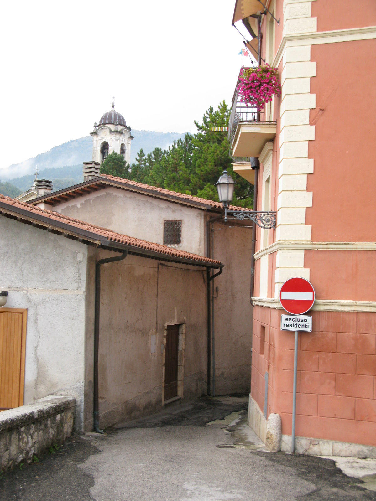
| 12:30, 22 August 2024 | Alley in Contigliano RI,Italy.JPG (file) |  |
6.19 MB | {{Information | description= | source= | date=2010-06-29 | author=dieterdreist | other_versions= }} | 1 |
| 12:24, 22 August 2024 | Alley at Civitella RI,Italy.JPG (file) |  |
514 KB | {{Information | description= | source= | date=2010-10-14 | author=dieterdreist | other_versions= }} | 1 |
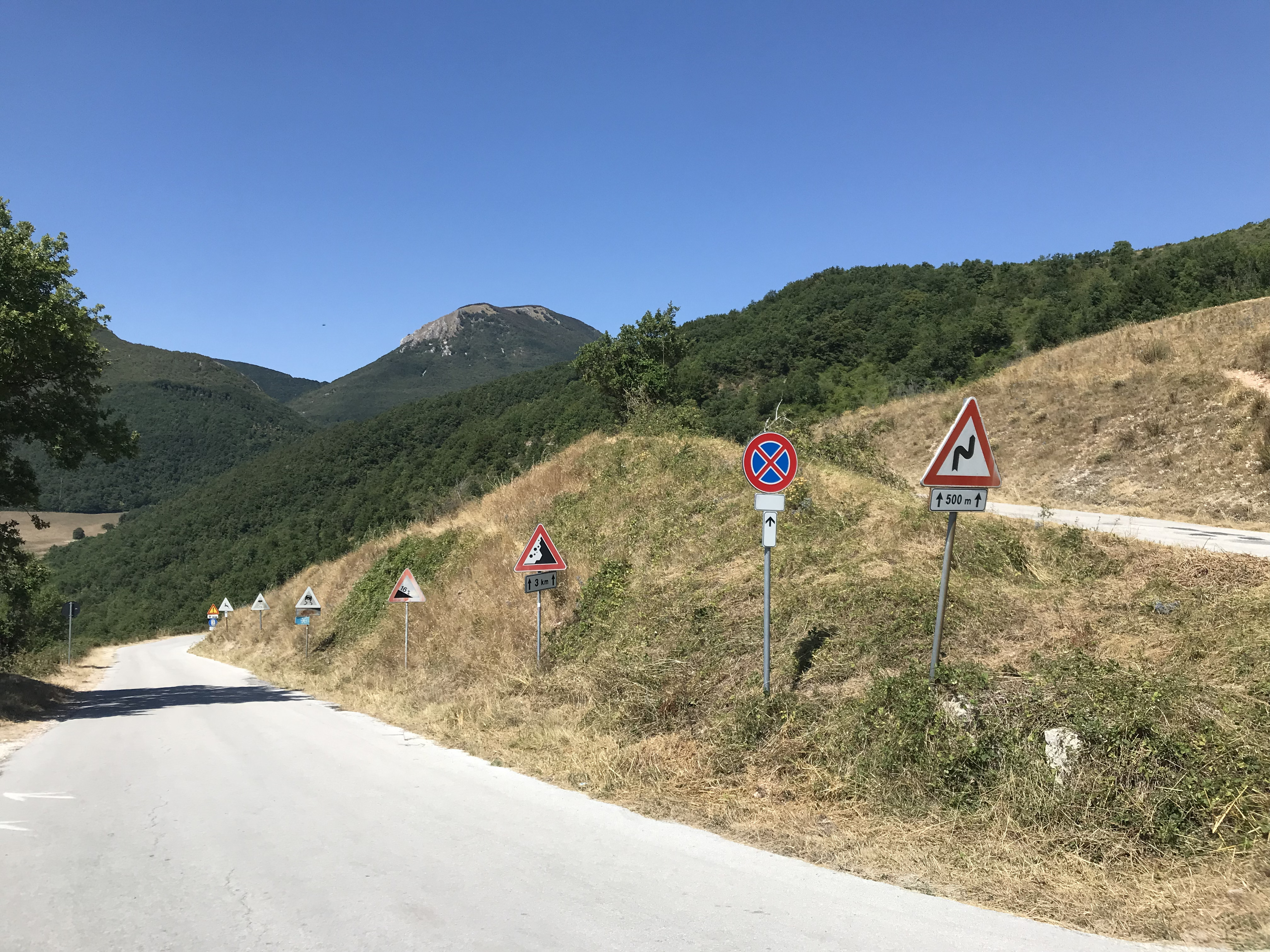
| 17:13, 19 August 2024 | Traffic signs in Elcito,Marche,Italy.jpg (file) |  |
3.43 MB | {{Information | description=Traffic signs in Elcito, Marche, Italy | source=own Image | date= | author=dieterdreist | other_versions= }} | 1 |
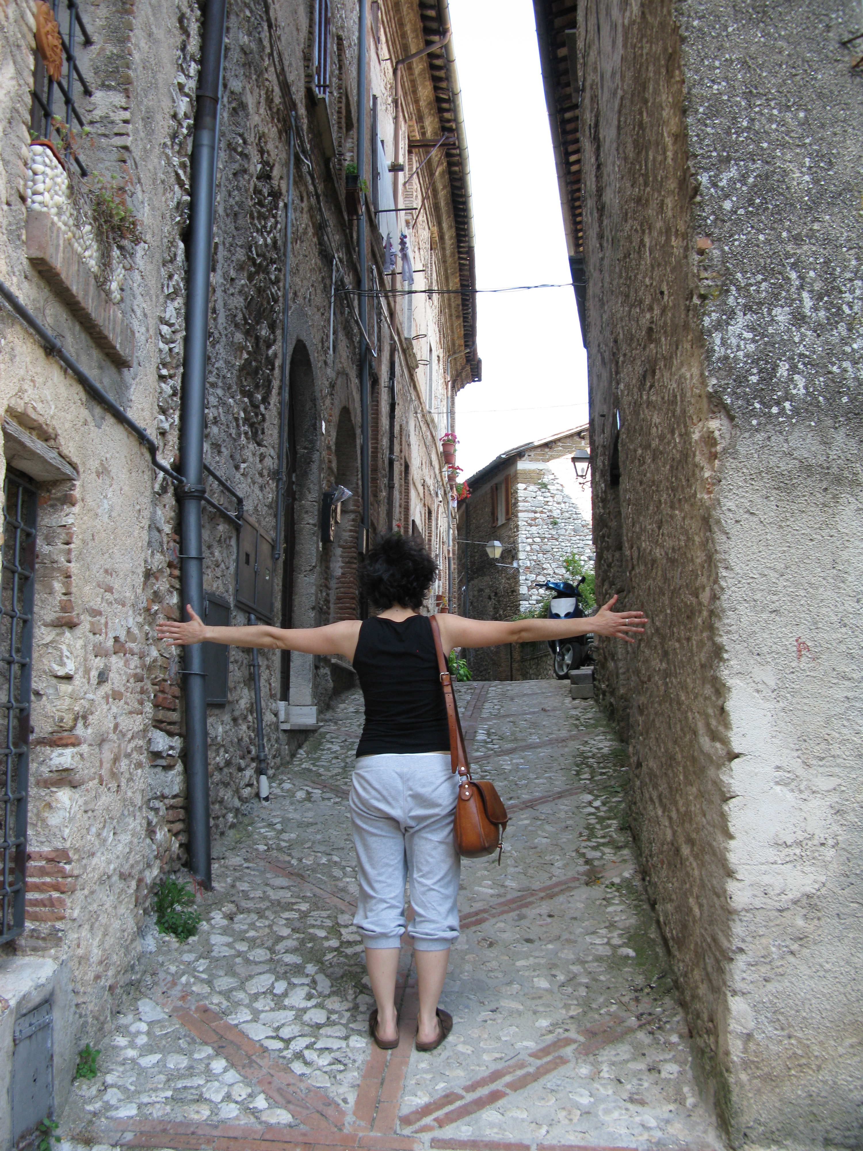
| 07:34, 13 August 2024 | Alley-in-sarnano-italy.jpeg (file) |  |
4.16 MB | {{Information | description=An alley in Sarnano, MC, Italy. Quite narrow but legally accessible to motor vehicles | source= | date= | author=dieterdreist | other_versions= }} | 1 |
| 09:52, 15 April 2024 | Railway=Station Tagging Node.svg (file) |  |
7 KB | landuse=railway extending on all railway landuse | 3 |
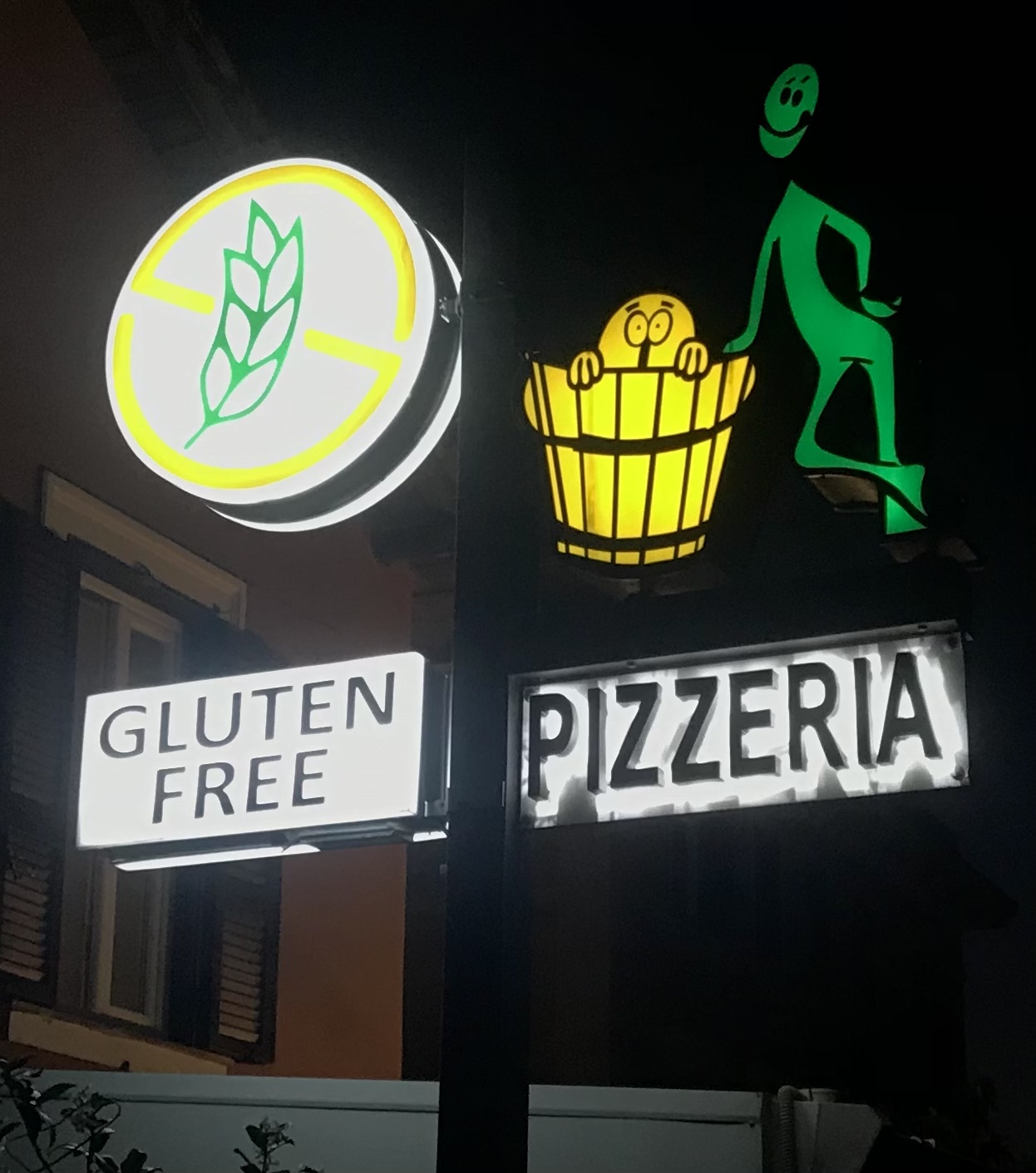
| 20:53, 9 October 2023 | Gluten free pizza.jpg (file) |  |
327 KB | {{Information | description=a neon sign for a pizzeria advertising gluten free | source= | date=20231005 | author=dieterdreist | other_versions= }} | 1 |
| 08:03, 1 July 2021 | BBF778DE-0119-4E36-94FD-18C52525ACCD.jpeg (file) |  |
5.2 MB | Modern amphitheatre in Percile, Lazio, Italy | 1 |
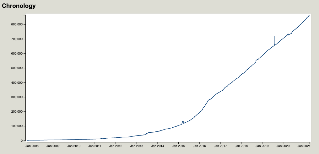
| 08:15, 9 April 2021 | Level use.png (file) |  |
36 KB | Usage chronology of the level tag according to taginfo.osm.org until April 9, 2021 | 1 |
| 09:44, 5 October 2020 | GoMap-1.9.6.png (file) |  |
1.05 MB | data in screenshot is by OpenStreetMap contributors | 1 |
| 09:07, 5 October 2020 | GoMap app icon-1024.png (file) | 43 KB | GoMap App Icon by Github user Binette https://github.com/Binnette | 1 | |
| 09:49, 6 September 2019 | Gas pipeline marker.jpg (file) |  |
6.18 MB | Marker of a gas pipeline near Terracina, LT, Italy. | 1 |
| 18:06, 4 May 2019 | Nohousenumber.svg (file) |  |
2 KB | Nohousenumber icon based on work by Tobias Zwick: https://wiki.openstreetmap.org/wiki/File:StreetComplete_quest_housenumber.svg | 1 |
| 17:52, 5 March 2018 | Studio upstairs csoa lastrada.jpeg (file) |  |
1.45 MB | 1 | |
| 14:42, 21 February 2018 | Bubbler.jpeg (file) |  |
3.58 MB | A drinking fountain which bubbles water into the air | 1 |
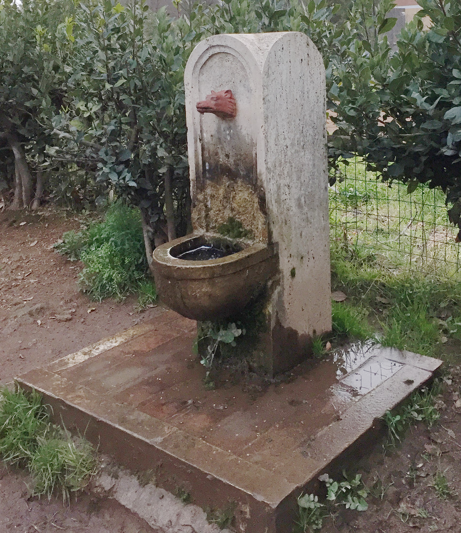
| 17:20, 26 January 2018 | Roman wolf fountain.JPG (file) |  |
494 KB | A drinking fountain which is typical for dog parks in Rome. The water comes off an iron cast wolf's head and there is a small trough where animals can drink. The fountain itself is made from travertine. | 1 |
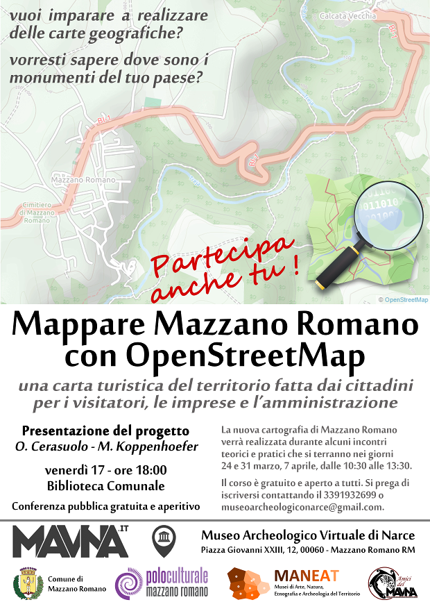
| 17:46, 8 March 2017 | 2017Mazzano Workshop OpenStreetMap locandina.png (file) |  |
491 KB | invitation poster for the mapping workshop in Mazzano Romano, RM, 03/2017. | 1 |
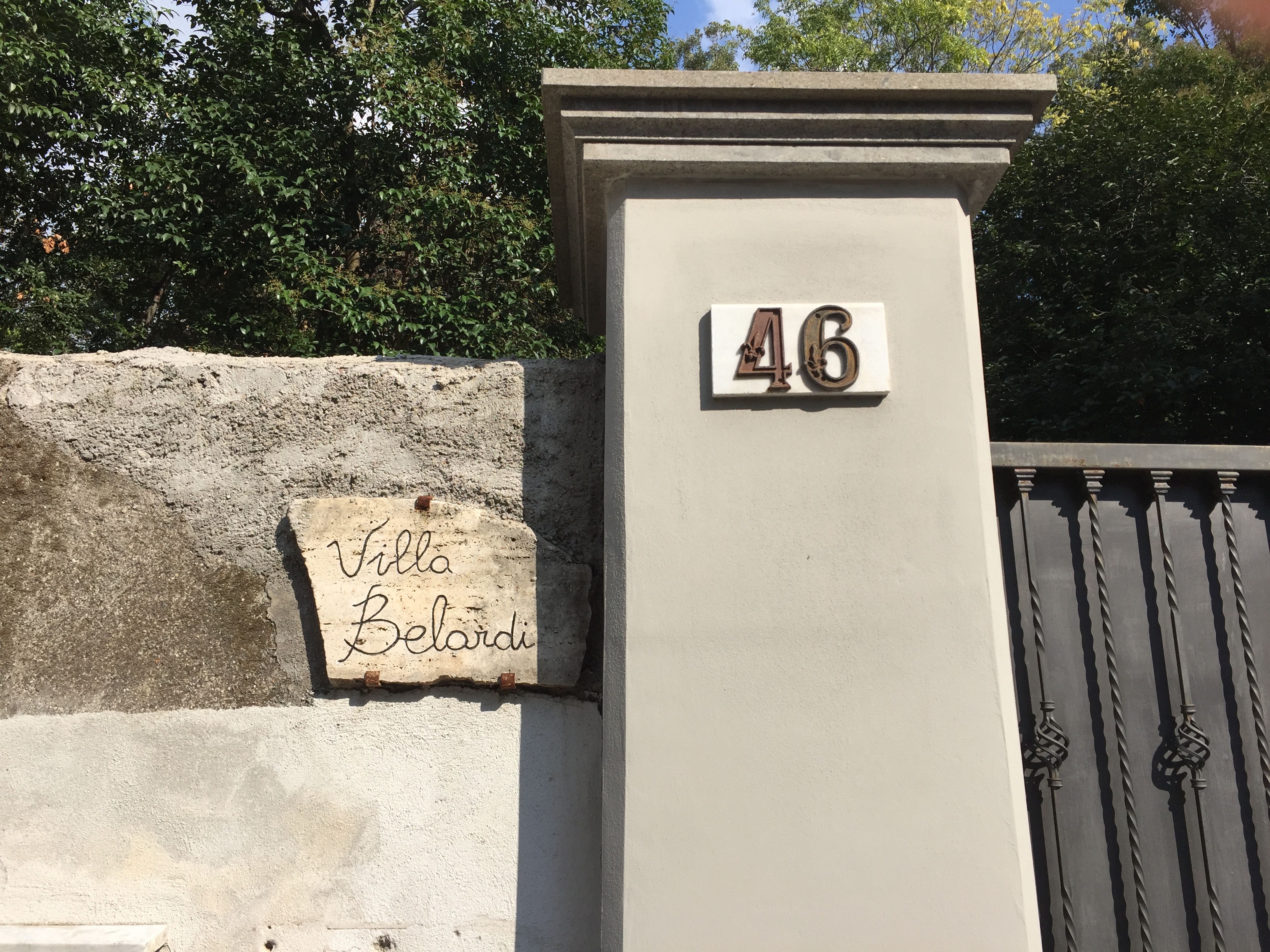
| 13:50, 25 September 2016 | Addr-housename.JPG (file) |  |
3.23 MB | example of an addr:housename together with an addr:housenumber | 1 |
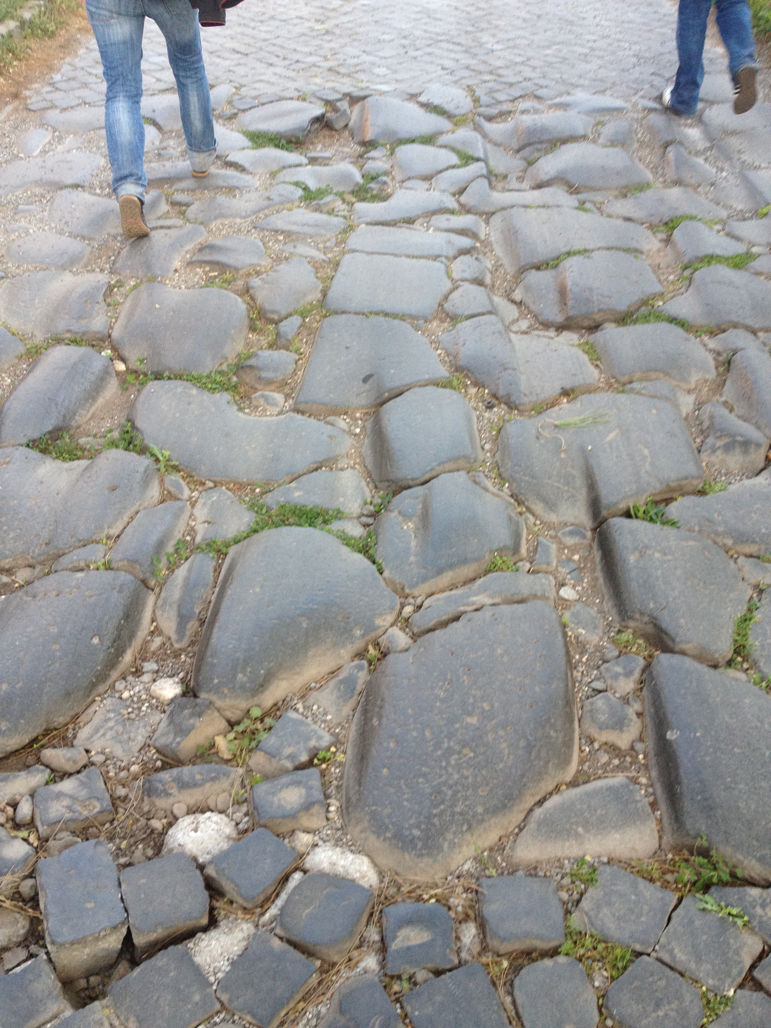
| 22:53, 4 January 2014 | Roman Paving.jpg (file) |  |
3.45 MB | contemporary sett and historic roman road paving in Rome at the Via Appia Antica | 1 |
| 00:33, 28 November 2012 | Etruscan hypogeum.jpg (file) |  |
347 KB | An etruscan hypogeum in the "Pian della Conserva" near Tolfa, Italy own work | 1 |
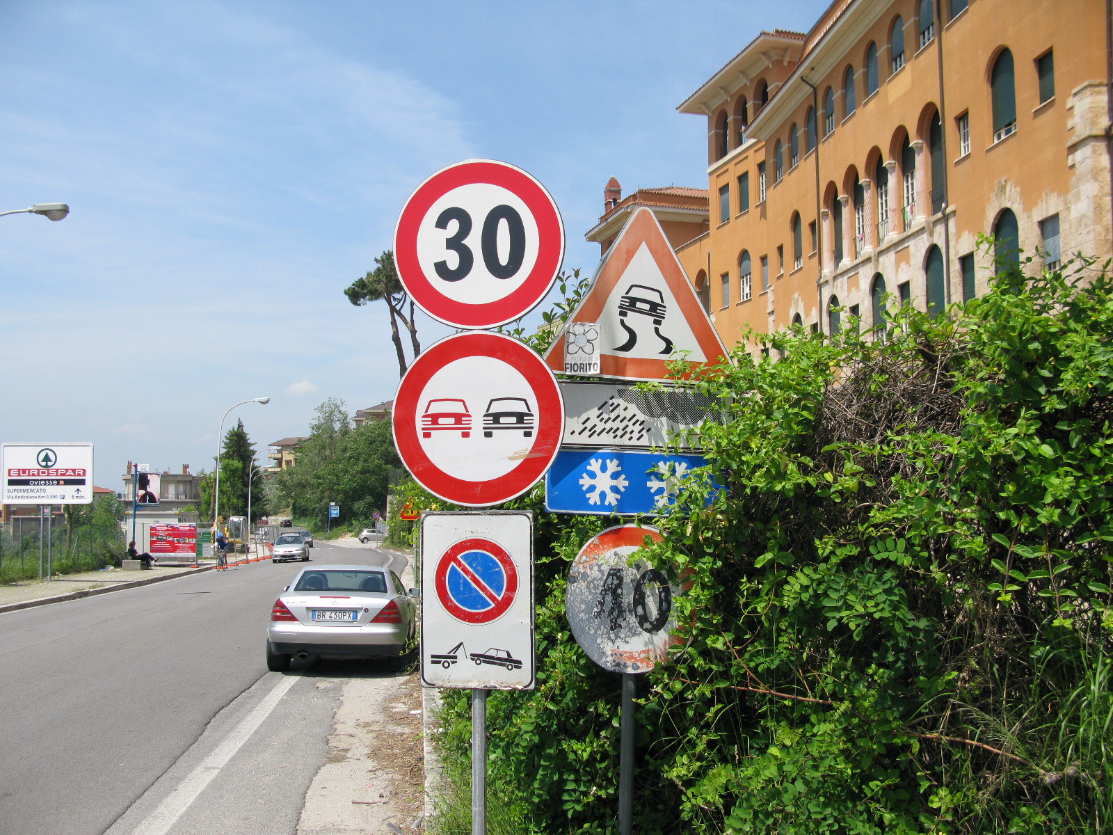
| 09:19, 22 May 2012 | Maxspeed snow.jpg (file) |  |
857 KB | Collection of arbitrary street signs in Italy, Latium, Anagni. General maxspeed 30 but 40 with snow and ice. | 1 |
| 13:30, 4 April 2012 | Futouring screenshot.png (file) |  |
298 KB | A screenshot of the internet portal for cultural tourism in the region of Latium (Lazio), Italy. The cartography of the portal is based on Openstreetmap data. | 1 |
| 13:41, 26 March 2011 | Rome history 2011 mercator.gif (file) |  |
831 KB | A history animation of the Rome area in central Italy from the beginning of OSM until march 2011. The animation was done with the history service of Geofabrik in spherical mercator projection with the following settings: http://labs.geofabrik.de/history/? | 1 |
| 18:22, 20 March 2011 | Ito roma2008-2011.png (file) |  |
1.72 MB | Edits in Rome, Italy, 2008-2011, rendered by ITO World Ltd. | 1 |
| 19:12, 13 March 2011 | Logofusolabtransp.png (file) | 11 KB | Logo del Fusolab a Roma http://www.fusolab.net | 1 | |
| 15:57, 11 March 2011 | Osm-roma t@h z12 20110311.jpg (file) |  |
479 KB | (This is the state of the Italian Capital as of 11th March 2011. Compare to older versions to see the progress.) | 1 |
| 20:32, 17 May 2010 | 16052010022.JPG (file) |  |
1.32 MB | a swing gate in Berlin. Note that pedestrians, cyclists, wheelchair users and others can laterally bypass the gate without the need to open it. | 1 |
| 01:20, 31 August 2009 | 090830 tracks roma.png (file) |  |
1.09 MB | (all gpx traces until 30-august 2009 for Rome area, BB 41.76 12.3 42 12.7) | 3 |
| 19:09, 8 August 2009 | Post box roma.jpg (file) |  |
775 KB | a Postbox in Garbatella, Rome, Italy, displaying the collection_times | 1 |
| 15:44, 5 June 2009 | It panciotto r.jpg (file) |  |
703 KB | il retro dei panciotti prodotti in 05/2009 | 1 |
| 15:43, 5 June 2009 | It panciotto f.jpg (file) |  |
779 KB | il fronte dei panciotti prodotti in 05/2009 | 1 |
| 14:58, 8 February 2009 | Osm-roma t@h z12 20090208.png (file) |  |
956 KB | This is the state of the Italian Capital as of 8th Feb 2009. Compare to older versions to see the progress. | 1 |
| 19:24, 2 November 2008 | Parking garage.svg (file) |  |
3 KB | homemade icon for covered parking. Similar to actual used osmarender-parking-symbol | 1 |
| 23:52, 28 September 2008 | 20080929 roma osma12.png (file) |  |
877 KB | Rome Italy in Osmarender Zoom 12 as of 29.09.2008 | 1 |
| 18:15, 20 September 2008 | Centre zone.png (file) |  |
120 KB | a rendering proposal for centres, tag: landuse=centre_zone, rendered in Osmarender. The rendering rules are: <rule e="way" k="landuse" v="centre_zone" layer="-5"> <area class="landuse-centre_zone"/> </rule> and the CSS-Class | 1 |
| 22:32, 28 August 2008 | Drinking water 32.png (file) |  |
1 KB | Drinking water Icon by Martin Koppenhöfer, 32x32 pixel png | 1 |
| 16:40, 27 April 2008 | 080427 Roma Osma.png (file) |  |
209 KB | Rome / Roma in Osmarender Level 13 as of 27.04.2008 | 1 |
| 12:52, 22 April 2008 | 080422 Roma Centro.png (file) |  |
261 KB | The inner area of Rome as of 22th April 2008 | 1 |
| 16:45, 18 April 2008 | Roma OSM History 607.gif (file) |  |
1.47 MB | A short animation of the development of OSM in Rome, Italy, from 07/2007 to 04/2008. You see one dot for each OSM node and for each worldfile one picture in one second. | 1 |
| 16:24, 18 April 2008 | 080418 density Roma OSM big.png (file) |  |
93 KB | density of all public gps-tracks uploaded in Openstreet Map for Rome, Italiy | 1 |
| 14:48, 18 April 2008 | 080418 Roma OSM.png (file) |  |
95 KB | Rome at 18th April 2008 in Openstreetmap (at Zoom 12) | 1 |