Uploads by Geochang scribe
Jump to navigation
Jump to search
This special page shows all uploaded files.
| Date | Name | Thumbnail | Size | Description | Versions |
|---|---|---|---|---|---|
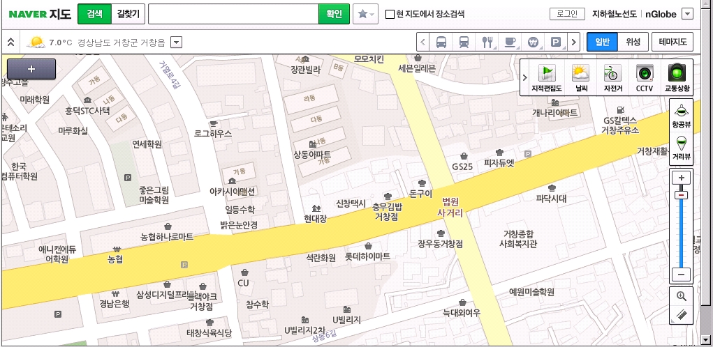
| 10:20, 25 March 2013 | Navercourtcrossroads.jpg (file) |  |
420 KB | 1 | |
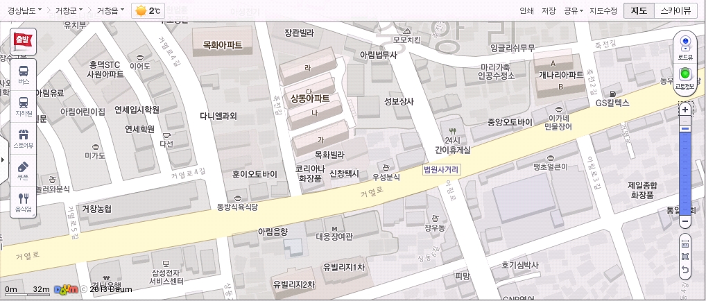
| 10:19, 25 March 2013 | Daumcourtcrossroads.jpg (file) |  |
355 KB | 1 | |
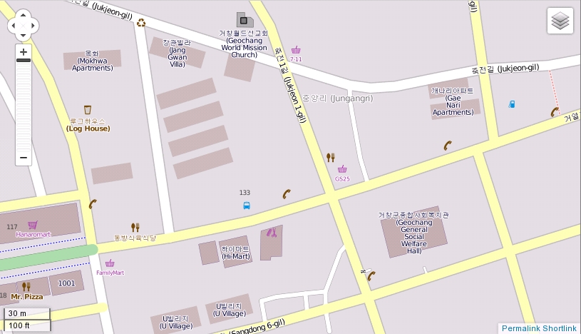
| 10:18, 25 March 2013 | Mapnikcourtcrossroads.jpg (file) |  |
284 KB | 1 | |
| 00:00, 2 October 2012 | Trail marker.jpg (file) |  |
1.52 MB | A Korean hiking trail marker showing the location and emergency phone number to call. | 1 |
| 08:40, 10 September 2012 | 1 251 300 expressway.jpg (file) |  |
1.16 MB | A Korean roadsign showing the names of highway 1, 251 and 300. | 1 |
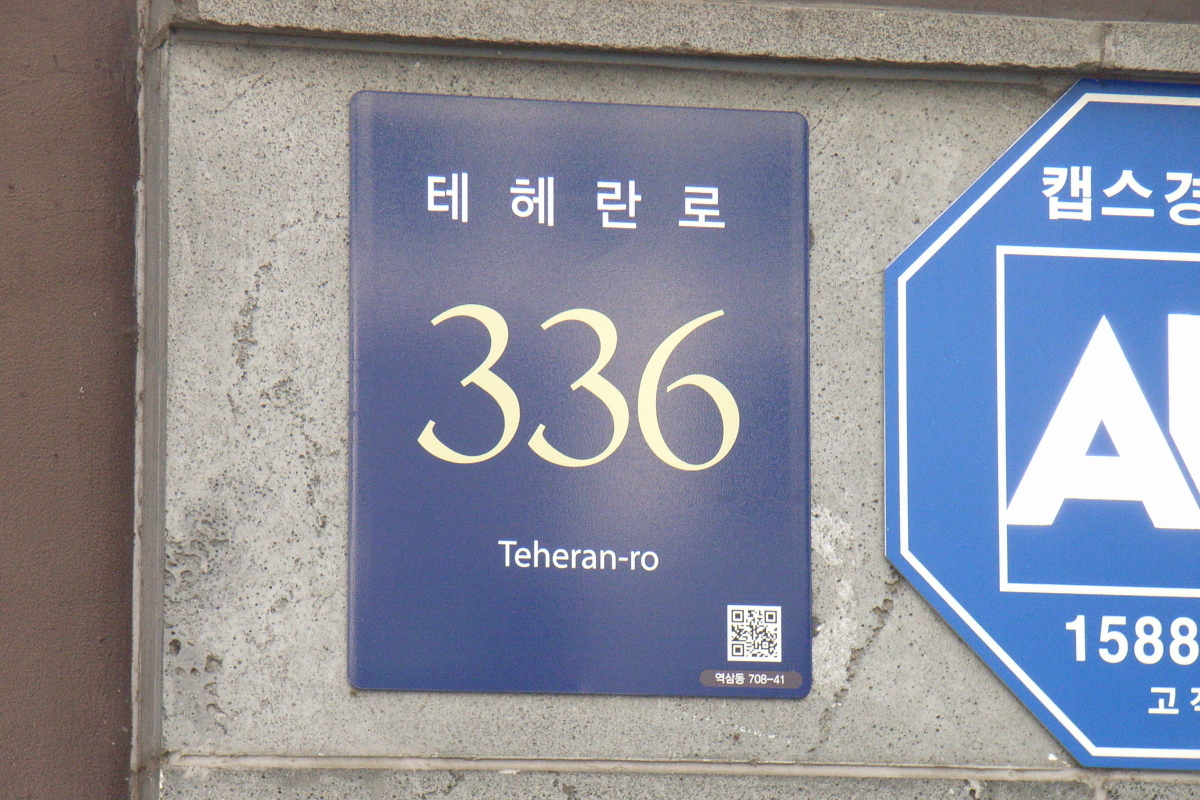
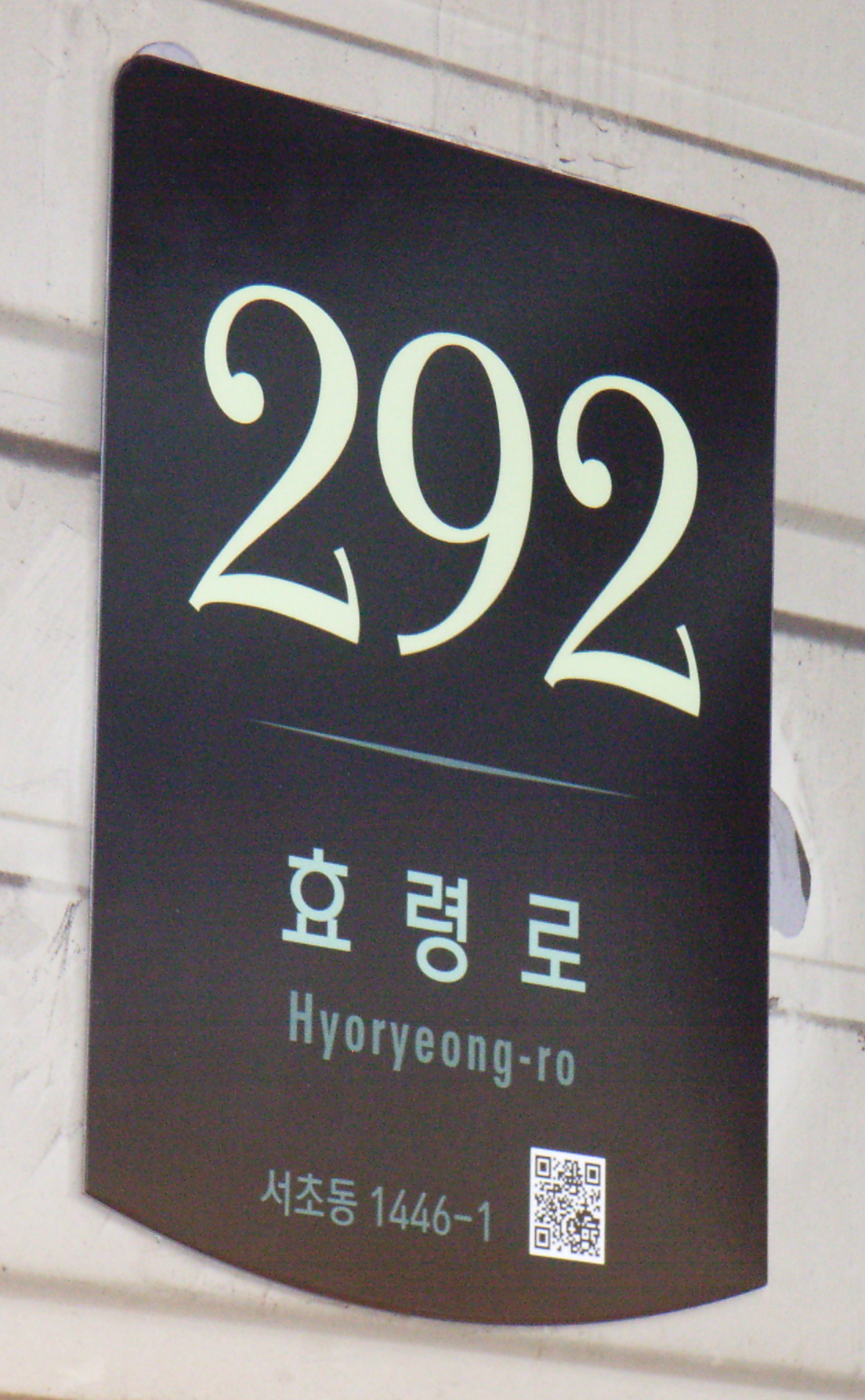
| 14:29, 24 December 2011 | Crop393.jpg (file) |  |
597 KB | A rectangular building address sign in Seoul. | 1 |
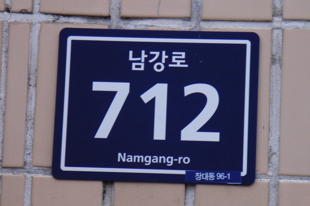
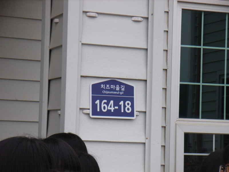
| 14:29, 24 December 2011 | Crop129.jpg (file) |  |
627 KB | A building address sign in Hamyang County, South Korea. | 1 |
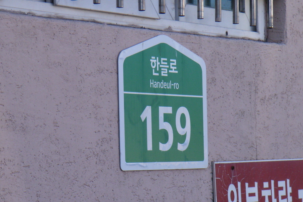
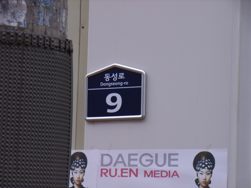
| 14:28, 24 December 2011 | Crop113.jpg (file) |  |
1,007 KB | A building address sign in Seoul. | 1 |
| 14:00, 24 December 2011 | Gscaltex.jpg (file) |  |
410 KB | A photo showing the branding of a GS Caltex gas station in Korea. | 1 |
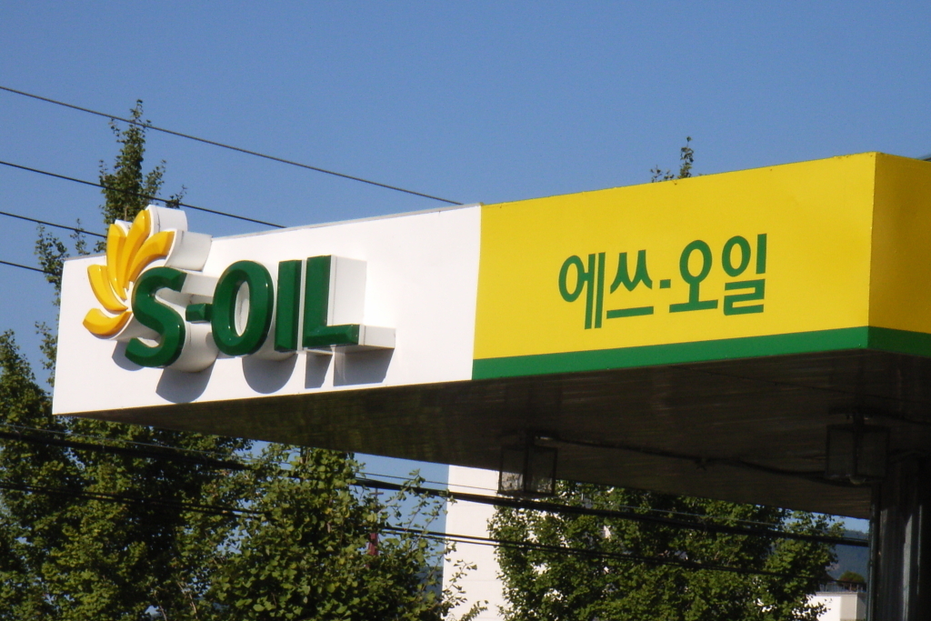
| 13:59, 24 December 2011 | S-oil.jpg (file) |  |
627 KB | A photo showing the branding of an S.Oil gas station in Korea. | 1 |
| 08:25, 20 November 2011 | Tunnellength.jpg (file) |  |
1.82 MB | A Korean roadsign showing a tunnel graphic and the length of the tunnel in metres. | 1 |
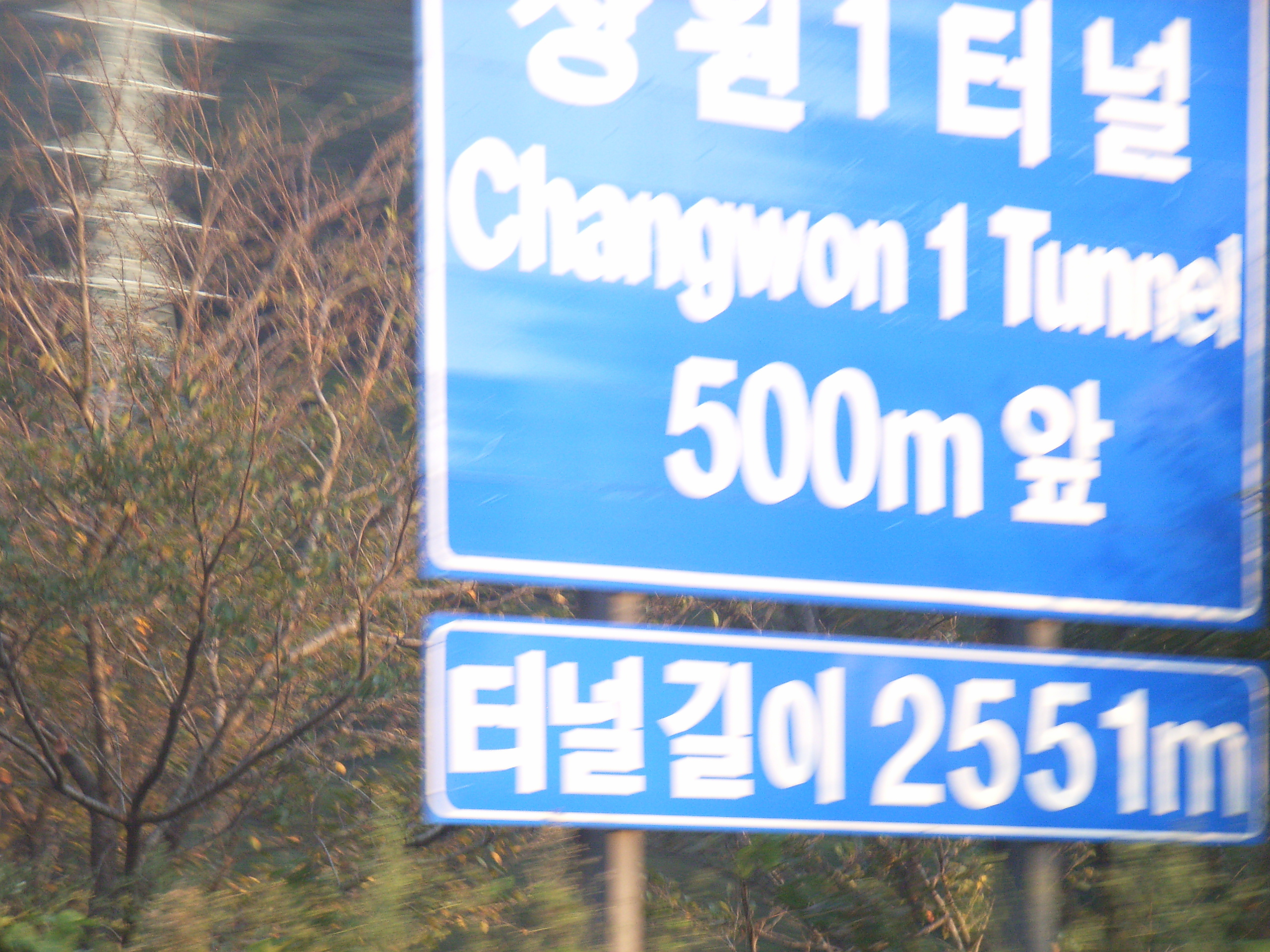
| 08:22, 20 November 2011 | Tunnelname2.jpg (file) |  |
1.72 MB | A Korean roadsign showing the name of a tunnel in Korean and English, with the distance to the tunnel and the length of the tunnel in metres. | 1 |
| 08:20, 20 November 2011 | Tunnelname.jpg (file) |  |
1.71 MB | A roadsign in Korea showing the name of a tunnel in Hangul and English, together with the distance to the tunnel, and the length of the tunnel. | 1 |
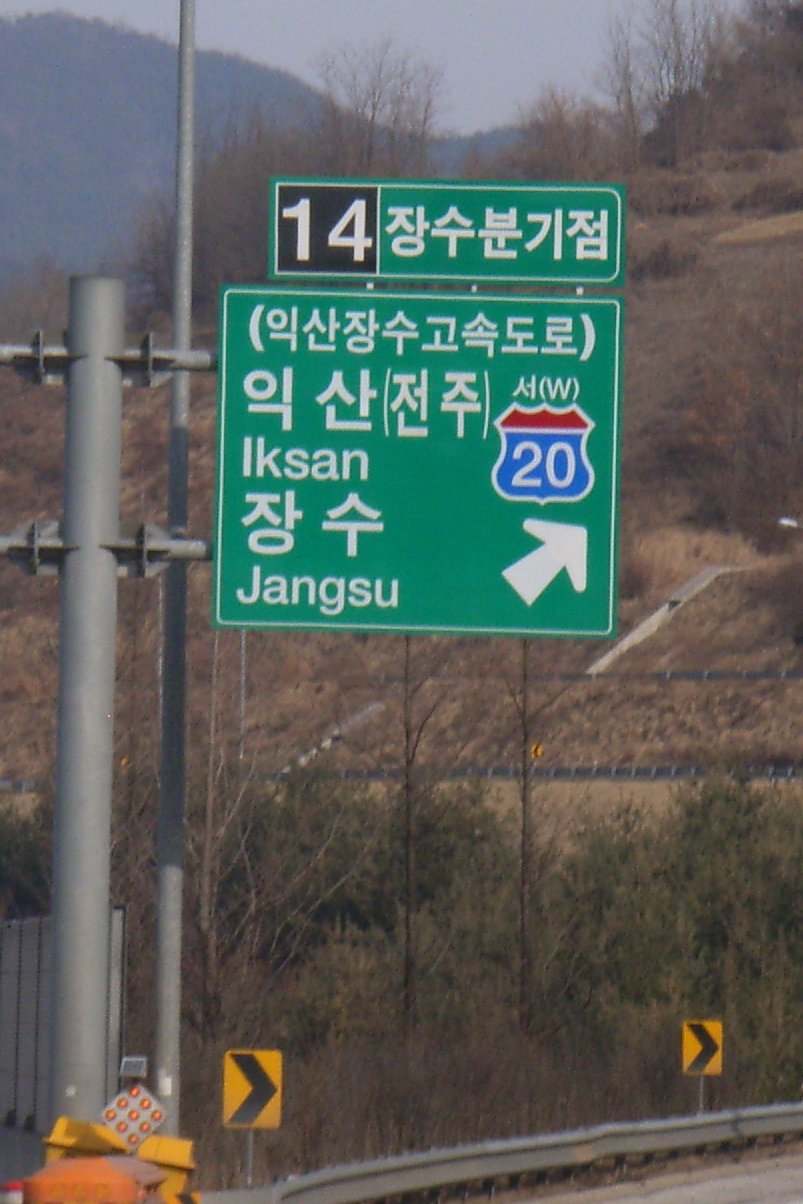
| 01:06, 16 February 2011 | 20expressway.jpg (file) |  |
830 KB | A Korean motorway sign showing the name of Highway 20. | 1 |
| 01:04, 16 February 2011 | 12expressway.jpg (file) |  |
1.01 MB | A Korean motorway exit sign showing the name of Highway 12. | 1 |
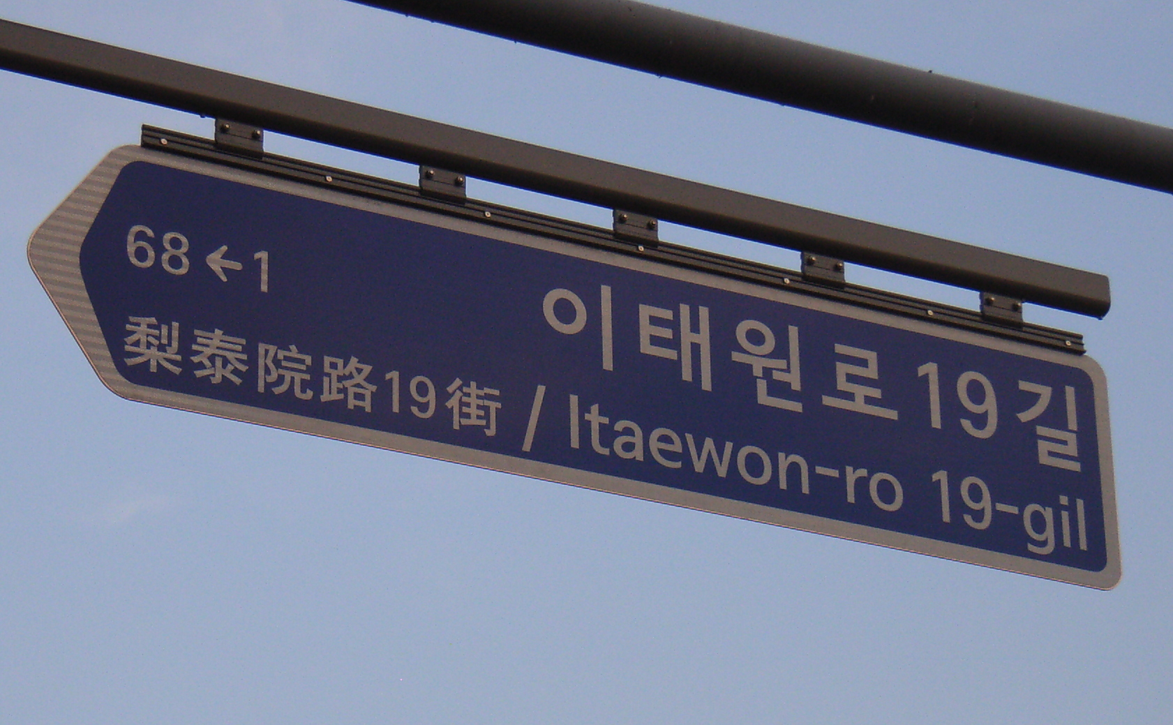
| 10:48, 15 November 2010 | Seoulhanja4.jpg (file) |  |
756 KB | Part of the sign above a Seoul Subway station platform door showing Korean, English and Hanja (Chinese characters) together. | 1 |
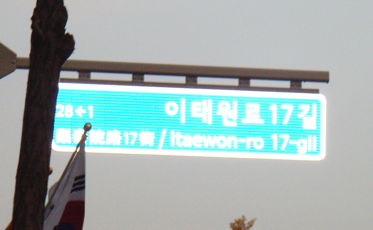
| 10:45, 15 November 2010 | Seoulhanja2.jpg (file) |  |
1.28 MB | A street sign in Seoul showing Korean, English and Hanja (Chinese characters) together. | 1 |
| 10:44, 15 November 2010 | Seoulhanja1.jpg (file) |  |
791 KB | A street sign in Seoul showing Korean, English and Hanja (Chinese characters) together. | 1 |
| 10:24, 15 November 2010 | Seoul3.jpg (file) |  |
1.64 MB | A picture of the address point plaque from Nambu Terminal in Seoul. | 1 |
| 06:54, 30 October 2010 | AH6 example.jpg (file) |  |
61 KB | A poor snapshot of a Korean roadsign showing the reference 'AH6' for the Asian Highway Network. | 1 |
| 11:54, 19 October 2010 | Th 887.jpg (file) |  |
199 KB | A picture of a Korean address sign for a house or business. | 1 |
| 11:54, 19 October 2010 | Th 379.jpg (file) |  |
226 KB | A picture of a Korean address sign for a public building. | 1 |
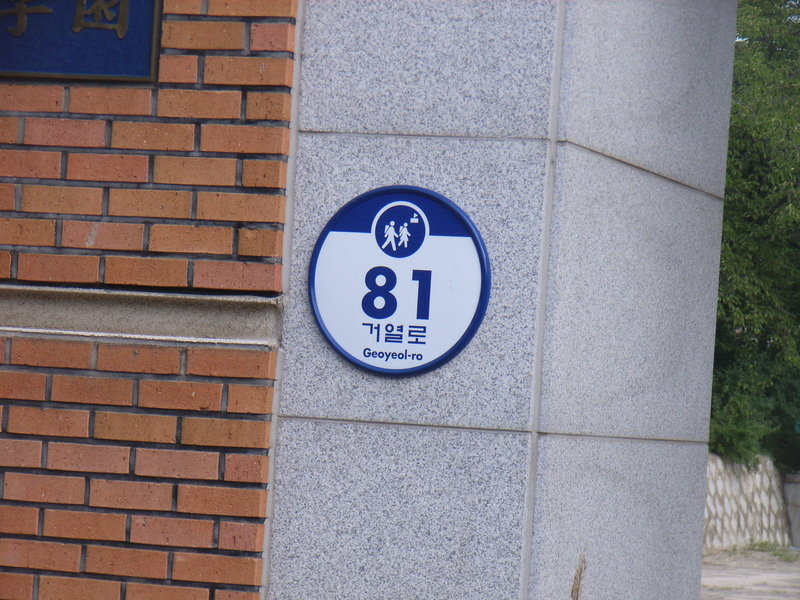
| 11:52, 19 October 2010 | Th 259.jpg (file) |  |
373 KB | A picture of a Korean address sign for a house or business. | 1 |
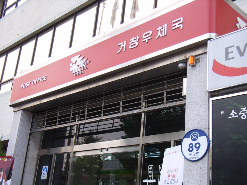
| 11:23, 19 October 2010 | Th 453.jpg (file) |  |
236 KB | A picture of a Korean post office, showing the circular address sign for public buildings. | 1 |
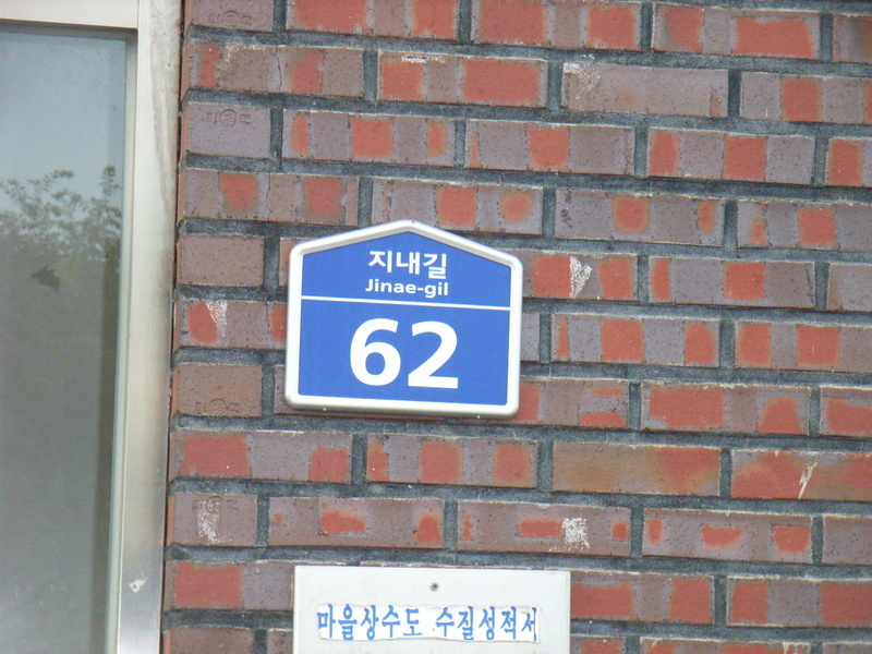
| 11:22, 19 October 2010 | Th 607.jpg (file) |  |
235 KB | A picture of a Korean address sign for a house or business. | 1 |
| 11:22, 12 October 2010 | Motorway JC sign.jpg (file) |  |
879 KB | A Korean motorway sign showing exits from hwy 12 onto another motorway, hwy 35. | 1 |
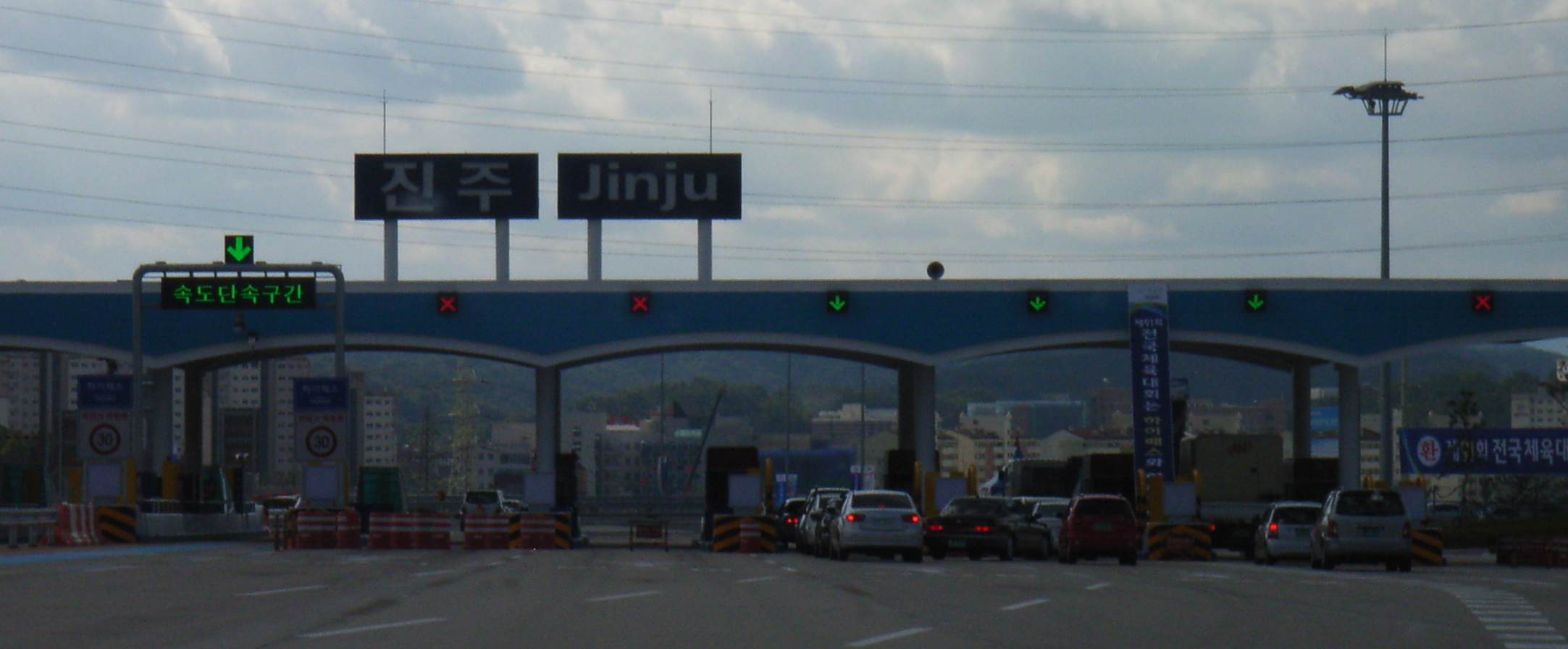
| 10:52, 12 October 2010 | Korean tollbooth.jpg (file) |  |
1.33 MB | A photo of a Korean motorway toll plaza and tollbooth at the exit from a motorway. | 1 |
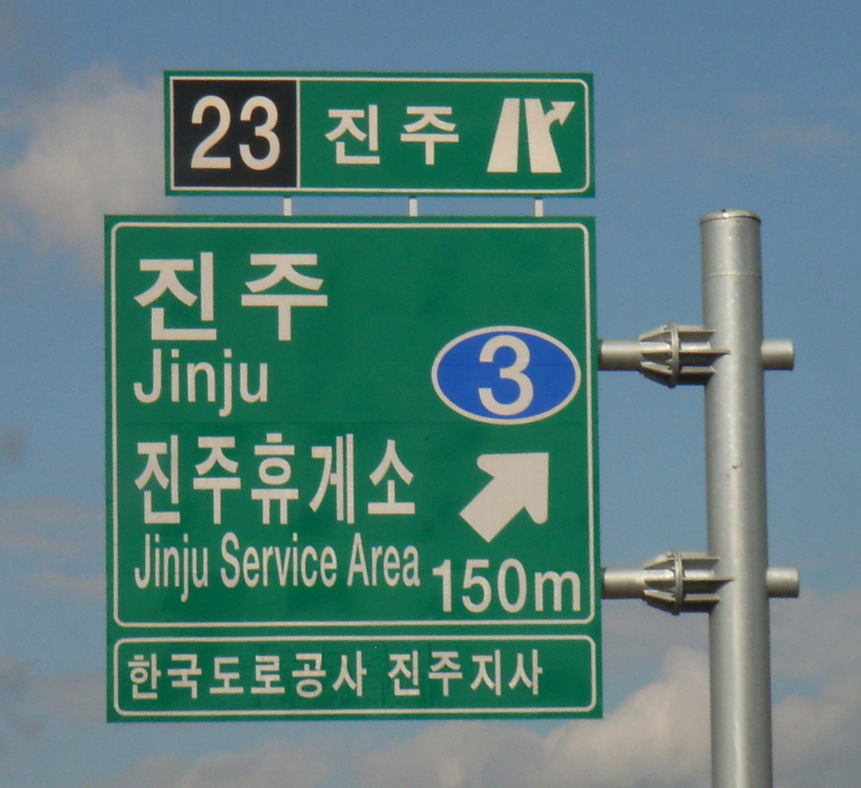
| 10:30, 12 October 2010 | Motorway exit sign.jpg (file) |  |
1.05 MB | A Korean motorway exit sign showing the interchange (IC) number and name. | 1 |
| 10:28, 12 October 2010 | Motorway exit symbol.jpg (file) |  |
15 KB | The interchange (IC) symbol from a Korean motorway exit sign. | 1 |
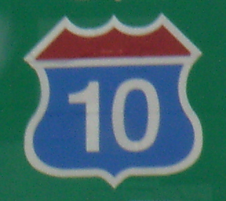
| 12:45, 11 October 2010 | Korean motorway shield.jpg (file) |  |
85 KB | A cropped image of a Korean motorway shield symbol from a Korean road sign. The shield is blue with a red top and a white number '10' in the centre. | 1 |
| 12:10, 11 October 2010 | 10expressway.jpg (file) |  |
1.38 MB | A roadsign showing the name of highway 10 in Korean. | 1 |
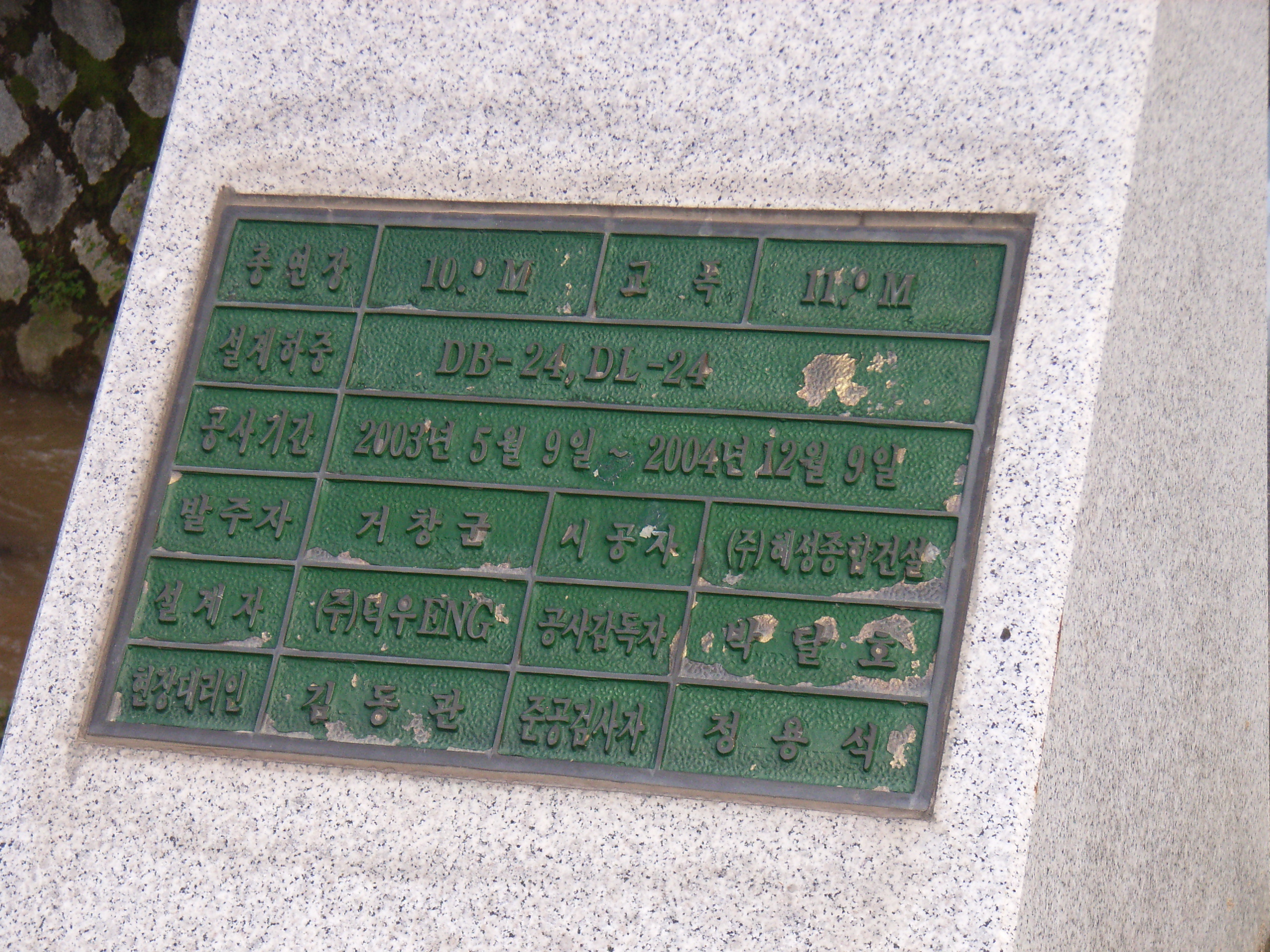
| 13:52, 12 September 2010 | Bridgeplaque.jpg (file) |  |
1.72 MB | A picture of the engineering information for a bridge in Korea. This one shows the length and width of the bridge, and the dates of the construction period. | 1 |
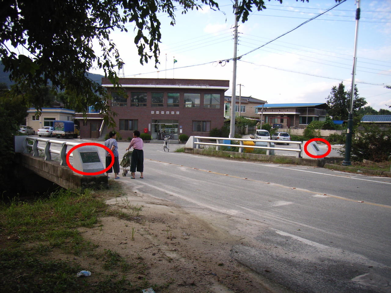
| 13:47, 12 September 2010 | Bridgeview annotated.jpg (file) |  |
220 KB | A picture of a small bridge in Korea. Red circles indicate information plaques on the bridge. | 1 |
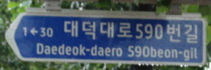
| 04:51, 16 August 2010 | New-daedok-daero590beon-gil.jpg (file) |  |
24 KB | Street sign installed June 2010. Picture taken August 2010. | 1 |
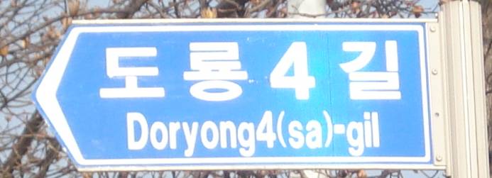
| 04:50, 16 August 2010 | Old-doryong4-gil.jpg (file) |  |
28 KB | Street sign installed c.1999. Picture taken January 2010. | 1 |
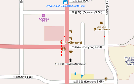
| 04:49, 16 August 2010 | Map-signlocation.png (file) |  |
40 KB | An OSM snapshot highlighting a street whose name has changed. | 1 |
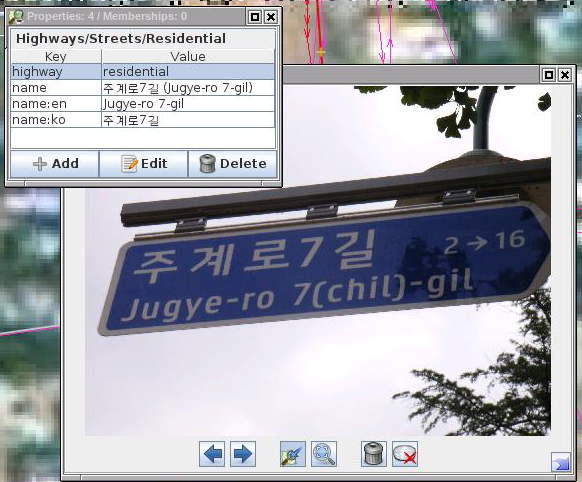
| 09:07, 11 August 2010 | Streetsigns.jpg (file) |  |
236 KB | A picture of a Korean street sign, opened in JOSM, with a data entry window showing the corresponding tags. | 1 |
| 12:56, 9 August 2010 | 35expressway.jpg (file) |  |
145 KB | A cropped shot of a Korean roadsign, showing the name of the 35 expressway. | 1 |
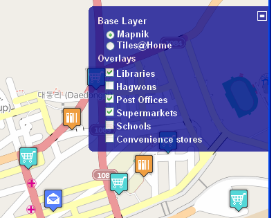
| 04:59, 9 October 2009 | Snapshot.PNG (file) |  |
48 KB | A snapshot of multiple POI layers | 1 |