Stoke on Trent Mapping Event
When
July 4th 2009
10am to 5pm
Where
Stoke-on-Trent, Staffordshire, UK.
Meetup Location
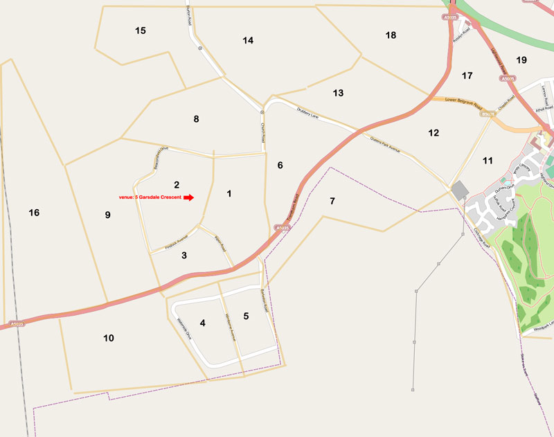
Blurton Farm Resident Group Centre
5 Garsdale Crescent, Blurton, ST3 3JP (Map)
What
This mapping event is being organised by Axis Design Architects as part of their relaunch of http://blurtonvision.co.uk - a project on behalf of the local residents to develop a community information tool using OpenStreetMap.
The primary goal is to map the area around the Blurton housing estate, spreading out as far we can from the meeting place during the course of the day.
Unfortunately the event clashes with the Mansfield UK party, but the 4th July is the best date for the resident group to provide us access to their centre to keep out the rain and use their wifi. Hopefully there's plenty of volunteers in the Midlands to split between the two events
The local school may also be involved to help map and photograph.
Who's Coming
- I'll be there. May not be able to do the full day, though Avantman42
- I can provisionally make it - will confirm nearer the date --Brianboru 18:56, 22 May 2009 (UTC)
- I expect to make it --sherbourne 15:47, 25 June 2009 (UTC)
- I think it's likely I'll be able to go Richard B 23:07, 29 June 2009 (UTC)
