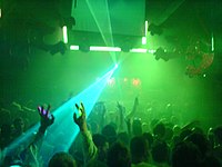
Tag:amenity=nightclub
Jump to navigation
Jump to search
| Description |
|---|
| A place to dance and drink at night. |
| Rendering in OSM Carto |
| Group: leisure |
| Used on these elements |
| Useful combination |
|
| See also |
| Status: approved |
| Tools for this tag |
|
A ![]() nightclub is a place to dance and drink at night. Also known as a disco.
nightclub is a place to dance and drink at night. Also known as a disco.
How to map
Set a node or draw as an area along the nightclub outline. Tag it with amenity=nightclub and name=*.
Tags used in combination
- operator=*
- addr:*=*
- website=*
- phone=*
- opening_hours=*
- wheelchair=*
- music=* - type of music performed
- live_music=* - used to specify whether a feature offers live music.
Rendering
See also
Some blurry distinctions. You'll need to make a judgement.
