Tag:amenity=ticket_validator
| Description |
|---|
| An analog device which validates public transport tickets, or devices which are integrated in systems to gain access to an area or service like public transport or parking garages. |
| Group: amenities |
| Used on these elements |
| Useful combination |
| Status: approved |
| Tools for this tag |
|
A ticket validator is a device that allows validation of a ticket be it public transport, park entrance or parking. These devices are used to scan a card (ticket scanner) or to validate a paper ticket (also known as ticket puncher, punching machine or ticket marker). Ticket validators can also be included in a gate/turnstile (see examples below). Therefore, this tag can also be used in combination with barrier=*.
How to map
Use the tag amenity=ticket_validator on a node ![]() or
or ![]() if you want to map a row of ticket validators. A single stand-alone node is the most suitable way to map a small detail such as a ticket validation machine.
if you want to map a row of ticket validators. A single stand-alone node is the most suitable way to map a small detail such as a ticket validation machine.
To map a ticket validator place a node ![]() (attach it if possible to a way like a highway=* so that it routes) and tag it with amenity=ticket_validator. You can optionally use tags from the list below to extend the tagging:
(attach it if possible to a way like a highway=* so that it routes) and tag it with amenity=ticket_validator. You can optionally use tags from the list below to extend the tagging:
- operator=*: to specify the name of the ticket validator operator.
- barrier=*: use values like gate or turnstile to indicate the type of barrier the ticket validator is included in.
- fee=*: use this tag to indicate a fee is required for access (also see payment=*). This is the case for most ticket validators on barriers. Note that access=customers often does not apply because in most cases because the areas behind the ticket validators (even those on barriers) are publically available, only with a fee. Alse see fee:conditional=*.
- payment=*: use this tag to indicate the accepted payment methods for this ticket validator.
- wheelchair=*: to indicate whether a ticket validator can also be used by people in a wheelchair (most likely combined with a barrier tag).
- level=*: use for indoor mapping to indicate at which level the ticker validator is located in the station.
- network=*: in case it a ticket validator for a public transport modality, you can specify the network it is part of.
- capacity=*: when multiple ticket validators are generalized into a single node (for example if placed on a highway for routing purpose), use capacity to indicate the number of ticket validator.
Examples
In the table below, some examples are illustrated of when to use amenity=ticket_validator.
| Tagging | Description | Image |
|---|---|---|
| barrier=gate | Ticket validators included in a gate. It can be mapped as a row of nodes or attached to a way with highway if present. | 
|
| barrier=turnstile | Ticket validators included in a turnstile. It can be mapped as a row of nodes or attached to a way with highway if present. | 
|
| The scanner on the left:
amenity=ticket_validator operator=Nederlandse Spoorwegen payment:ov-chipkaart=yes The scanner on the right: amenity=ticket_validator operator=Veolia payment:ov-chipkaart=yes |
2 ticket validators from different operators at a Dutch trainstation. These are examples of ticket validators that can be mapped as separate nodes and not attached to a highway=*. | 
|
| amenity=ticket_validator | A analog ticket validators (ticket puncher) on the left side. This is an example of a ticket validators that needs to be mapped as separate node and not attached to a highway=*. Note the machine on the right is an example of amenity=vending_machine + vending=public_transport_tickets | 
|
See also
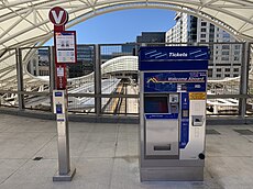
- amenity=vending_machine + vending=public_transport_tickets - A machine vending public transport (like bus, tram, train...) tickets
