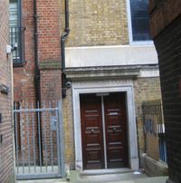
Tag:building=entrance
| Description |
|---|
| Using this tag is discouraged, use entrance instead. |
| Rendering in OSM Carto |

|
| Group: buildings |
| Used on these elements |
| Useful combination |
some of:
|
| Status: deprecated |
| Tools for this tag |
|
The reason is documented in Deprecated features. You are still free to continue to use or interpret this tag as you see fit since OpenStreetMap does not have “banned features”.
Under no circumstances should you (semi-)automatically change “deprecated” tags to something else in the database on a large scale without conforming to the automated edits code of conduct. Any such change will be reverted.
The tag building=entrance was used on nodes along and on the building outline to mark the locations of entrances, i.e. doors.
This tag conflicts with building=* because an entrance is not a building, but part of a building. entrance=* has been introduced as a replacement (see Proposed features/entrance). building=entrance currently coexists with entrance=*, while entrance=* is now used much more, see taginfo comparison.
Statistics:
- December 2012: entrance=* has overtaken building=entrance
- December 2014: entrance=* has 10x the usage [1]
- May 2016: 41.000 vs. 1.060.000 = 25x more
Tagging
Add a node on the way tagged with building=* and give that node the tag building=entrance.
In some countries each entrance is considered to have distinct housenumber, in others a housenumber is property of the whole building.
- Where each entrance of a single building has a unique house number, tag the addr:housenumber=* on that node; for a reasoning, see the SotM session presentation.
- Elsewhere an entrance may have a unique identifier in addition to the house number; you should add that on the entrance node.
If the entrance is, say, for personnel only, you can add a access=private.
Some ways to improve the location of the entrances
Although the GPS accuracy is limited, you can get reasonable results by visually approximating how far along the wall the entrance is. That is, is the door exactly at the halfway point, or one third of the wall length from either end? You can also visualize any passenger car of known length along the wall and count the distance accordingly. At least JOSM will show you the distance from any selected node to aid positioning the new node a known distance from the selected corner.
Another method is to approach the building straight to the entrance to have a track that you can extend until it meets the building outline.
When combined with meticulously positioned aerial images the result is better than a single GPS measurement at the door could provide. Remember to align the nodes of a straight wall in a line (in JOSM: Tools - Align Nodes in Line), but also remember that not all buildings that appear to be straigt are really straight.
If you estimate the position, please add fixme=Position estimated. Some software solutions for blind persons rely on accurate positions and give a warning message if there is a fixme tag set.
See also
- addr=* for adding house numbers, the current way for that is the Karlsruhe Schema
- entrance=* as another way of tagging entrances
- barrier=entrance
