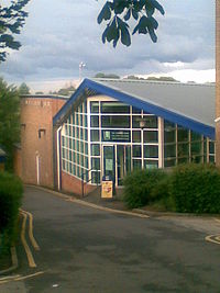
Tag:building=sports_centre
| Description |
|---|
| A building that was built as a sports centre |
| Rendering in OSM Carto |

|
| Group: buildings |
| Used on these elements |
| Useful combination |
|
| See also |
| Status: de facto |
| Tools for this tag |
|
A sports centre is a building that is designed for sports, e.g. for school sports, university or club sports. Typical sports centres often have a part with a roof in normal height, where the changing and washing rooms are located, and a part with a high roof, for ball sports and gymnastics.
Considering the usage and similar tags, this appears to describe a building with multiple large rooms/halls, as opposed to one for building=sports_hall.
Sports centre buildings still used for the original purpose can often be found on the terrain of schools or sports centres.
How to map
Draw an area marking this feature. Tag it with building=sports_centre.
It is also OK to set a node at its center, if mapping as area is impossible.
To describe the kind(s) of sport(s) the sports centre is equipped for use the sport=* tag.
See also
building=sports_hall is a very similar tag, although it describes a building with a single large room unlike the above. Check how similar facilities are mapped in your area before proceeding.
building=sport is an extremely generic and may cover anything from stadiums through aerialway buildings on ski slopes to sports centres. It should be avoided because it describes the usage and not the type of building.
