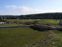
Tag:historic=archaeological_site
Jump to navigation
Jump to search
| Description |
|---|
| A place in which evidence of past activity is preserved. |
| Rendering in OSM Carto |
| Group: historic |
| Used on these elements |
| Useful combination |
| Status: de facto |
| Tools for this tag |
|
The tag historic=archaeological_site is not restricted to excavations, but should also encompass all visible ancient monuments, most of which will not have been excavated. Naturally, excavated monuments that are known should also be tagged, but please consider refraining from mapping non-obvious unexcavated sites as to do so could encourage damage from treasure hunters.
How to map
An archaeological site is mapped as a node ![]() or an area
or an area ![]() with the tag historic=archaeological_site.
with the tag historic=archaeological_site.
In addition, the following parameters should be given to describe the details of the object.
- name=name - the name of the archeological site, e.g.
 Brutkamp
 - archaeological_site=* - to further describe the type of the archaeological site
The following optional tags may also be useful on complement:
- historic:civilization=* (or more precise subtags) - the civilization (culture) that originally created the feature
- ref:sprockhoff=number - many graveyards are listed in the German Atlas der Megalithgräber by
 Ernst Sprockhoff(de) and can be referenced by this number.
 - ref:mhs=number - most archeological sites in France (even the smallest ones notably all prehistoric sites, unless their discovery is extremely recent) are classified as Monuments historiques in the public Merimée database, the number usually starting by "PA followed by digits brings details about the site, its approximate location and dimensions, its approximate date of construction, its state of conservation, a possible restoration, its level of protection, and accessibility (or not) to the public.
Maps
- Map of Historical objects: historic.place
- HistOSM
- Megalith map (Own database)
See also
- historic=aqueduct for aqueducts and their remains
- Proposed_features/tombs, historic=tomb, tomb=tumulus, tomb=rock-cut and others for tombs
- Archaeological site on Wikipedia
- geological=palaeontological_site
- historic=ruins
- ruins=*
- Megalith map External map (Choose the country on the top right)
