Proposal:Tag:natural=mesa
| Tag:natural=mesa | |
|---|---|
| Proposal status: | Draft (under way) |
| Proposed by: | jeisenbe |
| Tagging: | natural=mesa |
| Applies to: | landform |
| Definition: | A flat-topped elevated landform surrounded by cliffs |
| Statistics: |
|
| Draft started: | 2019-04-25 |
| RFC start: | 2019-04-26 |
Proposal
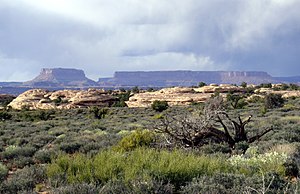
natural=mesa is used to map a mesa: an flat-topped landform that is elevated above the surrounding terrain and surrounded by cliffs. These features are also known as a table, tableland, potrero or tepui.
In contrast with a natural=butte (a hill with cliffs around the top), in a natural=mesa the width of the flat area is greater than its height above the surrounding terrain. Also, while the top of a natural=butte is not always flat, a mesa must have a flat top.
Rationale
The tag natural=plateau is already in use, but has a much less specific definition. A plateau can be a small, relatively flat highland landform or a term for a large region. The word "tableland" is also used for both small, specific features (i.e. buttes and mesas) and larger elevated regions (i.e. larger plateaus), and therefore can also be ambiguous. Therefore, a separate tag is useful for flat-topped elevated landforms that are surrounded by cliffs.
While "mesa" is an American English term, loaned from Spanish and Portuguese (where it means "table"), this word is used frequently and with a specific meaning by geologists and geographers. Since such features are common in areas with particular geology and climate, they are not commonly found in England or northern Europe, hence the American term is the most common.
I have also created a proposal pages for natural=butte - hills with tops surrounded by cliffs, where the top is narrower than the height of the hill. A mesa is shapped like a low table: a large flat top and short sides, while a butte is more like a tall stool with steep sides and a flat top
Current usage:
Tagging
- As a node: place a node at the center of the landform. Map the cliffs as natural=cliff, if possible.
- As an area: when the mesa is surrounded by cliffs, the mesa can be mapped as an area with a closed way following the top of the cliffs. These should be mapped as natural=cliff as well. Mesas should only be mapped as areas when they have sharp boundaries and where the geometry can be verified by individual mappers.
- See natural=butte for a hill surrounded by cliffs, where the height of the hill is greater than the width of the area within the cliffs.
- Caution: occasionally a feature will have a name that suggests it is a butte, mesa or tableland, but it lacks a flat top or is not surrounded by cliffs. In this case, another tag my be appropriate. See: natural=plateau for other flat landforms, natural=peak the summit of a hill or mountain, and natural=ridge. For example, Grand Mesa is the name of a large natural=plateau in western Colorado.
Applies to
- nodes
- areas
Useful Combinaton
- name=*
Rendering
- name label only (cliffs are already rendered and should also be mapped. Vegetation and bare rock areas can also be mapped and rendered.)
See also
- natural=butte - a hill with a top that is surrounded by cliffs. The width of the top is less than the relative height of the hill.
- natural=peak - the summit or secondary peak of a hill, mountain or ridge
- natural=ridge - a linear hill or mountain ridge
- natural=arete - a knife-edge rocky ridge formed by glaciers
- natural=cliff - a vertical or near-vertical slope
- natural=valley - a flat area that is surrounded by higher terrain on most sides
Examples
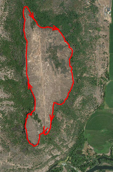
Upper and Lower Table Rocks
- Mesas in Medford, Oregon
* OSM Way 686257333
* natural=mesa
* name = Upper Table Rock
* OSM Way 686257333
* natural=mesa
* name = Lower Table Rock
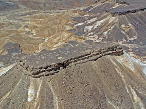
Har Qatum
- Har Qatum mesas, Makhtesh_Ramon
* natural=mesa
* name = Har Qatum
South Mesa, Chaco Canyon, New Mexico
* OSM way # 79163132
* natural=mesa
* name = South Mesa

Features/Pages affected
External discussions
See Tagging mailing list from April 2019
Comments
Please comment on the discussion page.


