Tag:waterway=dredged_area
Jump to navigation
Jump to search
| Description |
|---|
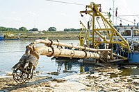
| Area dredged to maintain a certain minimum depth. |
| Group: waterways |
| Used on these elements |
| Useful combination |
|
| Status: proposed |
| Tools for this tag |
|
To indicate an area, such as an approach channel, port basin, or similar, that have been dredged, or are regularly dredged to maintain a certain minimum depth.
