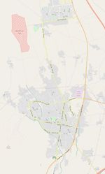
Torbat Heydarieh streets
Torbat Heydarieh
Torbat-e Heydarieh (Persian: تربت حيدريه) (Coordinates: 35° 16′ 26″ N, 59° 13′ 10″ E) is the Capital city of Torbat-e Heydarieh County, a County in Razavi Khorasan Province in Iran.
The County is subdivided into four districts (bakhsh): the Central District, Bayg District, Kadkan District, and Jolgeh Rokh District. The County has four cities: Torbat-e Heydarieh, Bayg, Kadkan, and Robat-e Sang. The name Torbat in Persian means Burial place, thus the name of the city means Burial Place of Heydar named after "Qotboddin Heydar" a Sufi mystic whose tomb lies in the heart of the city.
Torbat-e Heydarieh city is 1005 km. far from Tehran and is located in a mountainous region on the skirt of mountain having different weathers in different areas.
About The Project
Because of lack of high precision satellite imagery covering the city and for having a detailed map of city including all streets and alleys also the correct name of streets, municipality of Torbat Heydarieh ordered to complete and optimize inner city streets.
There is a good and update public domain data about inner city streets in AutoCad format in municipality website,
Goals
- Making easy and quickly access to street data for all who want to know Torbat Heydarieh.
- Having correct and based on sign names of streets and alleys.
- Being the first city in Iran that its municipality authorities want their city have a good data in OpenStreetMap.
- Maybe this project be a start for another cities and town in Iran to have a precise data in OpenStreetMap.
Schedule
The project will be started about 20th December 2016. Probably a two or maximum three-day process is sufficient for complete Import. All Import will be done in one changeset. We want a complete Torbat map for new year 2017.
P.S.: project imported exactly on time on 23rd December 2016 in changeset No. 4462559. Have a look there now and enjoy detailed map of streets.
Details
- We used an AutoCad file of city streets and ِِِDetailed Plan of the city as the base of work. Both of these files are Public Domain. Their License says that "Everyone is permitted to copy, transfer, convert, transform these data files and also append or join them with other data; but after these processes, the owner is not Torbat Heydarieh municipality".
- ArcGIS and JOSM software used for the project.
- First of all, current data of city downloaded in JOSM.
- New data processed with ArcGIS and converted to .osm file. Important information such as surface type and width of streets (in meter) derived and included .
- For maintaining data history, old data merged with these new data (Ctrl+Shift+G in JOSM).
- Name of streets updated manually based on documented data in the municipality.
- A dedicated user named Torbat_streets will be created in OpenStreetMap.
Import Data
Background
Data source site: http://www.thcity.ir/
Data license: http://www.thcity.ir/images/stories/Pdf/mostanadat/ejazename-naghshe1.pdf (in Persian)
Type of license: Public Domain.
ODbL Compliance verified: Yes
Import Type
Import will be performed one-time, in one changeset and will not use any scripts.

