UP Village+ Mapping Party
What is a Mapping Party?
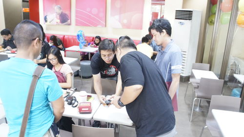
Mapping Parties are events where anyone can come and participate in the OpenStreetMap project. OpenStreetMap is a free and open source map that can be contributed, edited and used by anyone anywhere. Mapping Parties are social events where experienced and new mappers can meet to share and learn more about the project. The events are generally held in a public place, and allow time for discussions, mapping, and editing.
The event is open to all. Are you a newbie interested in OpenStreetMapping? We will help you get started right away. Are you a business owner who wants a map showing your business location? We can help get your business location in the map. Are you a Garmin GPS unit owner who wants a routable map in your device? We can help load our map into your GPS unit.
It's fun. It's free. You can help.
Schedule of activities
The Mapping Party will happen the whole day of April 30, 2016, Saturday, and will consist of three parts: a morning meet-up, the actual field surveying, and the afternoon meet-up and workshop.
| Time | Venue | Activity |
|---|---|---|
| 9:00am – 10:30am | Jollibee Philcoa | Morning meet-up and briefing. Participants meet up to get briefed on the day's activities and to be assigned cake slices |
| 10:30am – 3:00pm | All over UP Village, Teacher's Village, and surrounding areas | Field survey. Participants go and survey their assigned slices |
| 3:00pm onwards | Kwentong Bagnet (tentative) | Afternoon meet-up and mobile editing workshop. Participants meet up for a post-survey briefing and a mini-workshop on editing using mobile apps like OsmAnd, Maps.Me, and Vespucci. |
What will we map?
General objectives
The aim is to make the map even more complete and to verify existing data in OpenStreetMap. We will map points of interest (POIs), address information (like house numbers), building data, as well as locations of street gates and other routing information.
Additionally, building footprints and critical structures data will be used by Project NOAH in the development of their Risk Analysis map for use in the aversion of disasters.
Cake slices
Cake slicing is a phrase used in OpenStreetMap Mapping Parties where the area to be mapped (the cake) gets divided into smaller areas (the slices) such that each slice can be surveyed and mapped by around one to three people. It's basically your simple divide-and-conquer approach to mapping! The assignment of which cake slices will be surveyed by which people will be done during the morning briefing.
The planned cake slices are shown on the map below. Slices #8 and #9 are optional and may be covered if there is enough people and time.
News and updates
Please check out our Facebook event page for news and updates: https://www.facebook.com/events/219069125137044/
Contributors are encouraged to use the #ProjectNOAH and #UPVillMapParty hashtags in the changesets for monitoring purposes.


