User:Ast
| All my contributions to OpenStreetMap are released into the public domain. This applies worldwide. In case this is not legally possible, I grant anyone the right to use my contributions for any purpose, without any conditions, unless such conditions are required by law. |
| Babel user information | ||
|---|---|---|
| ||
| Users by language |
About me
I live in Switzerland near the Rhine falls. When I don't sit in front of my computer I like to do some sports (Mass sport, Rope Skipping and Snow Boarding).
I've done some small contribution to the gpsd (http://gpsd.berlios.de/) Daemon in my spare time. At work I sometime work with GPS devices too.
This project seems to be a good idea to put all together for an open source vector based navigation solution.
I'm working on memphis renderer.
You may meet me next at OSM Zurich meeting at bQm ETHZ
OSM Mapping Areas
Currently I'm completing the streets in Schaffhausen (the city).
Until writing those lines I mapped almost whole Neuhausen am Rheinfall and Schaffhausen, both in Canton Schaffhausen, Switzerland.
The mapping of Neuhausen was very easy: I didn't even need to wrote down the street names because I see them often when we collect waste paper. Doing this twice a year for almost 20 years and you know the streets. :-)
I'm also a contributor to the Piste Maps.
Plans
There is still plenty of work to do. I'll improve my fitness by mapping canton Schaffhausen.
See also the todo list on: Switzerland:Schaffhausen
Hardware
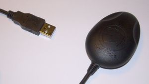
I'm currently using a Navilock BT-359 Bluetooth receiver (Sirf III) with my Mobile Phone (Nokia 6300) running GPS Track. I'm also using a Navilock NL-302U (Sirf III) on my Dell Inspiron 8100 notebook (which batteries are giving up...) for car drives.
I own a Wintec WSG 1000 that should become my primary GPS logger.
Software
The notebook runs Debian Linux Etch (4.0). gpsd read from this device an provides the position data for all connected software modules. I usually log both with gpspipe -r (NMEA) to a file an with gpsdrive. The big xgps satellit view provides a good check whether I got a 3D fix or not.
I made also some tests with J2ME Applications on my new mobile Phone (Nokia 6300) with Bluetooth receivers
- GPSLog from c't Heise periodical 10/2007, S.186: Works quite well but it's very simple and logs only every five seconds.
- GPS Track a nice OpenSource Application with some nice features. This works quite well! Maybe I improve it someday.
- trekbuddy a freeware application. This one allows to record raw NMEA and even show maps.
Mapping Areas
- Mainly in Schaffhausen
- Thurgau
- Zürich
- I've worked in these regions too:
- GR
- Chur
- Breil/Brigels
- VS
- Zermatt
- Stalden
- Visp
- Brig
- Simplon
- GR
- Foreign Countries
- Singen (Germany)
- L'viv (Ukraine)
Events I've been attended
- OpenExpo in Berne, April 2010 - helping at the booth
- I attended the first OSM Zurich meeting at the ETH/bQm
- I was a guest at Andreas Brauchlis CC presentation in the bQm at ETHZ
- Micro mapping party Bremgarten, Mai 2009
- OpenExpo in Berne, April 2009 - helping at the booth
- I presented OSM at LUG-SH in January 2009
- Meeting of Swiss mapper in Zurich, June 2008
- LinuxTag 2008 Friday night meeting
| This user submits data to OpenStreetMap under the name Andy%20Stricker. |

