Welcome and thank you for taking the time to visit this page!
If someone sent you a link to this page or included it in validation or invalidation comments it means they really appreciate your work and think that maybe by reading some of the tips on this page you can increase the value and helpfulness of the data you are creating by mapping.
This page is intended to be the shortest possible set of notes you need for typical HOT task mapping in West Africa. It assumes you know how to use an OpenStreetMap editor of your choice to outline an area, draw a road and add tags to them.
If you are using the iD web editor, and would like a full walk through of its features, here is a link to a short tutorial (multiple languages offered): http://learnosm.org/en/beginner/id-editor/
If you are using or ready to get started with a more full featured, stand alone editor, here is a link to getting started with the JOSM editor (multiple languages offered): http://learnosm.org/en/josm/start-josm/
If you have any questions about mapping, you can always ask on the HOT Email List, or if it easier, just send me a message directly via my OSM user profile: https://www.openstreetmap.org/user/bgirardot
Small Village and Road Mapping
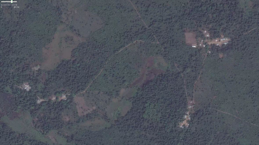
Typical small villages connected by roads in West Africa
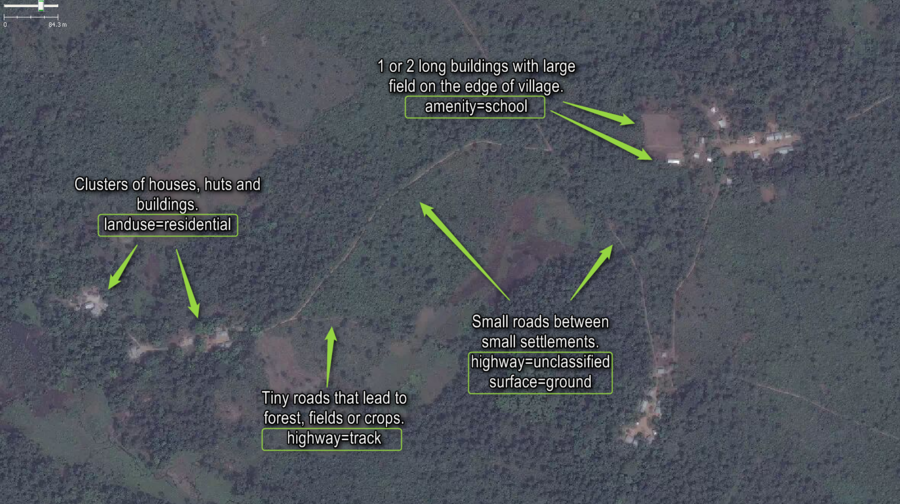
Typical small villages connected by roads in West Africa with notes indicating correct OSM tags

Typical small villages connected by roads in West Africa with items correctly mapped in OSM as displayed by the JOSM OSM editor

Typical small villages connected by roads in West Africa with items correctly mapped in OSM as displayed by the iD web browser OSM editor

Typical small villages connected by roads in West Africa with items correctly mapped in OSM as displayed by the JOSM OSM editor and notes added for things to pay attention to when mapping.
General Road, Track and Path Mapping
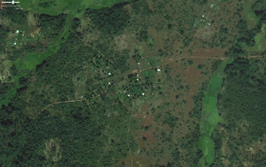
Typical roads, tracks and paths around and between small settlements in West Africa
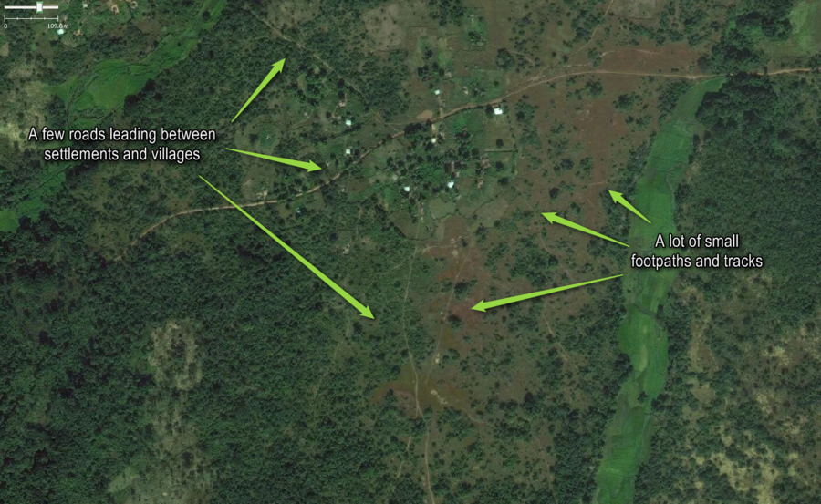
Typical roads, tracks and paths around and between small settlements in West Africa with annotations.
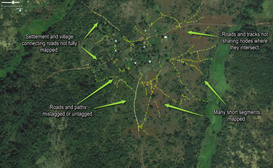
Typical roads, tracks and paths around and between small settlements mapped, but not mapped as helpfully as they could be mapped displayed by the JOSM OSM editor
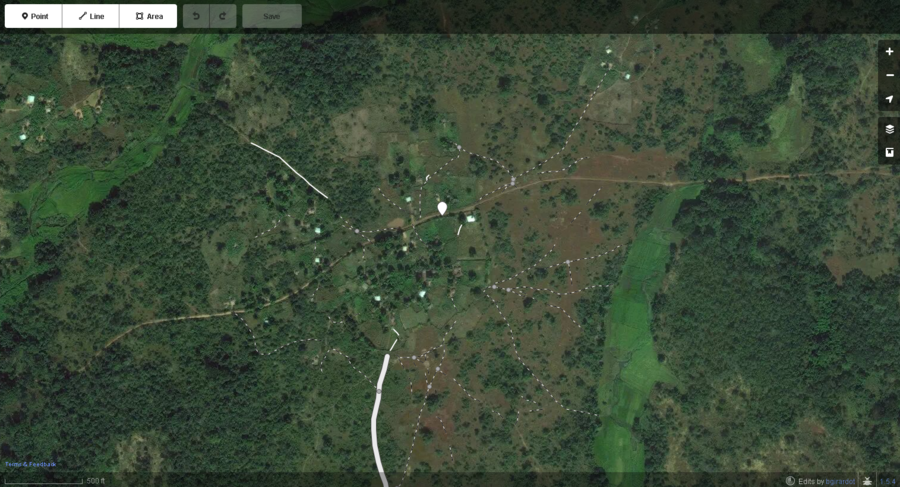
Typical roads, tracks and paths around and between small settlements mapped, but not mapped as helpfully as they could be mapped displayed by the iD web browser OSM editor
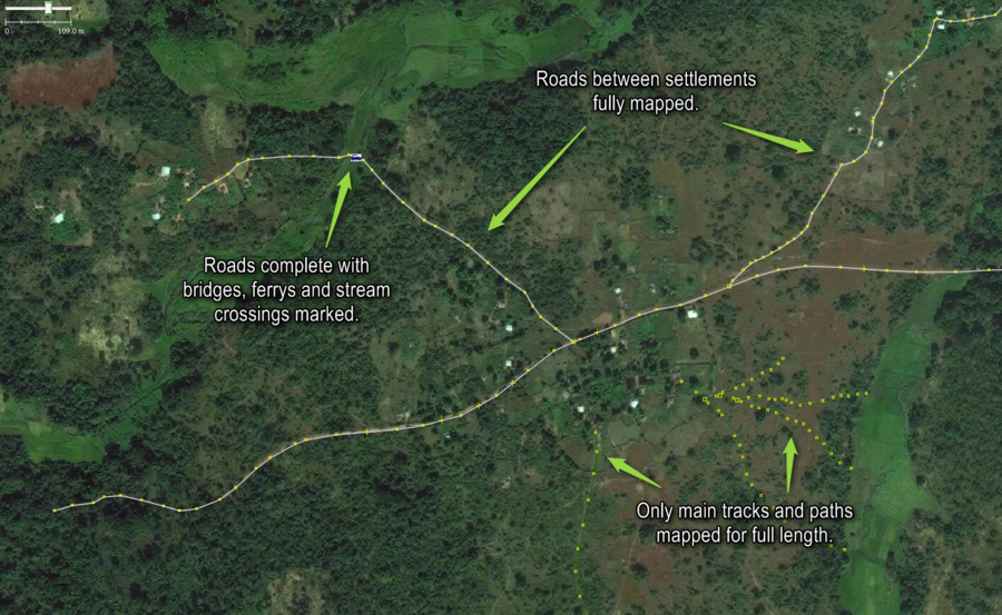
Typical roads, tracks and paths around and between small settlements mapped most helpfully as displayed by the JOSM OSM editor.
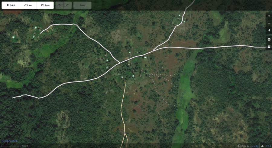
Typical roads, tracks and paths around and between small settlements mapped most helpfully as displayed by the iD web browswer OSM editor.
Issues with Mapping Buildings
Accidentally Sharing Nodes with Other Objects
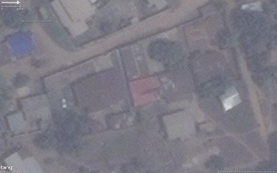
Typical buildings in a West African city.
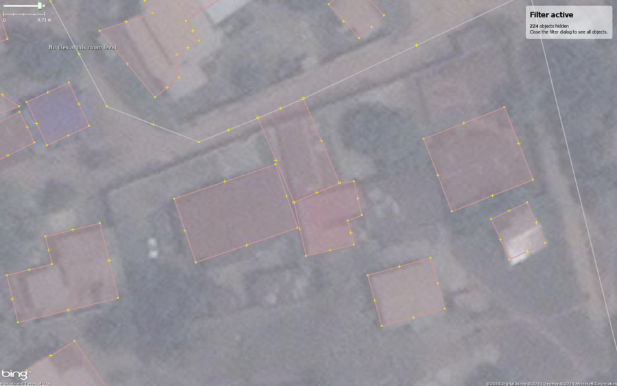
Typical buildings in West African city with a common mapping mistake, shared nodes with roads and other buildings. This is very easy to accidentally do in very densely populated areas, especially when the imagery is dark, not very clear, hazy or low contrast like in these examples. Zooming your view in very close will help make your mapping more accurate.
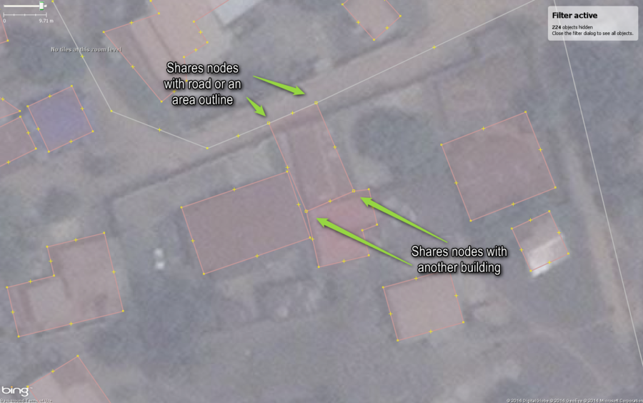
Typical buildings in West African city with a common mapping mistake, shared nodes with roads and other buildings. Notice that the JOSM editor makes the node squares slighly larger when the nodes are shared between more than one object or way.
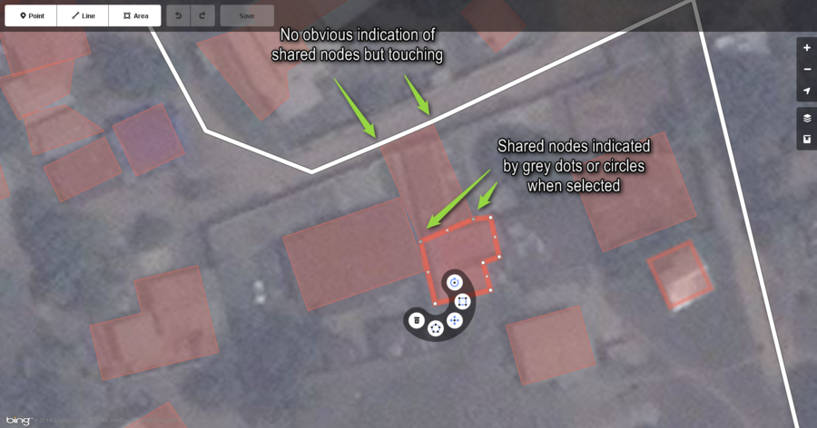
Typical buildings in West African city with a common mapping mistake, shared nodes with roads and other buildings. Notice that the iD OSM editor does not always display nodes so you cannot see if some nodes are shared other than by noticing the objects are touching. When selected an object with shared nodes displays them as grey instead of white.
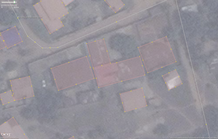
Typical buildings in West African city mapped correctly. Notice that one of the buildings is actually much longer than it was originally mapped. This is because using Mapbox imagery, while lower resolution, revealed this was actually one long building. Use multiple imagery sets to help you in difficult to map areas.
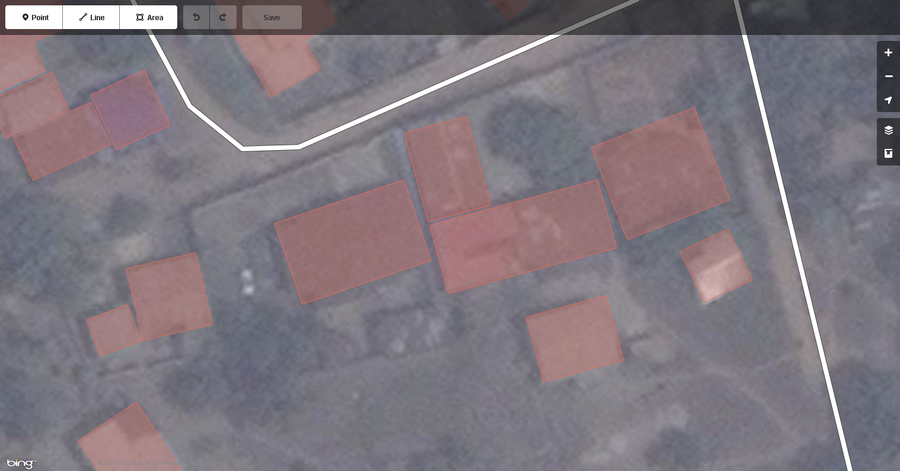
Typical buildings in West African city mapped correctly displayed in the iD web browser based editor.
Square The Corners and Exactly Map The Footprint
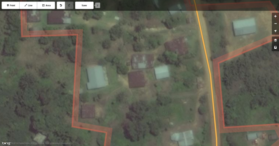
Typical buildings in a West African settlement.
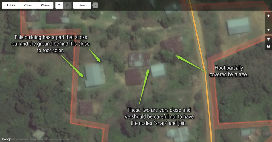
Just some things to notice about these buildings before they get mapped.
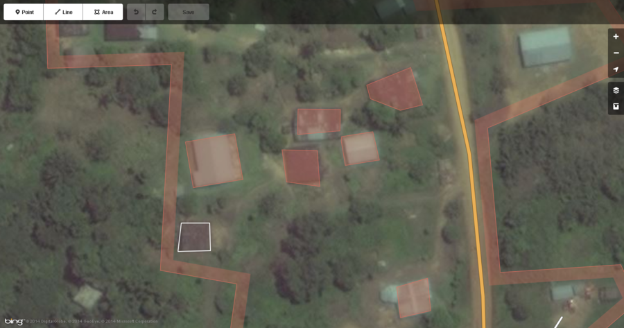
Buildings as they are very commonly mapped.
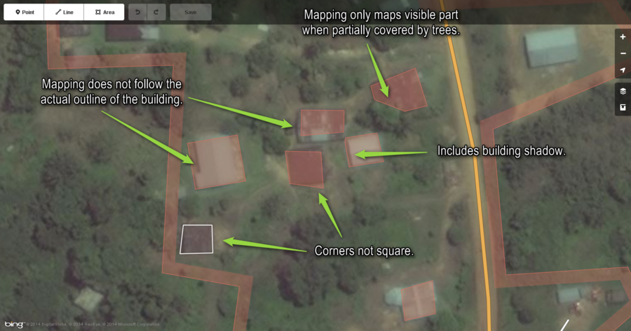
These are the common things mappers will overlook when mapping buildings. Zoom in and out when mapping buildings to get a good view of what the actual footprint of the building is. Trace the building as exactly as possible.
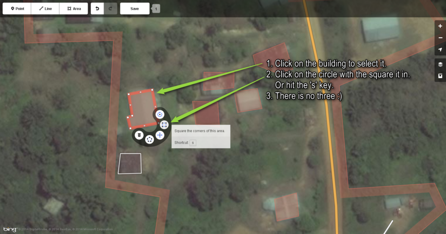
Here is how to use the iD editor to square the corners of a building in 2 easy steps. You should do this for every building you draw that is a rectangle or made up of rectangles.
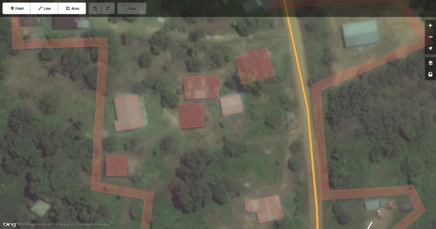
These are the same buildings mapped correctly. The most important thing is that they closely follow the outline of the building and have their corners squared.
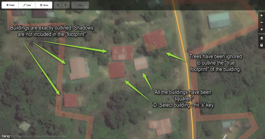
This image just points out the import things when mapping buildings. As mentioned above: Closely follow the actual outline of the building and square the corners.
Interesting Features to Map
Cassava (Manioc) Crops
SergioAJV writes:
Aerial imagery often shows cassava plantations as rounded light green patterns, planted in not very regular rows (new plants). Sometimes it will show only brown rounded remains, but in the exact place where there were plants that were already picked.
It is farmed from side to side on the same uncovered land seasonally so its allotments usually are permanent.
Since it is usually planted in small strips or areas by few individuals, usually not large areas managed by machines, the areas are sometimes isolated or sometimes following river margins or wetland.
They should be mapped as one area when brown and green areas are together since they are part of the same seasonal plantation area. Only when they are disconnected by remarkable different features such as portions of forest or rivers or non-farmed land should they be mapped as individual areas.
Paths can be found going through the areas. Plantation borders almost always can be ways for paths, if in straight patterns and not too close to dense vegetation.
They should be tagged as landuse=farmland and crop=cassava.
Blake adds:
As always if you are not sure, please feel free to send a url to the HOT email list, past it in the IRC channel and/or put a fixme=confirm tag on the area.
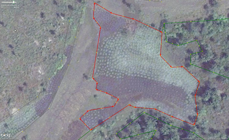
An example of cassava, also known as manioc, cultivation in West Africa. The main identifying feature are the collection of rounded shapes of 1 to 1.5 meters across arranged tightly but irregularly. Green areas are new and growing plants and brown areas are harvested.
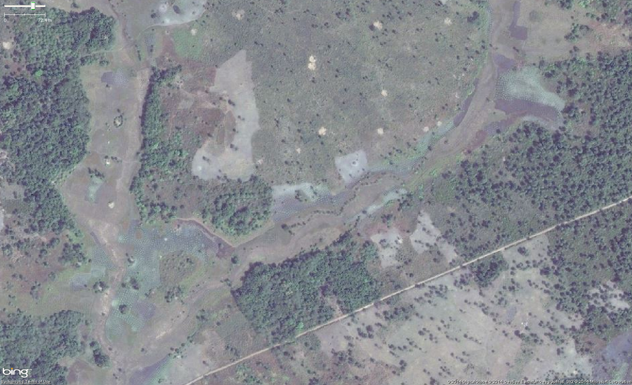
This example is the exact same area as the image directly above but zoomed out a lot more. It is intended that you view this photo by clicking on it and looking at the original size to see what they look like from a different, higher level perspective.
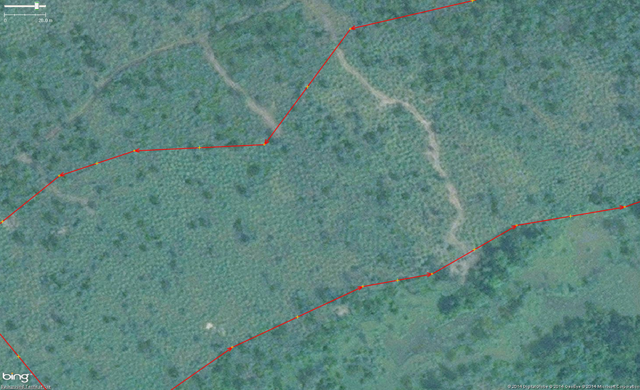
This example of cassava is a field of growing plants mixed in with some trees just to provide another example of how you might see this crop in imagery.
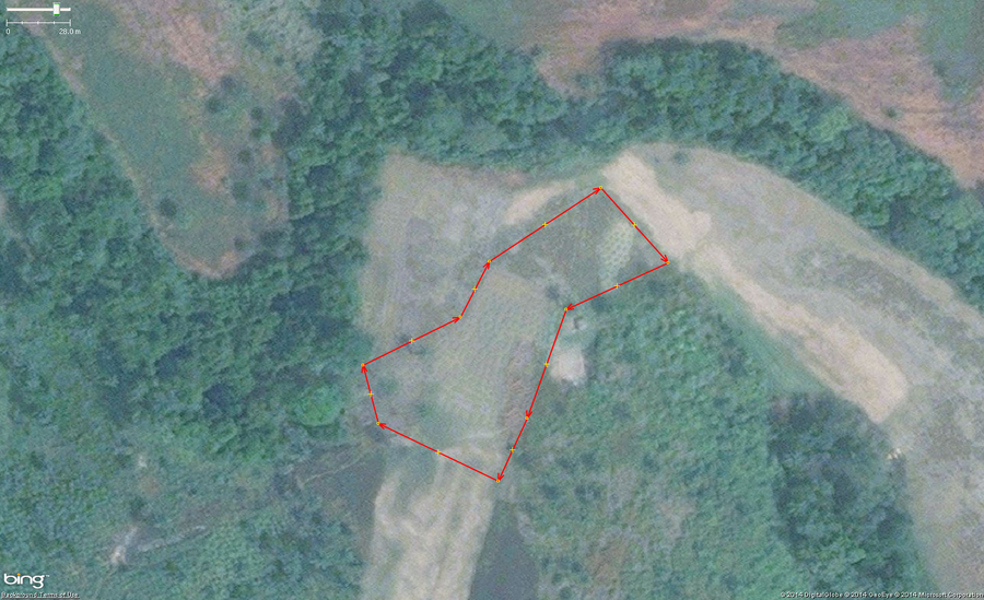
An example of cassava, also known as manioc, cultivation in West Africa. The main identifying feature are the collection of rounded shapes of 1 to 1.5 meters across arranged tightly but irregularly. Green areas are new and growing plants and brown areas are harvested.
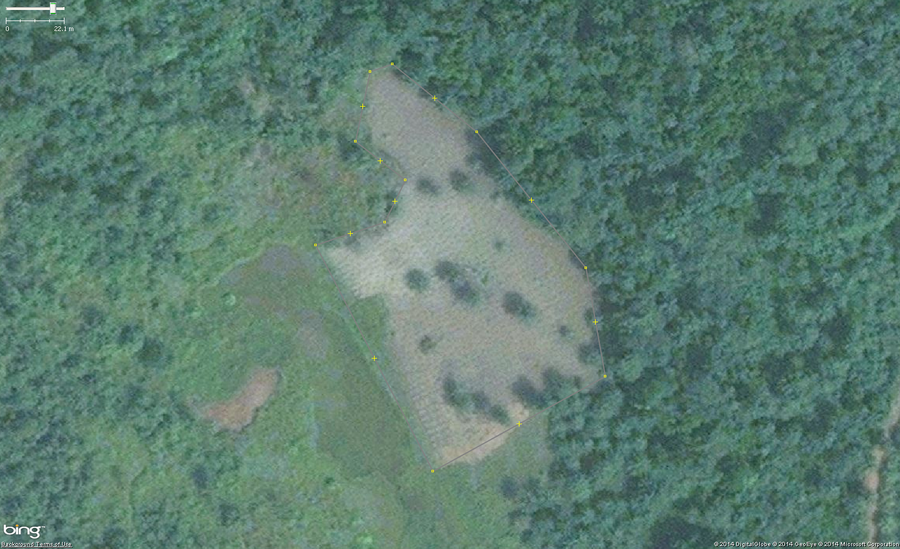
An example of cassava, also known as manioc, cultivation in West Africa. The main identifying feature are the collection of rounded shapes of 1 to 1.5 meters across arranged tightly but irregularly. Green areas are new and growing plants and brown areas are harvested.
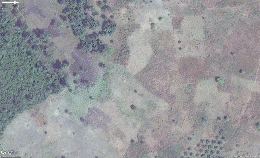
An example of cassava, also known as manioc, cultivation in West Africa. The main identifying feature are the collection of rounded shapes of 1 to 1.5 meters across arranged tightly but irregularly. Green areas are new and growing plants and brown areas are harvested. Also note that you can see a small part of a palm orchard in the lower right area of the image.
Rice Paddies
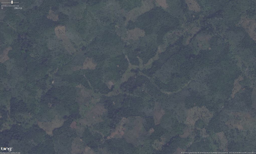
This is a zoomed out view of typical small scale rice farming. You can see the lighter colored green vegitation, formed from the watershed drainage area. Small scale row crops and rice paddies are often planted in these flood plane areas. Zooming in to check might reveal obvious rice paddies or row crops.
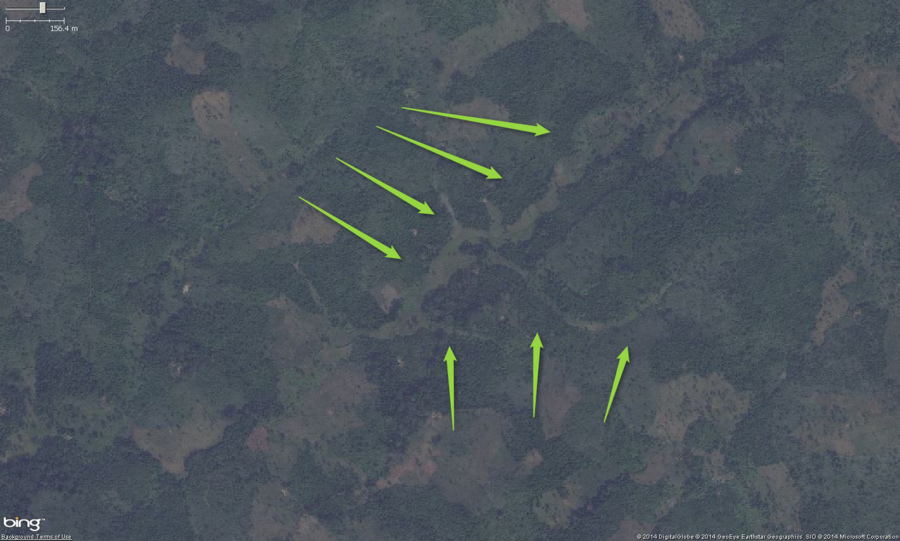
This is a zoomed out view of typical small scale rice farming. You can see the lighter colored green vegitation, formed from the watershed drainage area. Small scale row crops and rice paddies are often planted in these flood plane areas. Zooming in to check might reveal obvious rice paddies or row crops.
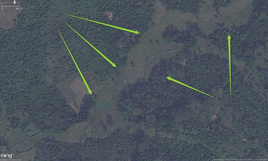
This is the same area as above, but zoomed in. Here you see very obvious land under cultivation. These are rice paddies and the key features to help you identify them are: 1. Large squares or irregular rectangles with earthen/vegitated dividers. 2. A central water canal with fields usually on each side. 3. Often in a wet or low land flood plain area. This should be tagged with landuse=farmland. Optionally, you can add the crop=rice tag.
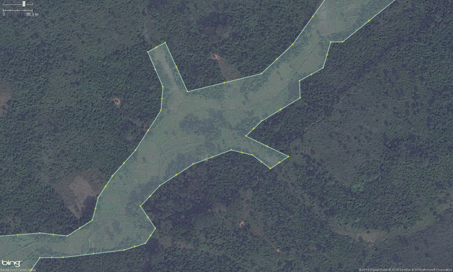
This is the same area as above, but zoomed in and having been outlined for mapping JOSM. These are rice paddies and the key features to help you identify them are: 1. Large squares or irregular rectangles with earthen/vegitated dividers. 2. A central water canal with fields usually on each side. 3. Often in a wet or low land flood plain area. This should be tagged with landuse=farmland. Optionally, you can add the crop=rice tag.
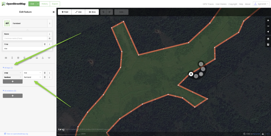
This is the same area as above, but zoomed in and having been outlined for mapping with the iD web browser editor. Please note the "All tags" area on the left has the suggested tags for this type of agriculture. These are rice paddies and the key features to help you identify them are: 1. Large squares or irregular rectangles with earthen/vegitated dividers. 2. A central water canal with fields usually on each side. 3. Often in a wet or low land flood plain area. This should be tagged with landuse=farmland. Optionally, you can add the crop=rice tag.
Palm Orchards
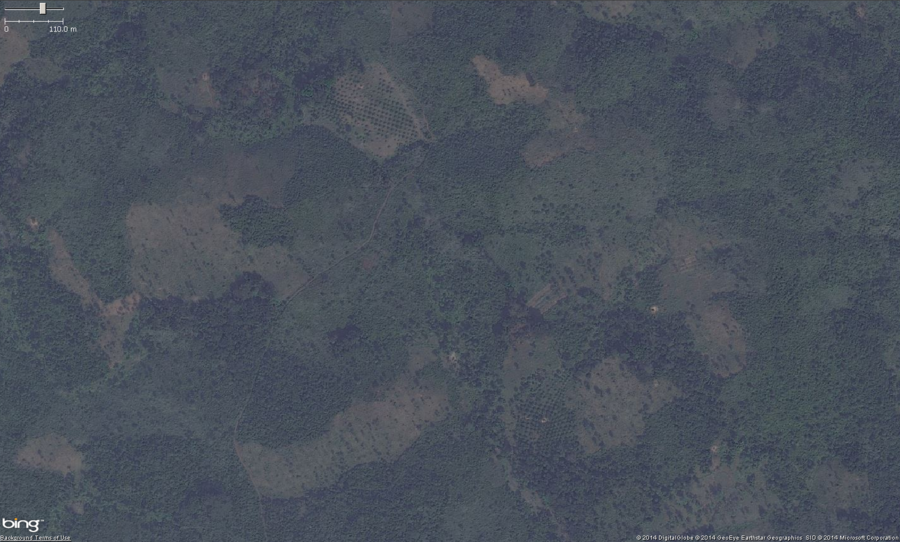
This is the zoomed out view of 2 small palm orchards in West Africa. The main feature to look for, especially zoomed out is a pattern of very regularly spaced trees. A close look at this photo shows two areas of potential palm orchards. Zooming in will confirm if it is a palm orchard or not.
These should get tagged with landuse=orchard. Optionally you can put the species=palm tag on them as well.
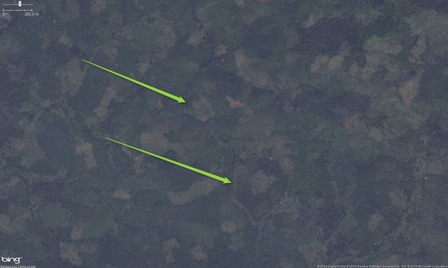
This is the zoomed out view of 2 small palm orchards in West Africa. The main feature to look for, especially zoomed out is a pattern of very regularly spaced trees. Viewing this file in the Original Size will help with identification of the orchards from this zoom level. Zooming in will confirm if it is a palm orchard or not.
These should get tagged with landuse=orchard. Optionally you can put the species=palm tag on them as well.
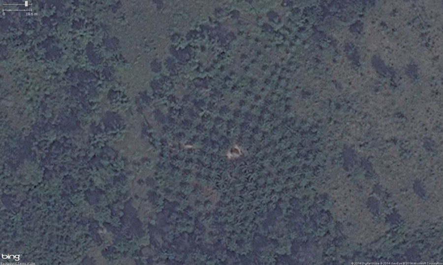
This is the zoomed in view of the southern orchard from the above images. You can see the very regular rows, well spaced placement of trees. Also note, these trees have a very distinctive "star" shape to their leaves, this is one of the indicators the crop is palm. This small orchard also has a small farm building in the middle of it.
These should get tagged with landuse=orchard. Optionally you can put the species=palm tag on them as well.
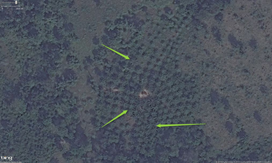
This is the zoomed in view of the southern orchard from the above images. You can see the very regular rows, well spaced placement of trees. Also note, these trees have a very distinctive "star" shape to their leaves, this is one of the indicators the crop is palm.
These should get tagged with landuse=orchard. Optionally you can put the species=palm tag on them as well.
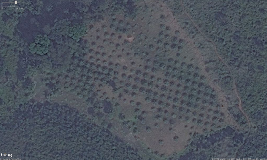
This is the zoomed in view of the southern orchard from the above images. You can see the very regular rows, well spaced placement of trees. Also note, these trees have a very distinctive "star" shape to their leaves, this is one of the indicators the crop is palm. These should get tagged with landuse=orchard. Optionally you can put the species=palm tag on them as well.
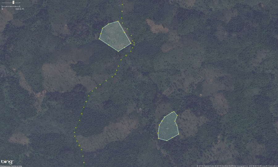
This is the zoomed in view of the southern orchard from the above images but with the landuse=orchard areas mapped in JOSM. You can see the very regular rows, well spaced placement of trees. Also note, these trees have a very distinctive "star" shape to their leaves, this is one of the indicators the crop is plam. These should get tagged with landuse=orchard. Optionally you can put the species=palm tag on them as well.
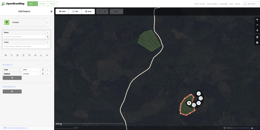
This is the zoomed in view of the southern orchard from the above images but with the landuse=orchard areas mapped in the iD web editor. You can see the very regular rows, well spaced placement of trees. Also note, these trees have a very distinctive "star" shape to their leaves, this is one of the indicators the crop is plam. These should get tagged with landuse=orchard. Optionally you can put the species=palm tag on them as well.
Cemeteries
Cemeteries are difficult to identify from aerial imagery and are not very common in rural areas. If you do find what you think is a cemetery it would be best to ask on the HOT email or irc to have others look at it as well.
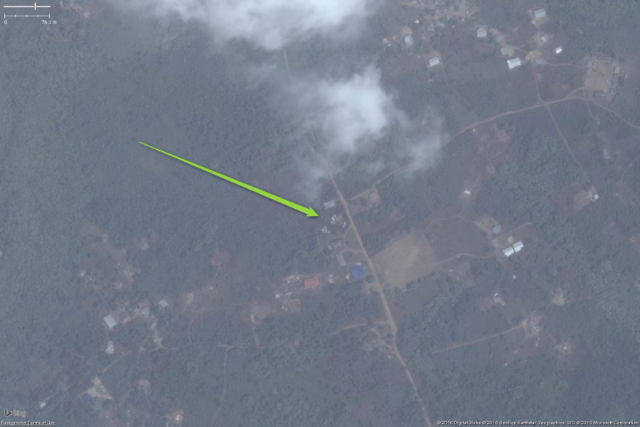
A likely small cemetery in West Africa. The main distinguishing feature is the very small white rectangles densely packed. This is a zoomed out view just to illustrate what they look like. This should be mapped as amenity=cemetery and fixme=confirm (unless you have first hand knowledge).
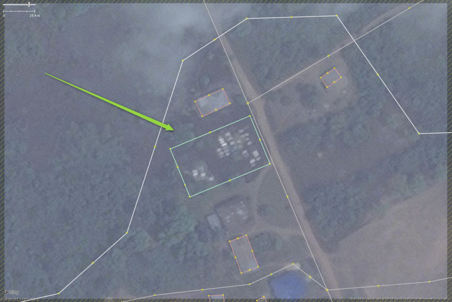
A likely small cemetery in West Africa. The main distinguishing feature is the very small white rectangles densely packed. Note the unmapped building immediately south's roof has been patched and shows a very similar pattern of white rectangles but they smaller, be careful not to confuse the two.
This should be mapped as amenity=cemetery and fixme=confirm (unless you have first hand knowledge).
Marketplaces
Marketplaces can be difficult to identify. The most important thing to see when giving them a preliminary identification is that they are a collection of very small buildings which are really very small market "stalls" or tents. It is important to see other buildings around them so you can compare the relative size of the structures. In some very high density low income areas the housing can be almost as small and just as densely packed with the roofs appearing to be one huge buildings, but in low income city housing the areas covered are usually much larger. As always, a fixme=confirm tag should be used unless you are very sure, usually with firsthand knowledge, that it is a marketplace.
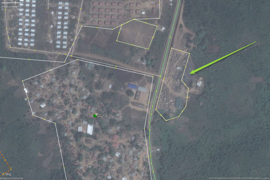
A likely marketplace in a larger West African settlement. The key features are the small buildings tightly packed. There is also one large building that is typically seen in marketplace areas used as a central storage or distribution building. The area also indicates a marketplace makes sense here, a large settlement and an industrial scale housing camp of some sort.
This should be tagged amenity=marketplace and fixme=confirm (unless you have first hand knowledge it is a marketplace).
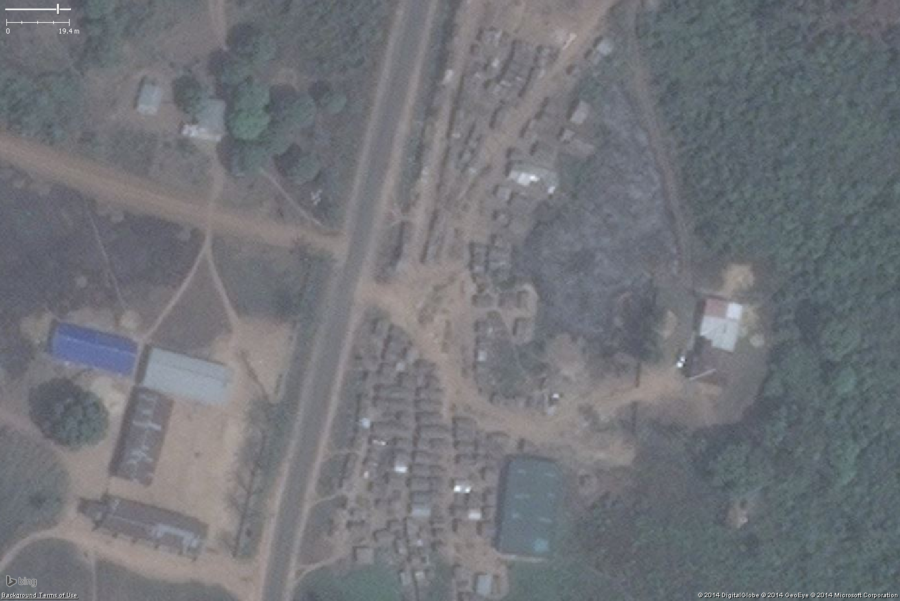
A likely marketplace in a larger West African settlement. This is just a zoomed in view of the marketplace above. The key features are the small buildings tightly packed and the one large building used as a central storage or distribution building.
This should be tagged amenity=marketplace and fixme=confirm (unless you have first hand knowledge it is a marketplace).
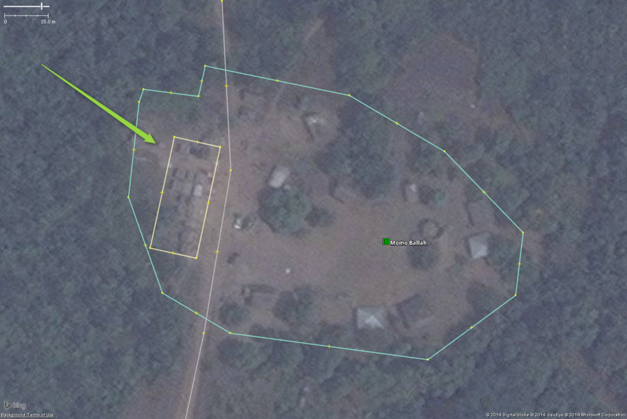
A likely marketplace in a small West African village. The key features are the small buildings tightly packed. This should be tagged amenity=marketplace and fixme=confirm (unless you have first hand knowledge it is a marketplace).
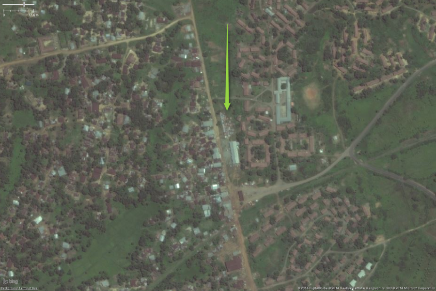
A likely marketplace in a larger West African settlement. The key features are the small buildings tightly packed. In this example they are so tightly packed the roofs appear to touch. The large building south is also part of the marketplace, in this case it looks to serve as more than just a storage facility.
The collection of small buildings should be tagged amenity=marketplace and fixme=confirm (unless you have first hand knowledge it is a marketplace).
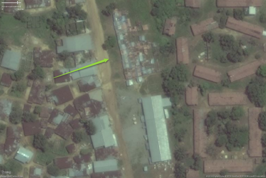
A likely marketplace in a larger West African settlement. Same as above, but zoomed in. The key features are the small buildings tightly packed. In this example they are so tightly packed the roofs appear to touch. The large building south is also part of the marketplace, in this case it looks to serve as more than just a storage facility.
The collection of small buildings should be tagged amenity=marketplace and fixme=confirm (unless you have first hand knowledge it is a marketplace).
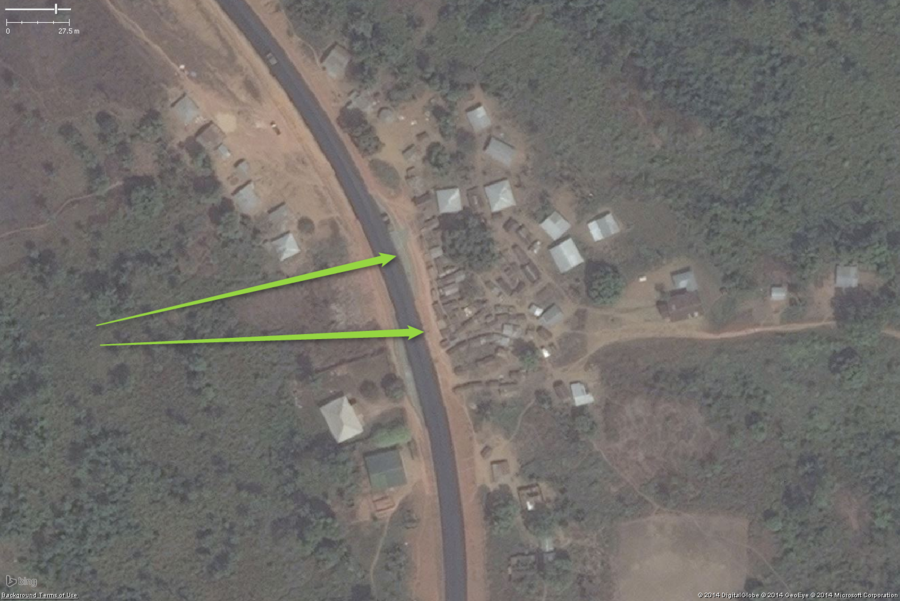
A likely marketplace in a small West African settlement. The key features are the small buildings tightly packed. The location also fits somewhat with a marketplace, this is along a major highway=primary between large cities and is at an intersection with a highway=unclassified and another south. You can see an area for passing vehicles to pull off and visit the marketplace.
The collection of small buildings should be tagged amenity=marketplace and fixme=confirm (unless you have first hand knowledge it is a marketplace).
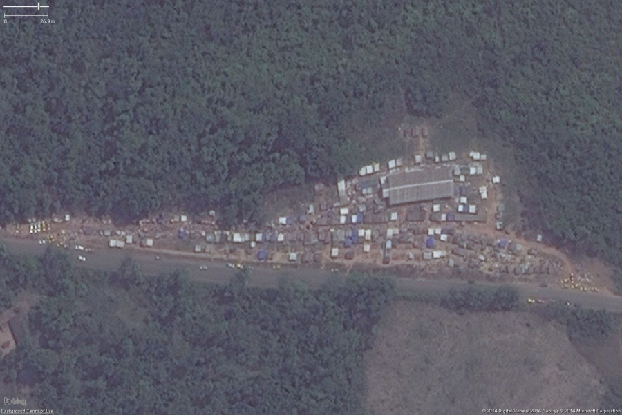
A likely marketplace in West Africa. The key features are the small buildings tightly packed, this one probably has tents for stalls as well. This is another roadside market along a major highway=primary just outside a large town. You can see a number of cars parked along the road and what is probably people along the main market area.
The collection of small buildings and tents should be tagged amenity=marketplace and fixme=confirm (unless you have first hand knowledge it is a marketplace).
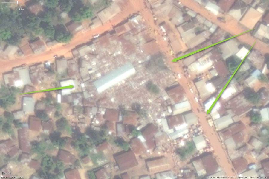
A likely marketplace in a large West African town. The key features are the small buildings tightly packed. In this example a rather large area is so densely packed with stalls the roofs appear to touch and overlap each other, covering almost an entire city block. The large building in the middle is probably a storage and distribution building. You can also see the stalls get slightly less densely packed in the areas and side streets around the main marketplace
The collection of small buildings should be tagged amenity=marketplace and fixme=confirm (unless you have first hand knowledge it is a marketplace).
Schools
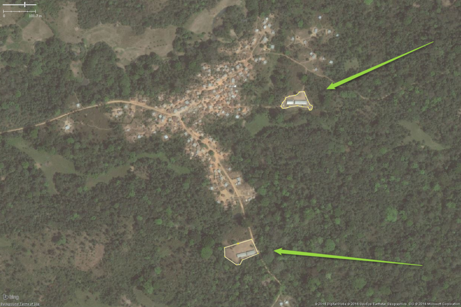
A typical rural school in West Africa. This zoomed out view shows two likely schools on the edge of the village. The overall school property should be tagged with amenity=school.
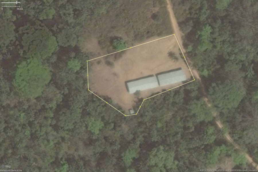
A typical rural school in West Africa. This zoomed in view shows the key features: 1 or 2 long buildings, 1 or 2 smaller toilet buildings, a large bare field.
The overall school property should be tagged with amenity=school and the buildings with building=yes.
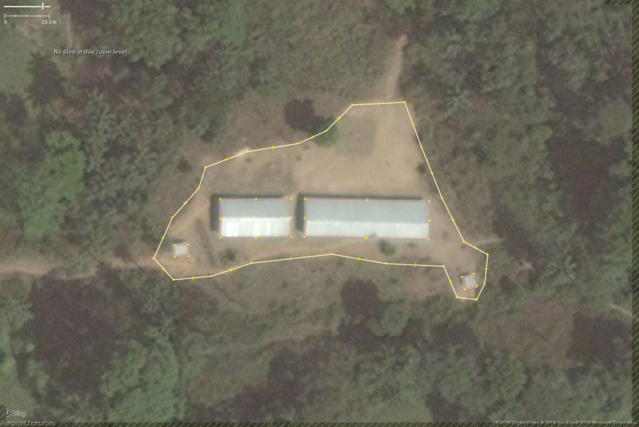
A typical rural school in West Africa. This zoomed in view shows the key features: 1 or 2 long buildings, 1 or 2 smaller toilet buildings, a large bare field.
The overall school property should be tagged with amenity=school and the buildings with building=yes.
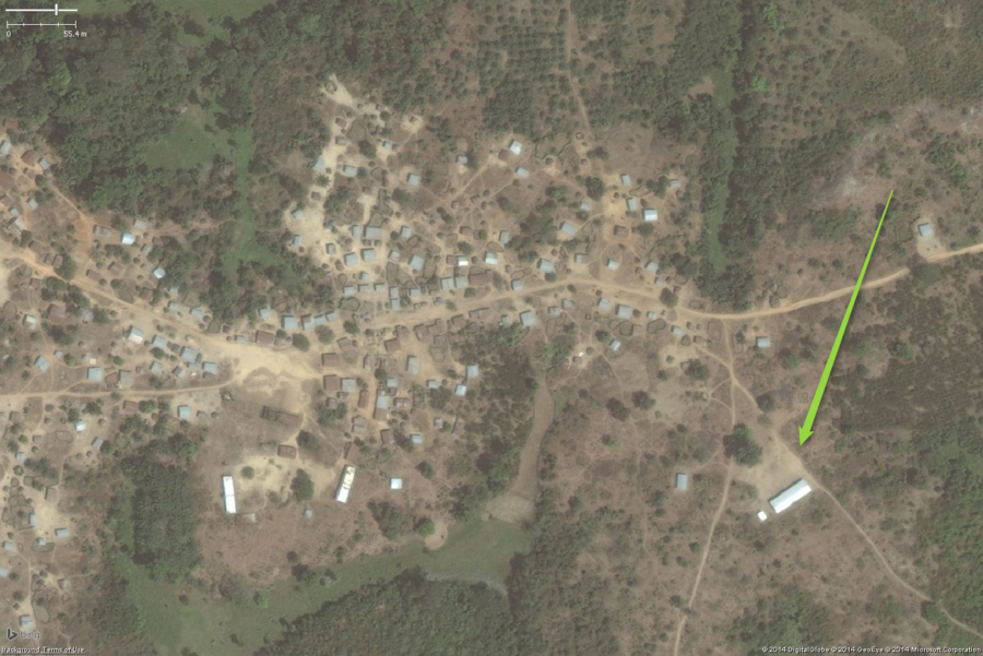
A typical rural school in West Africa. This zoomed out view shows a likely school on the eastern edge of the village. Please note the two long buildings on the western side of the image could easily be confused for school areas, but the lack of a large clear yard and toilet buildings suggests they are not schools. The overall school property should be tagged with amenity=school.
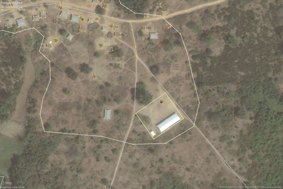
A typical rural school in West Africa. This zoomed in view shows the key features: 1 or 2 long buildings, 1 or 2 smaller toilet buildings, a large bare field.
The overall school property should be tagged with amenity=school and the buildings with building=yes This one also has a well tagged: man_made=water_well.
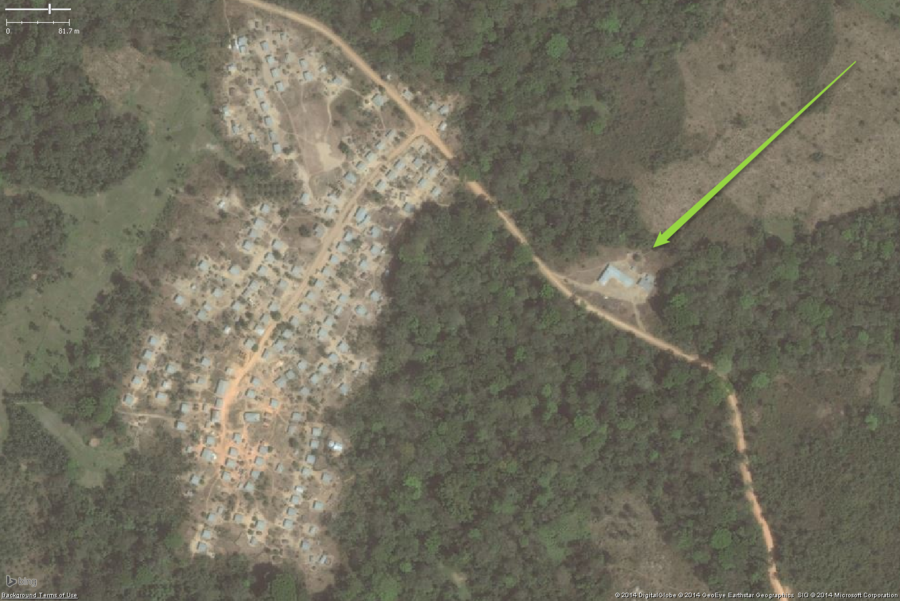
A typical rural school in West Africa. This zoomed out view shows a likely school on the eastern side of the village. While the buildings are not the very classic two long buildings, the over all placement helps to determine this is a school as will the detailed views below. The overall school property should be tagged with amenity=school and I would also put fixme=confirm on this one as well.
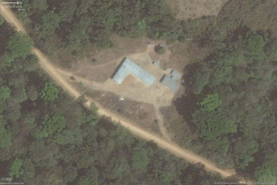
A typical rural school in West Africa. While not exactly the classic school area, you can see it still has the key features: 1 or 2 long buildings, 1 or 2 smaller toilet buildings, a large bare field. The overall school property should be tagged with amenity=school and the buildings with building=yes. I would also add fixme=confirm to the overall area polygon.
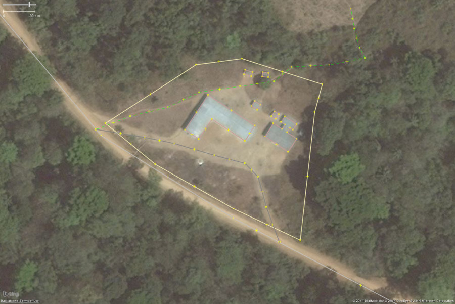
A typical rural school in West Africa. Same as above, but shown well mapped in JOSM.
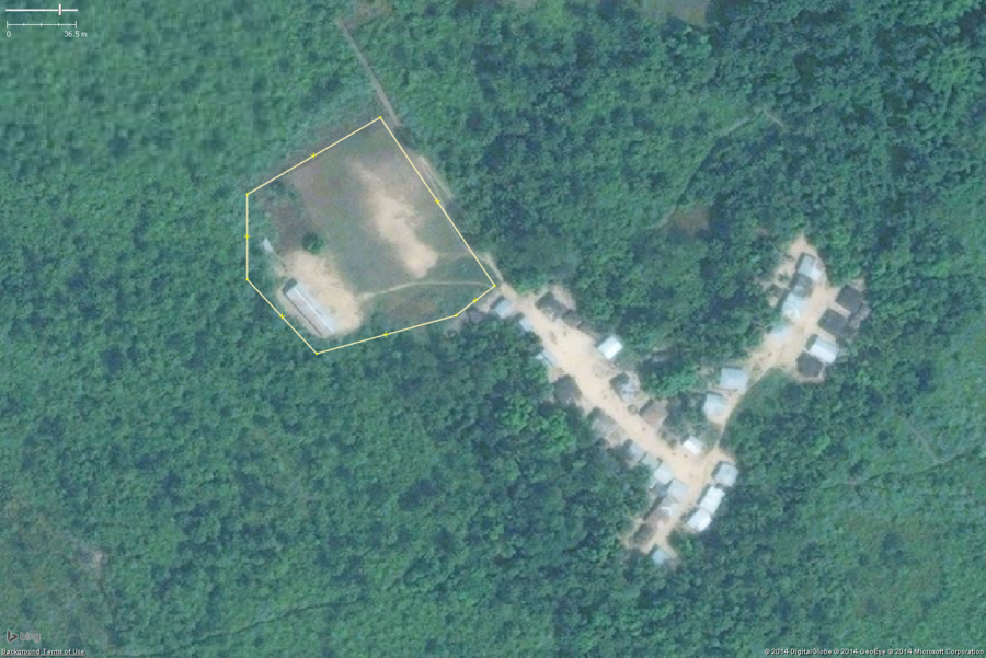
A typical rural school in West Africa. This zoomed in view shows the key features: 1 or 2 long buildings, 1 or 2 smaller toilet buildings, a large bare field.
The overall school property should be tagged with amenity=school and the buildings with building=yes
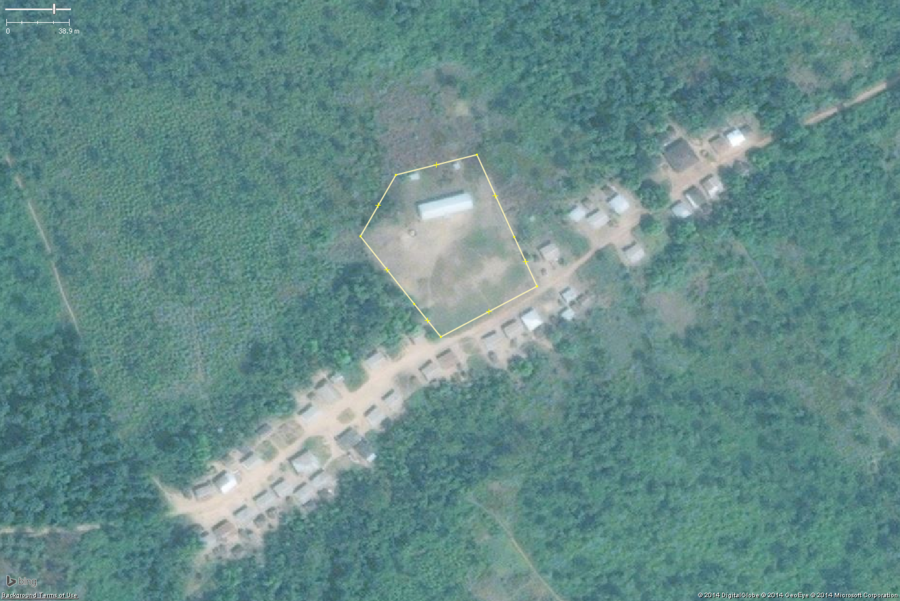
A typical rural school in West Africa. This zoomed in view shows the key features: 1 or 2 long buildings, 1 or 2 smaller toilet buildings, a large bare field.
The overall school property should be tagged with amenity=school and the buildings with building=yes. This school yard also has a well that should be tagged: man_made=water_well.
Surface Mines
The illustrations and descriptions for this section were contributed by Sonali Agrawal.
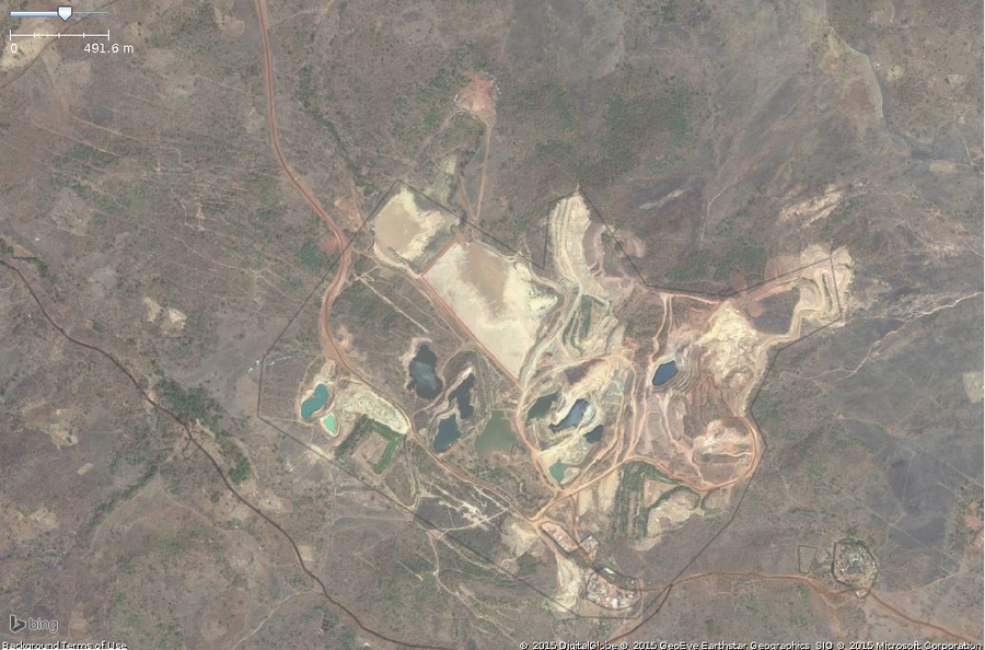
A typical site of surface mining in west africa. This zoomed in view shows the key features: pools of ground,funny color,exposed ground.The overall area should be tagged with landuse=quarry.
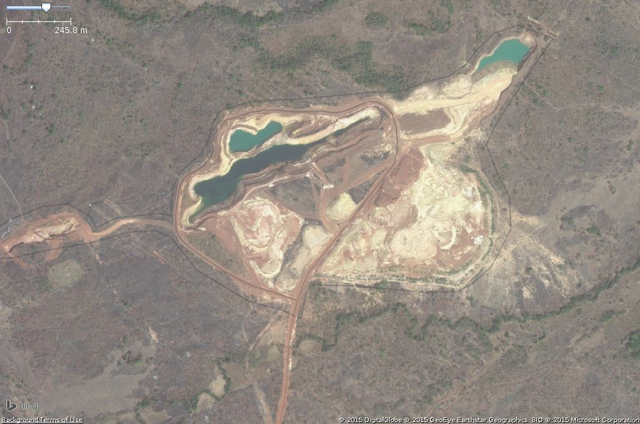
One of the other feature is roads around that area.
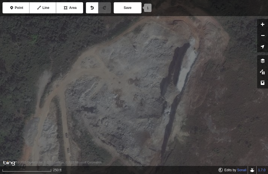
Vehicled visible near a exposed land
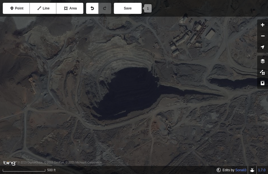
Man made hole digged on the surface. Step like structure.
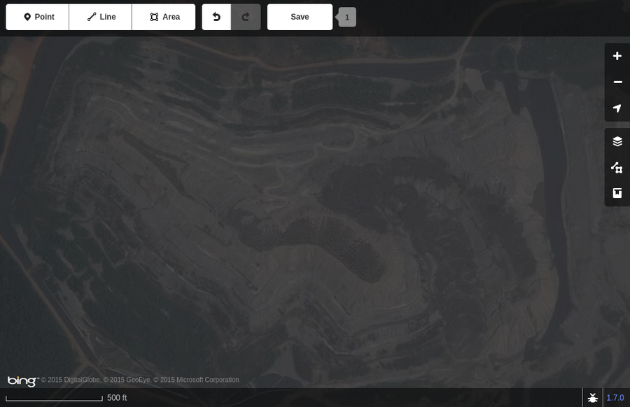
Example of step like structure
Water Wells
Also see


