User:Ieskok/OpenMap
Another map site?
Yes! But it uses its own server for distributing generic tiles, generating own layers and proxying 3rd party layers. Also there is my own look to map usability. I created it to be comfortable for me (and i think for many others).
Search
It is possible to search for streets or POIs, using either their name ("Čili kaimas, Vilnius") or by category ("restaurant, Vilnius"). Results display an icon for many types of POIs.
Search by substrings is supported and diacritic marks can be omitted. Hence, a search for "vokieciu, vilnius" will find Vokiečių g. as well as Vokiečių vaistinė.
Layers
Base map layers
The Mapnik, Osmarender and OpenCycleMap layers are available; it is possible to select a blank base layer.
The Mapnik and OpenCycleMap layers are cached from their main tile servers. As soon as tiles change on these servers, openmap.lt will also serve the updated tiles.
The Osmarender layer is fetched directly from T@H servers.
Public transport
This layer is still under construction.
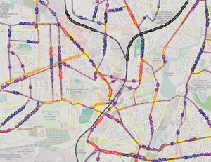
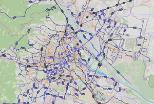
The Public transport layer is a transparent overlay showing route lines, stop groups&points, route numbers and stop names. It covers whole world. Data is updated at least once a week, using replicated Planet.osm. All public transport stops regardless of their relations are rendered.
The color scheme tries to use the colors most frequently used on similar maps in Europe (it happens to be quite similar to those used by the transport companies in Vilnius and Budapest):
| Railway | |
| Light rail | |
| Subway | |
| Tram | |
| Trolleybus | |
| Bus | |
| Share taxi | |
| Ferry |
Layer data
You can download filtered & processed public transport data directly from openmap.lt server - osm.ramuno.lt/downloads/transport/ which is ~272-304MB bzipped xml(April 2014). So there is two data types:
- just filtered public transport data from whole planet
- filtered and processed data for better rendering
Filters and processing scripts is still under construction but it will be available soon in openmap.lt repository. Filtering is done using tool Osmfilter and it's updated daily.
OpenStreetBugs
- Where did this layer go? I found it very useful (especially the combination with public transport), hope it's not gone for good...
This layer displays errors in the map reported through OpenStreetBugs. It is possible to add comments to existing bugs or close them, but new bugs cannot be opened.
Tile usage policy
- Are other websites allowed to use the tiles? If so, under what conditions? Do load limits apply (what are they)?
Reporting bugs
- TBD, important in my opinion - how can the author be contacted for bug reports, suggestions etc.?
There is repository on GitHub. Feel free to fork code or report issues in tracker. Whole openmap.lt code will be available soon.

