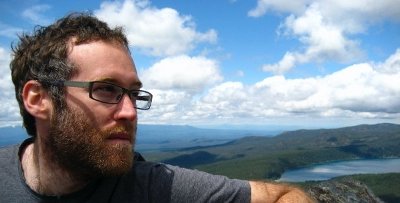
User:Mikel
Email: mikel_maron yahoo com
Skype: mikelmaron
Twitter: mikel
Weblog: Brain Off and GroundTruth and OSM Diary
I'm based in DC.
Foundation and Governance Roles
I am serving as a Foundation Board Member as of 2015, and did previously 2007-2011. I chair the Fundraising Committee
Served on working groups
- Data Working Group, founded and served until ~2011
- Communications Working Group
- State of the Map Working Group, 2015 - present
- Community team lead at Mapbox, 2015-2022
- Originator of HOT. President of the Humanitarian OpenStreetMap Team, 2011-2014. Chair of Voting Members 2015-2018
- co-Director of GroundTruth Initiative (http://groundtruthinitiative.org/, 2010 - 2015
- Founder and Director of http://mapkibera.org/, 2009 - present
- State Department MapGive, Presidential Innovation Fellow, 2014-2015
- TeachOSM steering committee member
my work in OpenStreetMap
I started with OSM in 2005. When exposed to OSM, weird people got excited, and regular people got scared .. that's usually a good sign. It was the most audacious, wonderous project I had come across, and it was either going to fail spectacularly, or succeed beyond anyone's expectations. As we've seen, it's definitely the latter. I continue to be inspired by the potential of OSM, to challenge inform and empower, to map the unmapped, and change the world for the better.
Early on, I got involved with technical stuff on the OSM pre-rails, pre-mapnik barely working server. Experimented quite a bit, with the first OSM map on a Garmin GPS, and later on the iPhone. One of the initating developers of Mapstraction, the mapping API abstraction library that supports and promotes OSM. My company Mapufacture (now part of FortiusOne) makes use of OSM maps (as well as sponsoring SOTM 2008). In 2008, I mentored Arindam Ghosh in the Google Summer of Code, work that led to the internationalization of the OSM rails app.
Working with corporations to support and use OSM data has been a focus. I worked with Yahoo to get permission to use their aerial imagery for OSM. I helped Nestoria, the first commercial user of OSM data. Introduced AND executives to OpenStreetMap and facilitated their data donation.
I have travelled, promoted, and taught OSM across the world. In February 2008, I spent a month in India introducing OSM to the open source community. In September 2008, we organizing a similar trip in Southern Africa, before and after FOSS4G. Through 2009, I've worked with JumpStart International, and facilitated the complete mapping of Palestine. I've helped organize mapping parties in Cairo and Merano Italy (and also help liberate all of Merano's municipal GIS data). Following Cyclone Nargis, I helped coordinate training and technical assistance for local groups in Myanmar to use OSM. With IBM, I've helped coordinate the import of the UN's data on Sudan, and advised Development Seed on the import of the AfriCover database. I map Burning Map. In late 2009, been mapping one of Africa's largest slums, Kibera.
Disaster and humanitarian applications of OSM are a special interest. I've had ongoing discussions with several UN agencies on the use of OSM in disaster response, and represent OSM at the UN Geographic Information Working Group, and the CODATA Global Roads Data Development working group. Helped with integration of OSM into Sahana, the open source disaster relief management software, and discussed use of OSM with groups like INSTEDD and MapAction. I'm organizing the Humanitarian OpenStreetMap Team, and am planning to participate in response exercises, conferences, and projects.
I've spoken about OSM at Where 2.0, Web 2.0 Expo, ETech, Yuri's Night, SOTM, and many small events in the UK, Europe and USA. Written several published articles myself, quoted in numerous newspaper articles, and in the process of contributing a chapter on OSM to a new book.
I mapped Brighton, UK.
 Mikel is awarded the North Star
for solving ticket 134
which kept the OSM website in limbo for two weeks February 5-17, 2006.
