User:Rajo
Jump to navigation
Jump to search
| |||||||
|
When I was working at the German Research Center for Artificial Intelligence in the Agents and Simulated Reality Group, I was dealing with the visualization of geographic data using Declarative 3D for the Web Architecture. As a further result, I created a simple viewer for OpenStreetMap using the OSM-W3DS provided by GIScience, Department of Geography, University of Heidelberg, which can be found here.
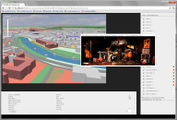
OSM-3D with XML3D, showing the inner city of Saarbrücken. See also: http://youtu.be/6zEx7t0E8bs?hd=1
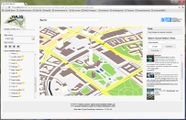
Screenshot of the W3DS-Version, live-demo at http://www.xml3d.org/xml3d/demos/osmxml3d/

