Vientiane
Jump to navigation
Jump to search
| V・T・E |
| latitude: 17.964, longitude: 102.613 |
| Browse map of Vientiane 17°57′50.40″ N, 102°36′46.80″ E |
| Edit map |
|
External links:
|
| Use this template for your locality |
Vientiane is a city in Vientiane municipality, Laos at latitude 17°57′50.40″ North, longitude 102°36′46.80″ East.
Status in Vientiane
Colour and symbol legend
The status of each map region is indicated by a symbol, which describes the type of feature, and a colour, which indicates the completeness of that feature in a map region.
Usage
The status is displayed using a template Template:State
{{State|Key=progress}}- progress - 1/2/3/4/NA
Meaning of symbols
 - Street names are labelled. This means that the map can be used to find an address - Key: l
 - All housenumbers are present - Key: h
 - All footways are present - Key: fo
 - All wheelchair access is present - Key: d
 - All cycleways, and field and forest roads suitable for bicycles are present - Key: b
 - Roads for car traffic are present. One way streets and pedestrian streets are present. This means that the map can be used for car navigation - Key: c
 - All public transports are present (including name of the bus stop/station names) - Key: tr
 - All stop/station/harbour names are present - Key: ha
 - All bus lines are present (including name of the bus stop names) - Key: bu
 - All trolley/guided bus lines are present (including name of the station names) - Key: ty
 - All tram lines are present (including name of the tram station names) - Key: tm
 - All fast railway lines transports are present (including name of the train station names) - Key: tn
 - All U-Bahn (subway in Germany) lines are present (including name of the station names) - Key: u
 - All S-Bahn (regional commuter train in Germany) lines are present (including name of the station names) - Key: s
 - All steam railway lines transports are present (including name of the train station names) - Key: st
 - All ship lines are present (including name of the harbour station names) - Key: sh
 - All public institutions are present (Churches, sports facilities, venues, schools, hospitals, city hall) - Key: p
 - All petrol stations are present - Key: fu
 - All restaurants and hotels are present - Key: r
 - All tourist attractions are present - Key: t
 - All natural resources are mapped (e.g Water, Lakes and Woodland) - Key: n
Meaning of colours
The English translation is Editable here.
Bilingual Map
Using the name tagging system proposed on WikiProject_Laos#Names it is possible to render bilingual maps.
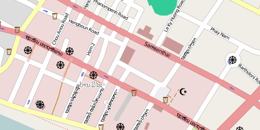
Vientiane downtown rendered in Lao language:

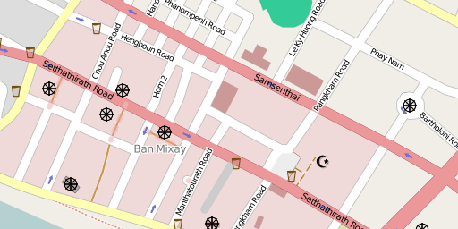
Vientiane downtown rendered in English:

Events
Upcoming
Finished
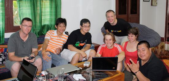
- 24 Oct, 2009. Initial meeting on OpenStreetMap
- 25 Oct, 2009. Initial mini mapping party
- 31 Oct, 2009. Mapping party
- Some mapping around Dongpaina and Lao-Thai Road
- 28 Nov, 2009. Mapping session
- Some editing around Mekong riverbank and T4 road
- 8 Nov, 2010. OSM introduction
- User:Webrian introduces OpenStreetMap to the Laozaa IT and Laoubuntu community at the Ubuntu 10.04 release party and Laozaa birthday
- 26 June, 2010 10.00am. Mapping party at Lao Air Express office 2nd floor, see: http://www.openstreetmap.org/?mlat=17.967434&mlon=102.600689&zoom=18&layers=B000FTF
- see also http://laozaa.com/thread-10365-1-1.html for pictures


