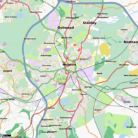
Wakefield
Jump to navigation
Jump to search
| V・T・E |
| latitude: 53.68, longitude: -1.49 |
| Browse map of Wakefield 53°40′48.00″ N, 1°29′24.00″ W |
| Edit map |

|
|
External links:
|
| Use this template for your locality |
Wakefield is a city in West Yorkshire at latitude 53°40′48.00″ North, longitude 1°29′24.00″ West.
Wakefield is in West Yorkshire (UK) just south of Leeds, to the SE of the intersection of the M1 & M62.
Coverage is spreading nicely, and we now have quite a number local mappers. Completion of WF1 and WF2 isn't too far away.
Who's mapping what?
There's nothing worse than spending a day out mapping then coming home to find that someone else has already covered the area you've been working on, so here's a list of what people are currently working on, or planning to cover in the near future.
- User:JonS - Not decided where to map next - anyone got any requests?
- User:Deluded - Calder Grove
- SamLiddicott - Agbrigg & Portobello
- nolife772000 - ?
What's left to map?
This is a list of areas I (Deluded) have noticed still need mapping:
- Calder Grove, next to M1 J39 (Deluded)
- Few roads off Blacker Lane on way to Denby Dale
- Bramley Lane, between Woolley Low Moor and Bretton Ln (goes
underover M1 - with service roads to motorway services) Cambridge Cresent + Kendal Drive off Doncaster Road- Works at end of Calder Vale Road
- Couple of dead ends off Park Mill Lane. Park Mill Lane looks way off sat images
Most of Crofton
Please put your name down before mapping so we don't map the same bits.