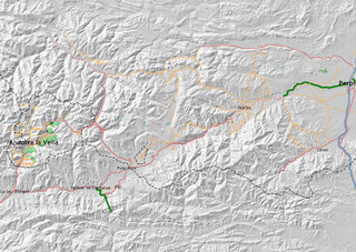
Andorra
(Redirected from WikiProject Andorra)
Jump to navigation
Jump to search
| V・T・E |
| latitude: 42.5425, longitude: 1.6000 |
| Browse map of the Principality of Andorra 42°32′33.00″ N, 1°36′00.00″ E |
| Edit map |

|
|
External links:
|
| Use this template for your locality |

|
The Principality of Andorra Mapping Project, the home of the Principality of Andorra on the OpenStreetMap wiki. |
| Hello! Welcome to the project for mapping efforts in the Principality of Andorra! You can find here national events, ongoing projects, map status and mapping guidelines, as well as links to other pages directly related to the mapping of the Principality of Andorra. You may also find a list of contacts and mappers involved with the OpenStreetMap community in the Principality of Andorra. |
Guidelines
Hi! This page contains information relating to mapping activity that is specific to Andorra.
Community
Events
- 1sth of March 2008, to 8th of March. When will we be mapping (old)
Contacts
 janklopper ( on osm, edits, contrib, heatmap, chngset com.) - visiting Andorra for a skiing trip
 Skywave (on osm, edits, contrib, heatmap, chngset com.) - visited Andorra 2 times, responsible for all current mapping which is traced from Yahoo when it was still there.
 lib2know (on osm, edits, contrib, heatmap, chngset com.) - mapping in Andorra.
Projects
Parishes and localities
- Andorra la Vella (Sant Esteve d’) : traditionnal parish now splitted into two civil parishes :
- Andorra la Vella (capitol) – Andorra la Vella · Santa Coloma d’Andòrra
- Escaldes-Engordany – Engordany · Escaldes
- Canilo (Sant Serni de) – l'Aldosa de Canillo · Canillo · el Forn · Incles · Meritxell · els Plans · Prats · Ransol · Soldeu · el Tarter · el Vilar
- Encamp (Santa Eulàlia d’) – les Bons · Encamp · la Mosquera · el Tramt · el Pas de la Casa · Vila
- la Massana (Sant Iscle de) – l'Aldosa de la Massana · Anyós · Arinsal · Erts · Escàs · la Massana · Pal · Syspony · Xirxerella
- Sant Julià de Lòria – Aixirivall · Aixovall · Auvinyà · Bissisarri · Certers · Fontaneda · Juberri · Llumeneres · Nagol · Sant Julià de Lòria
- Ordino (Sant Cebrià d’) – Ansalonga · Arans · la Cortinada · Llorts · Ordino · Segudet · el Serrat · Sornàs
Status
- Roads
- Most roads still need names
- Most high-mountain roads are not drawn or traced
- Update current road set
- Total road length
- total: 269 km
- paved: 198 km
- unpaved: 71 km
Links
- Resources
- Quality control
See also
- Places in neighbouring countries
- Occitanie, France (fr) :
- Ariège, Midi-Pyrénées (fr)
- Pyrénées-Orientales, Languedoc-Roussillon (fr)
- Alt Pirineu i Aran (Province of Lleida), Catalonia (ca), Spain (es) :
- Alt Urgell (ca)
- Cerdanya (ca)
- Pallars Sobirà (ca)


