Pyrénées-Orientales
Ain (01) · Aisne (02) · Allier (03) · Alpes-de-Haute-Provence (04) · Hautes-Alpes (05) · Alpes-Maritimes (06) · Ardèche (07) · Ardennes (08) · Ariège (09) · Aube (10) · Aude (11) · Aveyron (12) · Bouches-du-Rhône (13) · Calvados (14) · Cantal (15) · Charente (16) · Charente-Maritime (17) · Cher (18) · Corrèze (19) · Corse-du-Sud (2A) · Haute-Corse (2B) · Côte-d’Or (21) · Côtes-d’Armor (22) · Creuse (23) · Dordogne (24) · Doubs (25) · Drôme (26) · Eure (27) · Eure-et-Loir (28) · Finistère (29) · Gard (30) · Haute-Garonne (31) · Gers (32) · Gironde (33) · Hérault (34) · Ille-et-Vilaine (35) · Indre (36) · Indre-et-Loire (37) · Isère (38) · Jura (39) · Landes (40) · Loir-et-Cher (41) · Loire (42) · Haute-Loire (43) · Loire-Atlantique (44) · Loiret (45) · Lot (46) · Lot-et-Garonne (47) · Lozère (48) · Maine-et-Loire (49) · Manche (50) · Marne (51) · Haute-Marne (52) · Mayenne (53) · Meurthe-et-Moselle (54) · Meuse (55) · Morbihan (56) · Moselle (57) · Nièvre (58) · Nord (59) · Oise (60) · Orne (61) · Pas-de-Calais (62) · Puy-de-Dôme (63) · Pyrénées-Atlantiques (64) · Hautes-Pyrénées (65) · Pyrénées-Orientales (66) · Bas-Rhin (67) · Haut-Rhin (68) · Rhône (69) · Haute-Saône (70) · Saône-et-Loire (71) · Sarthe (72) · Savoie (73) · Haute-Savoie (74) · Paris (75) · Seine-Maritime (76) · Seine-et-Marne (77) · Yvelines (78) · Deux-Sèvres (79) · Somme (80) · Tarn (81) · Tarn-et-Garonne (82) · Var (83) · Vaucluse (84) · Vendée (85) · Vienne (86) · Haute-Vienne (87) · Vosges (88) · Yonne (89) · Territoire de Belfort (90) · Essonne (91) · Hauts-de-Seine (92) · Seine-Saint-Denis (93) · Val-de-Marne (94) · Val-d’Oise (95)
Overseas departments and collectivities:
Guadeloupe (971) · Martinique (972) · Guyane française (973) · La Réunion (974) · Mayotte (976) · Saint-Barthélemy (977) · Saint-Martin (France) (978) · Saint-Pierre-et-Miquelon (975) · Polynésie française (987) · Wallis-et-Futuna (986) · Île Clipperton (989) · Terres australes et antarctiques françaises (986) · Nouvelle-Calédonie (988) ·
| Pyrénées-Orientales | Toponyms(fr) | Public transport(fr) | Coverage | To do | Users group(fr) | |||||||||||||||||||||||
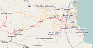
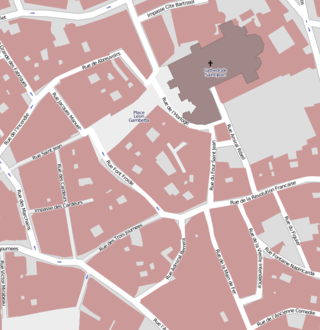
Borders of the Pyrénées-Orientales department: 7466 PresentationThis is the page where there is a bit of coordination of creating a map of Pyrénées-Orientales. Pyrénées-Orientales is situated in the South-East France, bordering Andorra and Spain (a Spanish municipality named Llivia is enclaved in the southwest of this departement). The local languages spoken are French and Catalan. How to contributeIf you have time on your hand and brave enough to risk a addiction please read the Beginners' Guide and start mapping, or ask your questions on the French forum. If you are not a computer wizard and still want to help out with some flaws in the map, please go to openstreetbugs.org. If you would like to be updated about the report you made please add some contact details. Common flaws at the moment are wrong/ missing oneway streets, incorrect/missing names, missing Catalan names. If you have a GPS please add your GPS traces, there are always useful. Work progressUn tableau affichant le statut actuel est consultable ici : Si vous considérez avoir avancé dans le travail, ou constatez que le statut actuel a changé, vous pouvez mettre à jour les lignes concernées, afin de permettre une coordination. Other status information, including links to objects to verify or continue, and some info about more precise topics will be slowly integrated in pages linked from tabs above. SourcesMuch of the roads in Pyrenees-Orientales were derived from the Cadastre information, Prades, Ria-Sirach, some of Ceret, Les Cluses and Maureillas-les-Illas (both unfinished) were done by GPS. The routes on areas which are not covered by the Cadastre are done as well with GPS traces. Every city which was in vector format has been derived. Information missing in the Cadastre are oneway restrictions and there are some wrong street names. If you see one please change or add a ticket on openstreetbugs.org. Also there is still some information left on the cadastre maps which can be used like address data. Map in CatalanThere is a beta version now available of the map of Pyrénées-Orientales / Catalogne Nord / Catalunya Nord at http://carto.110mb.com. Data is up to date to Thursday 18 september 2008. We have published a map of Northern Catalunya in Catalan : http://www.openstreetmap.cat. With help of the municipality of Perpignan, we already have street names in Catalan for this city. For more information about data to integrate, and soon about prototype maps, see tab Toponymie. |
||||||||||||||||||||||||||||


