2010 07 Pakistan Floods/Imagery and data sources
| ||||||
Imagery
Pre Floods Imagery
SPOT (2008)
SPOT provided a WMS for a pre-disaster mosaic of the area, however this appears to be no longer available:
http://www.geodatawork.net/__streaminguid.e30dcaa3-5929-4902-9834-12e6f51e1e7b/wms.ashx?
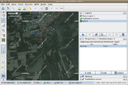
old coverage map shows boundaries where SPOT imagery used to be available, in blue.
Yahoo
Yahoo! Aerial Imagery can be used in editors.
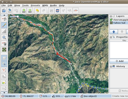
Low res: - There is complete coverage at a very low resolution. Zoom out until the grey 'sorry' messages are replaced by low res imagery tiles. In JOSM you need to remove the layer and restart the capture while zoomed out.
We can use this to trace any major features which may be visible, but only the largest highways would be visible. We can trace the positions of rivers in the where they can be clearly delineated in the mountain valleys (North) And this may be useful. We could also trace areas of mountain glaciers.
High res: Some high res imagery is available in and around some cities as indicated by the coverage outline relation![]() coverage outline relation (in these areas the grey 'sorry' message doesn't appear, and you see detailed imagery!) This is good enough for detailed highway sketching. Remember the imagery is pre-floods. Avoid overwriting anybody's live updated flood corrections! (at the moment there aren't really any) Go ahead and help us make a map! See the Mapping Coordination page for information on which areas are most urgent.
coverage outline relation (in these areas the grey 'sorry' message doesn't appear, and you see detailed imagery!) This is good enough for detailed highway sketching. Remember the imagery is pre-floods. Avoid overwriting anybody's live updated flood corrections! (at the moment there aren't really any) Go ahead and help us make a map! See the Mapping Coordination page for information on which areas are most urgent.
Landsat
Landsat low res suitable for mapping roads and rivers, and confirm the location of populated places.
Other opportunities
- "CIA Corona satellite imagery that was collected in the 1970s" has been mentioned as a possible asset for use (see HOT mail list message)
- Investigation of imagery available via the USGS has been mentioned as being started, including offering of personal funds outlay for purchase (see HOT mail list message)
Higher resolution imagery
On-going efforts to get access to satellite imagery under a license scheme suitable for tracing in OSM:
- UNOSAT
- UNSPIDER
Post Flood Imagery
Nasa imagery http://earthobservatory.nasa.gov/NaturalHazards/event.php?id=44986
On-going efforts to to get access to satellite imagery under a license scheme suitable for tracing in OSM:
- UNOSAT
- UNSPIDER
Satellite Images of Pakistan; Enhanced from NASA Images
Taking base images from NASA Observatory, PakGIS [1] has geo-referenced the following moderate resolution post flood images of Pakistan for national and regional analysis:
1. 13 September 2010 http://pakgis.blogspot.com/2009/07/satellite-image-of-pakistan-flood-07.html
2. 07 September 2010 http://pakgis.blogspot.com/2009/07/satellite-image-of-pakistan-flood-07.html
3. 02 September 2010 http://pakgis.blogspot.com/2009/07/satellite-image-pakistan-flood-02.html
4. 29 August 2010 http://pakgis.blogspot.com/2009/06/satellite-image-pakistan-flood-29.html
5. 22 August 2010 http://pakgis.blogspot.com/2009/07/satellite-image-pakistan-flood-22.html
6. 17 August 2010 http://pakgis.blogspot.com/2009/07/satellite-image-pakistan-flood-17_17.html
7. 15 August 2010 http://pakgis.blogspot.com/2009/07/satellite-image-pakistan-flood-15.html
8. 12 August 2010 http://pakgis.blogspot.com/2009/07/satellite-image-pakistan-flood-12.html
9. 11 August 2010 http://pakgis.blogspot.com/2009/07/satellite-image-pakistan-flood-11.html
10. 10 August 2010 http://pakgis.blogspot.com/2009/07/satellite-image-pakistan-flood-10.html
11. 08 August 2010 http://pakgis.blogspot.com/2009/07/satellite-image-pakistan-flood-08.html
12. 30 July 2010 http://pakgis.blogspot.com/2010/07/satellite-image-pakistan-flood-30-july.html
Map resources
Pre Flood Map resources
- Perry-Castaneda Map Collection at University of Texas-Austin.
- Pakistan Joint Operations Graphics, US Defense Mapping Agency, 1993, 1:250,000.
- Other Pakistan Maps (mostly from US Government sources)
A mosaic of maps from this collection is available as WMS / TMS for OSM editors:
- Names of places and rivers can also be found by searching GEOnet Names Server, which can also be used as a WMS layer.
- An OSM format file has been created from the a subset of GNS names (populated places). This is an additional aid for identifying names, please DO NOT IMPORT the whole file without consulting others mapping in the area & User:SK53 who created it (and may have a more useful version). Located here pk_gnis_names.zip
Vector Data sets
Pre-Flood Vector Data
Multi thematic data holdings
The Office of Coordination of Humanitarian Affair (OCHA) is chairing a data sets working group on the ground and providing guidance on core data layers, they managed a multi thematic public domain data download point.
| Source | Url | License / Permission | Notes |
|---|---|---|---|
| Geographic Information Support Team (GIST) | [2] | ? | ? |
| Ministry of Ennvironment of Pakistan Wetland Program | [3] | ? | ? |
| Pacific Data Center (PDC) | wms/wfs/kml feed | ? | Various datasets including imagery processing work on GeoEye & WorldView imagery around Nowshera and other imagery as it comes in along around the Indus and Chenab Rivers. PDC-Pak contact person: John Livengood at jlivengood@pdc.org |
Transportation data sets
The UN Logistics Cluster (UN LogCluster) who is the UN data custodian for transportation data had a long operation in Pakistan in 2009 and are holding a key transporation data sets for this region.
UN Log Cluster Public domain transportatiion data sets
- Un LogCluster GeoPortal (license/permission - ?)
UN LogCluster transportation data are based on the UN Spatial Data Model for Transport (UNSDIT) schema, see [4] for a crosswalk with OSM tagging system
Administrative boundaries
Clarity is needed from Pakistanese authorities, OCHA data sets working group and United Nations data custodians on which data sets to use for this operation
| Dataset | Source | Url | License / Permission | Notes |
|---|---|---|---|---|
| Admin boundaries (GAUL) | FAO (via OCHA) | [5] | non-commercial / permission (?) |
- Other sources?
- SALB
- Pakistan GIS
Hydrography
Not a dataset, but Wikipedia's List of rivers of Pakistan might help in tracing/naming rivers?
Post-Flood Vector Data
Flood Extents
- A geo-database of changing Flood Water Extent from MODIS, 12-29 Aug 2010 , available at PakGIS[6]
Settlements
Refugees Camps
Imagery Requests & Responses
| Agency/Company | Imagery Type | Requested Date | Response Date | Success | Response |
|---|---|---|---|---|---|
| Agency | Imagery | Date | Date | Y | Response |
See also
SPOT imagery
- OSM Blog entry "Pakistan SPOT imagery coverage extended"

