2010 Chile earthquake/Imagery and data sources
| ||||||||||||||
Imagery
Post Quake Imagery
JAXA/ALOS satellite Imagery
By NIED(National Research Institute for Earth Science and Disaster Prevention, Japanese national institute for disaster), a satellite image of Chile after the earthquake from JAXA(Japan Aerospace Exploration Agency) is permitted to be traced.
Note that the resolution is nearly as bad as the landsat imagery, so you cannot identify actual buildings. But it is possible to identify landuse and guess/interpret larger highways. (see discussion for an example of resolution)
International Charter Imagery
Activation of the International Charter Space and Major Disasters has been requested (WFP, UNOOSA) to support the damage assessment and response efforts in the earthquake that impacted Concepción, Chile on 2010-02-27. Clarification on re-usability of Charter imagery within the OSM project has been requested. Target area requested from the Charter are the following
- Concepción - Lat 36° 44’ 37” S; Long 73° 06‘ 33” W
- nearby Coronel - Lat 36° 58’ 39” S; Long 73° 10‘ 23” W
Information about what is being made available on http://www.un-spider.org/chile ( detailed page)
GeoEye and DigitalGlobe
Chris Nicolas from UNOSAT...
I am working now to put the recent GeoEye images of San Javier, Santiago, and Puerto Saavedra online as OGC WMS services, KML, and accessible within the OpenStreetMap. Attached are the shapefile coverages. These can be downloaded (~8Gigs) at
- ftp://chile.geoeye.com
- 204.236.220.178
- User ID: chile
- Password: ch1l3p1c$
There is a WMS set up at http://geohub.jrc.ec.europa.eu/mapserv/chile?LAYERS=chile:geoeye
- Use the following WMS URL in JOSM: http://geohub.jrc.ec.europa.eu/hot/wms?LAYERS=chile:geoeye&SERVICE=WMS&VERSION=1.1.1&REQUEST=GetMap&STYLES=&FORMAT=image/png&TRANSPARENT=TRUE&
- Use the following URL in Potlatch: http://geohub.jrc.ec.europa.eu/tilecache/tilecache.cgi/1.0.0/chile/!/!/!.png
Coverage areas for Puerto Saavedra![]() Puerto Saavedra and San Javier
Puerto Saavedra and San Javier![]() San Javier. The images for the San Javier area appear to be off by about 10 meters, so first find some roads verified by GPS tracks to rectify your image background. There is also coverage around Santiago, but those images appear to be off by about 400 meters!
San Javier. The images for the San Javier area appear to be off by about 10 meters, so first find some roads verified by GPS tracks to rectify your image background. There is also coverage around Santiago, but those images appear to be off by about 400 meters!
- (Santiago images can also be adjusted to streets. Take large feature, like e.g. Club Hipico in the center, as starting landmark.)
More services here:
- WMS http://geohub.jrc.ec.europa.eu/hot/wms?LAYERS=chile:geoeye
- WMS-C http://geohub.jrc.ec.europa.eu/hot/gwc/service/wms?SERVICE=WMS&VERSION=1.1.1&REQUEST=getcapabilities&TILED=true
- WMTS http://geohub.jrc.ec.europa.eu/hot/gwc/service/wmts?REQUEST=getcapabilities
GeoEye and DigitalGlobe earliest imagery expected to be made available Sunday 28-Feb as well as clarification on its re-usability within the OSM project.
Digital Globe, Worldview-1, 2010-02-28 - Browse (max available resolution): 1, 2, 3, 4, 5, 6.
Astronaut Photo from Space Station
- Would it be useful for someone experienced in warping to prepare this for use in JOSM? Ceyockey 02:51, 1 March 2010 (UTC)
RapidEye
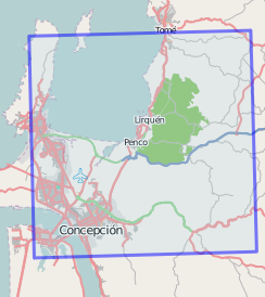
German company RapidEye AG published a 5000x5000 pixel JPEG of Concepcion and its surrounding area. They announced to publish future images and a reference from before the earth quake soon. See their website and press release for more information.
The resolution seems to be 6.5m (high enough to see larger roads, but too low to actually see any damages). And, sadly, the image suffers from heavy JPEG compression artifacts. Apparently, this is the tile 1822122 which is (along with other tiles) available from the geodata kiosk in diverse formats (GeoTIFF, etc.) at the same resolution, priced about 186 Euro (approx. 250 US-Dollar. Maybe there is a way to get it for free, but following the usual checkout process, that amount would be billed.)
Use the tag: source=RAPIDEYE/RE3/LEO, 2009-02-27
Rapideye has now (2010-03-03) released images from after the earthquake explicitly allowing use in OSM. They are available on a WMS for use in JOSM and as tiles for Potlatch.
- JOSM: Use WMS URL: http://wms.openstreetmap.de/wms?layers=Chile&
- Potlatch Link
Eros-B
Russian Company ScanEx published tiles of Constitución and its surrounding area.
The resolution seems to be 0.7m (from the EROS-B specs).
Use the tag: source=EROS-B/SCANEX, 2010-03-02
ScanEx has now (2010-03-04) released images from after the earthquake. They are available on a WMS for use in JOSM and as tiles for Potlatch.
- JOSM: Use WMS URL: http://irs.gis-lab.info/?layers=eros-b-chile&
- Potlatch Link
The image can also be seen in this viewer.
Summary
| Image set oldest first; same age, ordered alphabetically |
Boundary | Use in JOSM | Use in Potlatch |
|---|---|---|---|
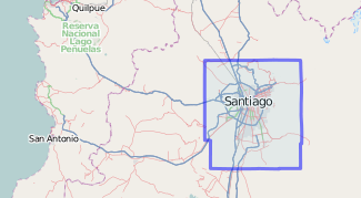
| ALOS/AVNIR-2
Area: North Santiago Use the tag: source=JAXA/ALOS/AVNIR-2, 2010-02-27 |
 depiction of 446801 |
Use the following WMS URL in JOSM (how to configure):
http://hazardmap.service-section.com/cgi-bin/mapserv?map=/map/UserRaster/alos_avnir2_chile_santiago_north_20100227.map&SERVICE=WMS&VERSION=1.1.1&REQUEST=GetMap&LAYERS=alos_avnir2_chile_santiago_north_20100227&STYLES=&EXCEPTIONS=application%2Fvnd.ogc.se_inimage&FORMAT=image/png&SRS=EPSG:4326& |
In Potlatch paste the following URL into the 'custom' setting:
http://184.73.236.108/wms2tile/?ALOS-AVNIR-2-N/!/!/! (or launch directly) |
| ALOS/AVNIR-2
Area: South Santiago Use the tag: source=JAXA/ALOS/AVNIR-2, 2010-02-27 |
Use the following WMS URL in JOSM (how to configure):
http://hazardmap.service-section.com/cgi-bin/mapserv?map=/map/UserRaster/alos_avnir2_chile_santiago_south_20100227.map&SERVICE=WMS&VERSION=1.1.1&REQUEST=GetMap&LAYERS=alos_avnir2_chile_santiago_south_20100227&STYLES=&EXCEPTIONS=application%2Fvnd.ogc.se_inimage&FORMAT=image/png&SRS=EPSG:4326& |
In Potlatch paste the following URL into the 'custom' setting:
http://184.73.236.108/wms2tile/?ALOS-AVNIR-2-S/!/!/! (or launch directly) | |
| RapidEye
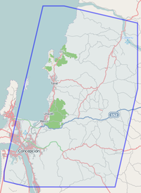
Area: Concepción Use the tag: source=RAPIDEYE/RE3/LEO, 2010-02-27 |
 Coverage by RapidEye. See 421648 |
Use the following WMS URL in JOSM (how to configure):
http://wms.openstreetmap.de/wms?layers=Chile& |
In Potlatch paste the following URL into the 'custom' setting:
http://wms.openstreetmap.de/tms/Chile/!/!/!.png (or launch directly) |
| GeoEye and DigitalGlobe
Details: #GeoEye and DigitalGlobe Use the tag: source=Digital Globe, Worldview-1, 2010-02-28 |
 Coverage by Worldview-1. See 52176621 |
Use the following WMS URL in JOSM (how to configure):
http://geohub.jrc.ec.europa.eu/hot/wms?LAYERS=chile:geoeye&SERVICE=WMS&VERSION=1.1.1&REQUEST=GetMap&STYLES=&FORMAT=image/png&TRANSPARENT=TRUE& |
In Potlatch paste the following URL into the 'custom' setting:
http://geohub.jrc.ec.europa.eu/tilecache/tilecache.cgi/1.0.0/chile/!/!/!.png (or launch directly) |
| GeoEye and DigitalGlobe
Details: #GeoEye and DigitalGlobe Use the tag: source=Digital Globe, Worldview-1, 2010-02-28 |
 Coverage by Worldview-1. See 52134990 | ||
| Eros-B
Area: Constitución Use the tag: source=EROS-B/SCANEX, 2010-03-02 |
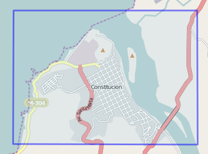 Coverage by Eros-B. See 443329 |
Use the following WMS URL in JOSM (how to configure):
http://irs.gis-lab.info/?layers=eros-b-chile& |
In Potlatch paste the following URL into the 'custom' setting:
http://irs.gis-lab.info/?layers=eros-b-chile&request=GetTile&z=!&x=!&y=! (or launch directly) |
| ALOS/Pan-sharpened
Area: Constitucio'n Use the tag: source=JAXA/ALOS/pan-sharpened, 2010-03-04 |
Use the following WMS URL in JOSM (how to configure):
http://hazardmap.service-section.com/cgi-bin/mapserv?map=/map/UserRaster/alos_pansharpen_chile_20100304_cl_1.map&SERVICE=WMS&VERSION=1.1.1&REQUEST=GetMap&LAYERS=alos_pansharpen_chile_20100304_cl_1&STYLES=&EXCEPTIONS=application%2Fvnd.ogc.se_inimage&FORMAT=image/png&SRS=EPSG:4326& |
||
| ALOS/Pan-sharpened
Area: South from Constitucio'n Use the tag: source=JAXA/ALOS/pan-sharpened, 2010-03-04 |
Use the following WMS URL in JOSM (how to configure):
http://hazardmap.service-section.com/cgi-bin/mapserv?map=/map/UserRaster/alos_pansharpen_chile_20100304_cl_2.map&SERVICE=WMS&VERSION=1.1.1&REQUEST=GetMap&LAYERS=alos_pansharpen_chile_20100304_cl_2&STYLES=&EXCEPTIONS=application%2Fvnd.ogc.se_inimage&FORMAT=image/png&SRS=EPSG:4326& |
||
| ALOS/Pan-sharpened
Area: Pelluhue Use the tag: source=JAXA/ALOS/pan-sharpened, 2010-03-04 |
Use the following WMS URL in JOSM (how to configure):
http://hazardmap.service-section.com/cgi-bin/mapserv?map=/map/UserRaster/alos_pansharpen_chile_20100304_cl_3.map&SERVICE=WMS&VERSION=1.1.1&REQUEST=GetMap&LAYERS=alos_pansharpen_chile_20100304_cl_3&STYLES=&EXCEPTIONS=application%2Fvnd.ogc.se_inimage&FORMAT=image/png&SRS=EPSG:4326& |
||
| ALOS/Pan-sharpened
Area: Cobquecura Use the tag: source=JAXA/ALOS/pan-sharpened, 2010-03-04 |
Use the following WMS URL in JOSM (how to configure):
http://hazardmap.service-section.com/cgi-bin/mapserv?map=/map/UserRaster/alos_pansharpen_chile_20100304_cl_4.map&SERVICE=WMS&VERSION=1.1.1&REQUEST=GetMap&LAYERS=alos_pansharpen_chile_20100304_cl_4&STYLES=&EXCEPTIONS=application%2Fvnd.ogc.se_inimage&FORMAT=image/png&SRS=EPSG:4326& |
||
| ALOS/Pan-sharpened
Area: Treguaco Use the tag: source=JAXA/ALOS/pan-sharpened, 2010-03-04 |
Use the following WMS URL in JOSM (how to configure):
http://hazardmap.service-section.com/cgi-bin/mapserv?map=/map/UserRaster/alos_pansharpen_chile_20100304_cl_5.map&SERVICE=WMS&VERSION=1.1.1&REQUEST=GetMap&LAYERS=alos_pansharpen_chile_20100304_cl_5&STYLES=&EXCEPTIONS=application%2Fvnd.ogc.se_inimage&FORMAT=image/png&SRS=EPSG:4326& |
||
| ALOS/Pan-sharpened
Area: Tome (cloudy) Use the tag: source=JAXA/ALOS/pan-sharpened, 2010-03-04 |
Use the following WMS URL in JOSM (how to configure):
http://hazardmap.service-section.com/cgi-bin/mapserv?map=/map/UserRaster/alos_pansharpen_chile_20100304_cl_6.map&SERVICE=WMS&VERSION=1.1.1&REQUEST=GetMap&LAYERS=alos_pansharpen_chile_20100304_cl_6&STYLES=&EXCEPTIONS=application%2Fvnd.ogc.se_inimage&FORMAT=image/png&SRS=EPSG:4326& |
||
| ALOS/Pan-sharpened
Area: Concepcion (cloudy) Use the tag: source=JAXA/ALOS/pan-sharpened, 2010-03-04 |
Use the following WMS URL in JOSM (how to configure):
http://hazardmap.service-section.com/cgi-bin/mapserv?map=/map/UserRaster/alos_pansharpen_chile_20100304_cl_7.map&SERVICE=WMS&VERSION=1.1.1&REQUEST=GetMap&LAYERS=alos_pansharpen_chile_20100304_cl_7&STYLES=&EXCEPTIONS=application%2Fvnd.ogc.se_inimage&FORMAT=image/png&SRS=EPSG:4326& |
Pre-quake imagery
JAXA/ALOS satellite imagery
ATTENTION: The information of this section currently is contradictory. See the discussion page for more information.
By NIED(National Research Institute for Earth Science and Disaster Prevention, Japanese national institute for disaster), a satellite image of Chile after the earthquake from JAXA(Japan Aerospace Exploration Agency) is permitted to be traced.
Note that the resolution is nearly as bad as the landsat imagery, so you cannot identify actual buildings. But it is possible to identify landuse and guess/interpret larger highways. (see discussion for an example of resolution)
| Image set | Boundary | Use in JOSM | Use in Potlatch |
|---|---|---|---|
| ALOS/AVNIR-2
Area: North Santiago Use the tag: source=JAXA/ALOS/AVNIR-2, 2009-02-24 |
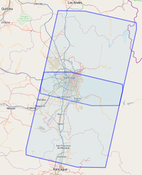 depiction of 420909 |
Use the following WMS URL in JOSM:
http://hazardmap.service-section.com/cgi-bin/mapserv?map=/map/UserRaster/alos_avnir2_chile_santiago_north_20090224.map&SERVICE=WMS&VERSION=1.1.1&REQUEST=GetMap&LAYERS=alos_avnir2_chile_santiago_north_20090224&STYLES=&EXCEPTIONS=application%2Fvnd.ogc.se_inimage&FORMAT=image/png&SRS=EPSG:4326& |
|
| ALOS/AVNIR-2
Area: South Santiago Use the tag: source=JAXA/ALOS/AVNIR-2, 2009-02-24 |
Use the following WMS URL in JOSM:
http://hazardmap.service-section.com/cgi-bin/mapserv?map=/map/UserRaster/alos_avnir2_chile_santiago_south_20090224.map&SERVICE=WMS&VERSION=1.1.1&REQUEST=GetMap&LAYERS=alos_avnir2_chile_santiago_south_20090224&STYLES=&EXCEPTIONS=application%2Fvnd.ogc.se_inimage&FORMAT=image/png&SRS=EPSG:4326& |
||
| ALOS/pan-sharpened
Area: Center Santiago Use the tag: source=JAXA/ALOS/pan-sharpend, 2009-08-24 |
 depiction of 52049727 |
Use the following WMS URL in JOSM:
http://hazardmap.service-section.com/cgi-bin/mapserv?map=/map/UserRaster/alos_pansharpen_chile_santiago_pre_eq.map&SERVICE=WMS&VERSION=1.1.1&REQUEST=GetMap&LAYERS=alos_pansharpen_chile_santiago_pre_eq&STYLES=&EXCEPTIONS=application%2Fvnd.ogc.se_inimage&FORMAT=image/png&SRS=EPSG:4326& |
|
| ALOS/pan-sharpened
Area: Center Concepción Use the tag: source=JAXA/ALOS/pan-sharpend, 2007-05-27 |
 depiction of 52049833 |
Use the following WMS URL in JOSM:
http://hazardmap.service-section.com/cgi-bin/mapserv?map=/map/UserRaster/alos_pansharpen_chile_concepzeon_pre_eq.map&SERVICE=WMS&VERSION=1.1.1&REQUEST=GetMap&LAYERS=alos_pansharpen_chile_concepzeon_pre_eq&STYLES=&EXCEPTIONS=application%2Fvnd.ogc.se_inimage&FORMAT=image/png&SRS=EPSG:4326& |
Yahoo! imagery
As of February 2010, the only high resolution image data available is the normal Yahoo! Aerial Imagery. This only covers Santiago (coverage map) and Iquique, and is pre quake (around 10 years old and might not reflect the current reality!)
Low resolution Landsat imagery is available for the entire impacted area, as well as low resolution Yahoo! Aerial Imagery.
Astronaut Photography of Earth
Existing Data Sets
Attribution of data used in OSM is very important. In the table below, 'source' and 'source_ref' columns correspond to source=* and source_ref=* values, while 'resource/info' is freeform and section-linked. At present, only things which have been used are represented.
| Resource/info | source | source_ref |
|---|---|---|
| Willett-Nicholas data sets | source=B. Willett | http://maps.geography.uc.edu/~cgn/maps/Chile/vectors/ |
| Earthquake epicentres | source=USGS Earthquake Hazards Program | use specific quake record url; running list url (latter used in relation) |
GIS data depot
Data sets covering all of Chile:
- list of datasets available
- all downloads require a free account to be set up
- E00-format files: "E00" is a file type which can only be used effectively by ArcEditor, ArcView and ArcInfo software in the ArcGIS series from ESRI.
- place name gazetteer: no free download option; 23 fields, unknown number of records
- Landsat mosaics: no free download option; multi-spectral false color image sets from 1990 and 2000
- DTED Level 0 files: Sparse post elevation data; should not be imported into OSM, but can be used to provide ele=* values.
Willett-Nicholas data sets
Data sets covering all of Chile:
- Content origin information
- http://maps.geography.uc.edu/~cgn/maps/Chile/vectors/
- includes streets for Santiago, Talca, and Puentes
- archive file types .zip and .rar; .rar files can be opened by apps such as winzip
- Includes shapefiles for the Región del Biobío (which includes Concepción). List of file classes:
- camino (roads)
- cnivel (contour lines (with elevations, 100 m intervals))
- cuidad (800 towns and villages)
- hidro (hydrology)
- limadarc (administrative limits and coastline)
- limadpol (polygons for administrative "Province" / districts)
- sislac ("lagunas y lagos" / lakes)
- urbano ("Province" names (districts))
- 2010-02-28 23:46: Región del Maule .rar file added (161 MB)
- 2010-03-01 17:15: Region 9 .rar file added (18 MB)
- 2010-03-01 17:15: Nueva Imperial .rar file added (10 MB)
Hospitals
- Wikipedia:
- English: wikipedia:List of hospitals in Chile
- Spanish, grouped by Región: wikipedia:es:Anexo:Hospitales en Chile
- Is there a Chilean equivalent to the PAHO dataset for Haiti?
- if a map request like Haiti [1] send me a mail --Jan Tappenbeck 14:00, 28 February 2010 (UTC)
USGS Earthquake Hazards Program
As stated on the website, "This web site is provided by the United States Geological Survey’s (USGS) Earthquake Hazards Program as part of our effort to reduce earthquake hazard in the United States." However, the resource provides global information as well.
Information such as location, time and magnitude for the primary and aftershock events for this earthquake can be found on the Earthquake List for Map of S America Region. Several records have been interrogated from this resource to create natural=epicentre objects. A list of these objects in the vicinity of the primary epicentre is automatically generated by the Query-to-map resource; the list is accessible from http://toolserver.org/~kolossos/qtm2/featurelist.php?key=natural&value=epicentre&types=points-areas-infos&BBOX=-73.7051612,-38.1451672,-70.3863533,-33.2718196 . Aftershocks >6 in magnitude have been collected into 418723![]() 418723, a static rendering of which appears on the main 2010 Chile earthquake page.
418723, a static rendering of which appears on the main 2010 Chile earthquake page.
Wikimedia Commons
See Chile.
G-MOSAIC project
See http://spatial.telespazio.it/gmosaic_chile/
Coverage
- The index file dated 6 March 2010 was consulted for the information below.
The "index to available products" is a boundary listing of the resources available. This is provided as a .kmz file. The .kmz file can be converted to a .gpx file using the online tool KML2x provided by Zonum Solutions. This .gpx file can subsequently be opened in JOSM. An accompanying XAPI call to identify places which are included in the region covered by the G-MOSAIC Project can also be opened in JOSM:
http://www.informationfreeway.org/api/0.6/node[place=*][bbox=-73.17,-36.855,-73,-36.67]
For the approximate area of coverage viewed in Potlatch, see this link (based on the bbox shown above).
Georeferenced reports from Ushahidi
There are many pharmacies ("Farmacias"), and also supermarkets ("Supermercado"), in the .csv file that can be downloaded from http://chile.ushahidi.com/download/ (as well as road blocks and collapsed structures) (Mar Mar 2 12:11:34 GMT 2010)
OSM is allowed to use this data [2].
Use source=Ushahidi.
