2016 Hurricane Matthew
| General Information | |
|
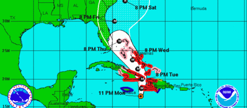
Hurricane Matthew was an extremely powerful and deadly tropical cyclone which became the first Category 5 Atlantic hurricane since Hurricane Felix in 2007. It caused widespread destruction and catastrophic loss of life in several Western Atlantic countries. At least 1,042 deaths have been attributed to the storm, including 1,000 in Haiti, 1 in Colombia, 4 in the Dominican Republic, 1 in Saint Vincent and the Grenadines and 36 in the United States. Early on October 4, Matthew made landfall on the Tiburon Peninsula of Haiti, causing widespread destruction. | |
For Aid Organizations
Map and Data Services
About OpenStreetMap
OpenStreetMap offers an online map (and spatial database) which is updated by the minute. Various tools and services allow data extracts for GIS specialists, use in smartphone navigation apps and traditional GPS personal devices. With an internet connection, regular syncing is possible with open access to the community contributed data as it generated and updated. In addition, maps can also be printed to paper.
Browse the (example) Activation Area to get a feel for the data that is currently available. Different map styles including an Humanitarian style can be selected on the right side, and some data may not render (appear) on the map, but could be exported from the underlying database (See export section below).
Paper Maps
Poster size Maps and normal sized paper atlases of custom areas can be printed:
- FieldPapers paper maps with grid for field survey or general navigation purposes,
Exporting OpenStreetMap data
- See Downloading data for instructions on getting large scale map data. See Shapefiles if you need this format to export to GIS tools.
- Data is also available at Humanitarian Data eXchange (HDX)
Usage of OSM data for Humanitarian Emergency Management
About This Humanitarian Activation
About HOT
To learn more about the Humanitarian OpenStreetMap Team (HOT), explore of our Humanitarian OSM Team wiki-page or our website. We are a global community of mostly volunteers, and also a US non-profit organization able to contract with organizations (email info-at-hotosm.org to contact our staff) and receive donations.
History of this Activation
Reaction of the OSM Community
- 1 October 2016 - Dale Kunce alerted the HOT community about hurricane Matthew's potential destructive path on Haiti and published an preemptive mapping task along the southern Haiti peninsula coastal area.
Post-event Imagery Become Available
- 7 October 2016 - some post event satellite imagery becomes available.
Coordination
Dale Kunce and Blake Girardot are leading this activation.
Status Updates
- Tuesday, Oct. 4, 2016 - First update
- Saturday, Oct. 8, 2016 - Second update
Media coverage
For Mappers
How You Can Contribute

Learn to Map
- Most of our volunteer needs are for remote OSM contributors, visit LearnOSM.org to get started.
- If step by step videos work better for you these videos will get you from zero to mapping fast: Mapgive Learn to Map Videos
- See the WikiProject Haiti page for information on mapping in Haiti.
Mapping Priority
- Please choose from highest priority first from the task listed on the OSM Tasking Manager
- Experienced mappers are also asked to participate in validating completed tasks. Information on validating can be found here
Available Imagery
DigitalGlobe
DigitalGlobe has published pre-event imagery with 30-50cm accuracy as a TMS layer.
- JOSM url: https://a.tiles.mapbox.com/v4/digitalglobe.nal0g75k/{zoom}/{x}/{y}.png?access_token=pk.eyJ1IjoiZGlnaXRhbGdsb2JlIiwiYSI6ImNpdHltd3BraDA4MTAyc282YjBkN2NuazEifQ.3SZ-IZETnHsSQNoZMZRtGQ
- ID url: https://a.tiles.mapbox.com/v4/digitalglobe.nal0g75k/{z}/{x}/{y}.png?access_token=pk.eyJ1IjoiZGlnaXRhbGdsb2JlIiwiYSI6ImNpdHltd3BraDA4MTAyc282YjBkN2NuazEifQ.3SZ-IZETnHsSQNoZMZRtGQ
Other resources and info from DigitalGlobe are available on their blog
Post event imagery is available in OpenAerialMap:

