Bike Citizens
| Bike Citizens | ||||||||||||||||||||||||||||||||||||||||||||||||||||||||||||||||||||||||||||||||||||||||||||||||||||||||
|---|---|---|---|---|---|---|---|---|---|---|---|---|---|---|---|---|---|---|---|---|---|---|---|---|---|---|---|---|---|---|---|---|---|---|---|---|---|---|---|---|---|---|---|---|---|---|---|---|---|---|---|---|---|---|---|---|---|---|---|---|---|---|---|---|---|---|---|---|---|---|---|---|---|---|---|---|---|---|---|---|---|---|---|---|---|---|---|---|---|---|---|---|---|---|---|---|---|---|---|---|---|---|---|---|
| Author: | BikeCityGuide Apps GmbH | |||||||||||||||||||||||||||||||||||||||||||||||||||||||||||||||||||||||||||||||||||||||||||||||||||||||
| License: | Proprietary | |||||||||||||||||||||||||||||||||||||||||||||||||||||||||||||||||||||||||||||||||||||||||||||||||||||||
| Platforms: | Android and iPhone | |||||||||||||||||||||||||||||||||||||||||||||||||||||||||||||||||||||||||||||||||||||||||||||||||||||||
| Version: | 8.22.1 (Android), 8.5.2 (iOS) (2024-12-11) | |||||||||||||||||||||||||||||||||||||||||||||||||||||||||||||||||||||||||||||||||||||||||||||||||||||||
| Languages: | English, German, French, and Spanish
| |||||||||||||||||||||||||||||||||||||||||||||||||||||||||||||||||||||||||||||||||||||||||||||||||||||||
| Website: | https://www.bikecitizens.net | |||||||||||||||||||||||||||||||||||||||||||||||||||||||||||||||||||||||||||||||||||||||||||||||||||||||
| Install: | ||||||||||||||||||||||||||||||||||||||||||||||||||||||||||||||||||||||||||||||||||||||||||||||||||||||||
| Programming languages: | Python, Java, C, and C++ | |||||||||||||||||||||||||||||||||||||||||||||||||||||||||||||||||||||||||||||||||||||||||||||||||||||||
|
Designed for cyclists in urban areas incl. Insider tours. |
||||||||||||||||||||||||||||||||||||||||||||||||||||||||||||||||||||||||||||||||||||||||||||||||||||||||
| ||||||||||||||||||||||||||||||||||||||||||||||||||||||||||||||||||||||||||||||||||||||||||||||||||||||||
Bike Citizens (former BikeCityGuide) is a bicycle app designed for urban cyclists.
History
The initial idea was born during a trip to Budapest, where Andi, one of the founders, struggled to explore the city with his bike. Being an experienced cyclist (cycle messenger), he accepted the challenge to fix this problem for the future and started the project BikeCityGuide with a colleague in late 2010
- 2011
- Idea evolved, a prototype (for Android) was created and more and more people got involved. The initial idea of offering predefined tours with focus on tourists was extended, resulting in an app also useful for everyday use in one's home city
- 2012
- First release went public for Android and iOS. Initially, only 5 Austrian cities were available.
- 2013
- 35 supported cities in different European countries , more to come vote here. Version 2 of the App: changes being configurable routing and bike profiles and the option to track rides.
- Finn[1] was created to mount the smartphone at the handlebar.
- 2014
- Redesign of navi and map function, bike computer added, bigger offline maps (radius), 49 supported cities, the Cycle Route Planner was developed.
- App wins Apps for Europe Award 2014 in Manchester (Jury prize).
- 2015
- More than 100 European cities available (amongst that all cities in Germany with more than 100k inhabitants).
- BikeCityGuide goes Bike Citizens. The App gets a new name and a new design.
Features
- Cycle-friendly routing
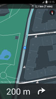
- Turn by turn navigation
- Offline maps, which can be obtained in the following ways: Entering a voucher code (e.g. included in Finn smartphone mount); Cycle to Free: If you cycle 100 km in the 30 days trial period, the city will be unlocked permanently; In-App purchase: €4.99 per city
- Offline routing
- Touristic POIs
- Predefined tours
- Create custom tours connecting POIs
- Address geocoding for point to point navigation
- (Optional) tracking with automatic upload - cycled ways can be seen on Finnder [2] (only when registered before in the app)
- Bike computer
OpenStreetMap
Bike Citizens was made possible by the OpenStreetMap project.
We are in close contact with the local OSM community in Graz and occasionally support them with some free Finns.
Additionally, every OpenStreetMap member is invited to get a Voucher for a free City Pack. Just send us a message with subject "Voucher".
