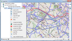
Brigantine
Jump to navigation
Jump to search
This page describes a historic artifact in the history of OpenStreetMap. It does not reflect the current situation, but instead documents the historical concepts, issues, or ideas.
- About
- Brigantine was a program to visualize and copy geometry and raster data that stored in various databases and raster and vector file formats for geospatial data (not limited to OSM).
- Reason for being historic
- It is not maintained any more and available on the historic Google Code platform only. Replaced by Nanogis.
- Captured time
- 2018
| Brigantine | ||||||||||||||||||||||||||||||||||||
|---|---|---|---|---|---|---|---|---|---|---|---|---|---|---|---|---|---|---|---|---|---|---|---|---|---|---|---|---|---|---|---|---|---|---|---|---|
| License: | MIT License (free of charge) | |||||||||||||||||||||||||||||||||||
| Platforms: | Windows and Linux | |||||||||||||||||||||||||||||||||||
| Version: | 1306 | |||||||||||||||||||||||||||||||||||
| Language: | English
| |||||||||||||||||||||||||||||||||||
| Website: | http://code.google.com/p/brigantine | |||||||||||||||||||||||||||||||||||
| ||||||||||||||||||||||||||||||||||||
Deprecated - see Bark (C++ library). This program can visualize (panning, zooming, reprojection on the fly) and copy geometry and raster data that stored in databases:
- DB2 + Spatial Extender
- Informix + Spatial DataBlade
- Ingres (no valid spatial index)
- Microsoft SQL Server
- MySQL
- Oracle
- Postgres + PostGIS
- SQLite + SpatiaLite.
The same is true for a variety of raster and vector file formats supported by GDAL/OGR (for example: OpenStreetMap PBF).
Also available OpenStreetMap tilemaps.

