Category:Featured images/2016
Jump to navigation
Jump to search
These are featured images, which have been identified as the best examples of OpenStreetMap mapping, or as useful illustrations of the OpenStreetMap project.
If you know another image of similar quality, you can nominate it on Featured image proposals.
See also: Category:Featured images/2015 and Category:Featured images/2017
Subcategories
This category has only the following subcategory.
/
Pages in category "Featured images/2016"
The following 5 pages are in this category, out of 5 total.
Media in category "Featured images/2016"
The following 52 files are in this category, out of 52 total.
- Amenity tag transitions diagram.png 1,260 × 866; 241 KB
- Sticker of openstreetmap taiwan logo.jpg 640 × 424; 54 KB
- OpenStreetMap in an IC2 carriage (DB).jpg 3,000 × 1,987; 1.31 MB
- Geoshepherds cross-country ski mapping.png 558 × 417; 350 KB
- Mapathon-la-guajira.jpg 1,256 × 804; 334 KB
- FabLab Lannion laser cutter map.jpg 711 × 487; 55 KB
- Smelly map of London.png 460 × 381; 348 KB
- Tandale.jpg 864 × 543; 321 KB
- OSM-Workshop-Bogo-Cebu-Philippines.jpg 670 × 411; 116 KB
- MapeoLibreMexico.jpg 1,000 × 902; 303 KB
- StLuciaMapathon 2016-02-28 15.14.08.jpg 2,448 × 3,264; 4.23 MB
- OpenDataDay2016-Santiago-Chile.jpg 1,024 × 768; 187 KB
- Chris Roth Place names visualisation, Switzerland.png 916 × 597; 122 KB
- Argentina-streets.jpg 934 × 501; 83 KB
- Multilingual-india-map.gif 785 × 492; 614 KB
- Epworth heatmap.jpg 3,003 × 2,056; 423 KB
- Fredy Rivera mapping mountain tracks.jpg 1,024 × 768; 226 KB
- MediaLabUIO mapping Ecuador.jpg 960 × 720; 105 KB
- OSM Analytics Haiti buildings.png 1,006 × 678; 452 KB
- GirlPower.JPG 5,184 × 3,456; 7.29 MB
- Kathmandu Living Labs at Understanding Risk.jpg 5,312 × 2,730; 3.18 MB
- SotMFR 2016 Group photo.jpg 5,184 × 3,456; 2.13 MB
- Kyrgyzstan Tien Shan OSM workshop.jpg 4,096 × 2,712; 1.37 MB
- Parmelin keller geosumitt sosm P1070779.jpg 2,000 × 1,314; 302 KB
- Managua bus users map.jpg 5,184 × 3,456; 7.6 MB
- Touch that data.jpg 2,592 × 1,456; 540 KB
- Board game osm.jpg 2,948 × 2,981; 3.09 MB
- Heatmap-municipios-sem-mapeamento BR.png 1,038 × 570; 126 KB
- MapLesotho June 2016 minister visit.jpg 1,024 × 768; 59 KB
- SOTMUS 2016 group photo.jpg 719 × 461; 90 KB
- Bluefields risk places identification.jpg 1,101 × 826; 198 KB
- Info screen on a polish bus.jpg 956 × 562; 72 KB
- Sotm japan 2016.jpg 1,908 × 891; 773 KB
- Dubai bike share.jpg 2,952 × 2,320; 911 KB
- 12th birthday cakes montage.jpg 2,000 × 1,726; 998 KB
- Plaza del ejecutivo-Mexico-City.jpg 760 × 715; 100 KB
- Screenshot osm-tile-access-log-viewer.png 911 × 521; 90 KB
- Mapping Event Earthquake Italy.jpg 1,024 × 576; 73 KB
- State Of The Map 2016 group photo.jpg 2,048 × 1,365; 1.35 MB
- State Of The Map Asia 2016 opening.jpg 2,048 × 1,536; 239 KB
- Monte Pisano map graphic.png 713 × 429; 666 KB
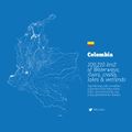
- Colombia-rivers.jpg 1,200 × 1,200; 147 KB
- STAR bus sign in Rennes.jpg 1,200 × 1,600; 711 KB
- Mapathon-valencia-hurricane-mathew.jpg 1,024 × 575; 236 KB
- WikiData C19th Aberystwyth shipwrecks.jpg 1,878 × 966; 293 KB
- Interchange Choreography sample.png 962 × 615; 235 KB
- Meshu.io.jpg 654 × 282; 44 KB
- MapSwipe results to tasking manager.png 517 × 254; 95 KB
- SotM Latam2016.jpg 2,764 × 1,562; 979 KB
- Red Cross volunteer GPS tracks in Forecariah Guinea.jpg 1,144 × 1,065; 262 KB
- Water Worlds Alex Szabo-Haslam.png 596 × 449; 519 KB
- Shizuoka-uturn.jpg 1,717 × 1,152; 310 KB


