Category:Maps of places in the United Kingdom
Jump to navigation
Jump to search
Pages in category "Maps of places in the United Kingdom"
The following 5 pages are in this category, out of 5 total.
Media in category "Maps of places in the United Kingdom"
The following 24 files are in this category, out of 24 total.
 Arlesey.png 554 × 568; 45 KB
 Castletown, Isle of Man.png 886 × 479; 109 KB
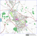
 Chester.png 1,533 × 1,176; 822 KB
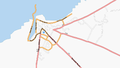
 Douglas, Isle of Man.png 896 × 506; 213 KB
 Edinburgh-20060828.png 1,089 × 545; 212 KB
 Geographia-IOW-small.jpg 402 × 213; 21 KB
 Glasgow 25-07-07.png 1,280 × 1,024; 431 KB
 GreaterChester.png 1,024 × 1,293; 980 KB
 IoW thumbnail.png 200 × 132; 22 KB
 Iow-laptop-pic.jpg 400 × 300; 37 KB
 IoW.png 1,000 × 1,000; 50 KB
 Isle of Man.png 416 × 496; 88 KB
 IsleOfMan.png 416 × 496; 88 KB
 Leeds200.jpg 500 × 398; 37 KB
 Leeds200centre.jpg 200 × 176; 8 KB
 Oxford-svg.png 1,173 × 1,142; 1.07 MB
 Peel, Isle of Man.png 896 × 505; 100 KB
 Port Erin, Isle of Man.png 786 × 505; 101 KB
 Port St Mary, Isle of Man.png 718 × 404; 84 KB
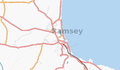 Ramsey, Isle of Man.png 786 × 457; 74 KB
 Reading.png 2,000 × 2,628; 663 KB
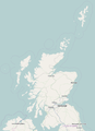 Scotland-map.png 510 × 703; 105 KB
 Uk reading 20060831.png 818 × 549; 179 KB
 Wight24052006.png 2,642 × 1,738; 155 KB


