Category:Maps of the United Kingdom
Jump to navigation
Jump to search
Subcategories
This category has only the following subcategory.
M
Media in category "Maps of the United Kingdom"
The following 25 files are in this category, out of 25 total.
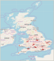
- Addr locality UK 2021-11.png 447 × 503; 106 KB
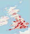
- Addr place UK 2021-11.png 445 × 502; 128 KB
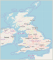
- Addr site UK 2021-11.png 449 × 504; 101 KB
- British isles osmarender August 2010.png 1,227 × 1,881; 1.86 MB
- GPS 2007.png 2,283 × 3,266; 403 KB
- GPS 2008.png 2,283 × 3,266; 298 KB
- GPS 2009.png 2,283 × 3,266; 329 KB
- GPS 2010.png 2,283 × 3,266; 700 KB
- GPS 2011.png 2,283 × 3,266; 506 KB
- GPS 2012.png 2,283 × 3,266; 237 KB
- Open Whitewater Map 2010-02-26 screenshot1.png 1,344 × 900; 380 KB
- OpenDoorLogistics-UK-sales-map.png 422 × 354; 178 KB
- Openinframap-uk-ireland.png 1,884 × 2,766; 1.57 MB
- Oslmusicalchairs screenshot.png 1,246 × 719; 701 KB
- OSM vs OS trig stations map.pdf 1,027 × 1,754; 4.74 MB
- Osm-planet-2.jpg 1,024 × 768; 141 KB
- Placeparty.png 432 × 800; 206 KB
- Postcodes screenshot.png 768 × 760; 347 KB
- QGIS default vs OSTN02 map.pdf 991 × 1,754; 593 KB
- Sotm08-limerick.png 400 × 509; 125 KB
- Uk ojw gd.png 822 × 1,122; 58 KB
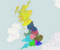
- UK regional mapathons 2019-2020.png 429 × 522; 877 KB
- UK-map.jpg 629 × 783; 46 KB
- UK-Postcodes-06-05-09.png 650 × 920; 467 KB
- World Maps Offline screenshots.jpg 332 × 568; 31 KB


