Category:Maxheight Map
Jump to navigation
Jump to search
Pages in category "Maxheight Map"
The following 2 pages are in this category, out of 2 total.
Media in category "Maxheight Map"
The following 14 files are in this category, out of 14 total.
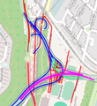
- Maxheight map complex.png 286 × 313; 97 KB
- Maxheight map garmin.png 240 × 400; 53 KB
- Maxheight Map Heatmap Germany.png 992 × 1,403; 1 MB
- Maxheight Map History.png 229 × 283; 17 KB
- Maxheight Map icon1.gif 15 × 15; 246 bytes
- Maxheight Map icon2.gif 15 × 15; 246 bytes
- Maxheight Map Label.png 102 × 21; 2 KB
- Maxheight map lines.png 263 × 150; 38 KB
- Maxheight map maxweight with labels.png 285 × 192; 25 KB
- Maxheight map points.png 263 × 150; 36 KB
- Maxheight Map Simulation.png 243 × 142; 7 KB
- Maxheight Map.png 1,600 × 900; 820 KB
- Mmd maxheight map screenshot.png 1,098 × 694; 536 KB
- Powered by Overpass API.png 140 × 56; 7 KB


