Wanderkarte Gutau
Jump to navigation
Jump to search
Project Hiking And Cycling Map for Gutau im Mühlkreis in Upper Austria, made by Holger Schöner.
Hiking And Cycling Map Gutau 2013
2013-06-01
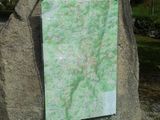
2013 a new edition was issued, this time as A3 sheets to tear off. Also a new display board at the starting point of many hiking trails and at the rental station of the e-bikes was created.
Ornithology Hiking Trail Gutau 2009
2009-07-06
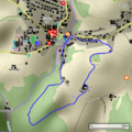
For the new ornithology hiking trail ("Vogelkundeweg") a display board was created in july 2009.
Hiking Map of Gutau 2009
2009-04-30
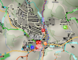
At the end of april 2009 the new hiking maps were finalized and offset printed.
Cross-Country Skiing Map of Gutau
2009-02-19
The map shows an overview of cross country skiing routes around Gutau.
You can find further details on lorien.ancalime.de/gutau.html.


