CheckTheMonuments
| CheckTheMonuments | ||||||||||||||||||||||||||||||||||||
|---|---|---|---|---|---|---|---|---|---|---|---|---|---|---|---|---|---|---|---|---|---|---|---|---|---|---|---|---|---|---|---|---|---|---|---|---|
| Authors: | Lutz, Netzwolf, Reneman | |||||||||||||||||||||||||||||||||||
| License: | CC BY-SA, ODbL, OpenStreetMap, and ShareAlike | |||||||||||||||||||||||||||||||||||
| Platform: | Web | |||||||||||||||||||||||||||||||||||
| Version: | (2013-05-01) | |||||||||||||||||||||||||||||||||||
| Language: | German
| |||||||||||||||||||||||||||||||||||
| Website: | http://www.historic.place/themes/monuments/ | |||||||||||||||||||||||||||||||||||
| Programming language: | JavaScript | |||||||||||||||||||||||||||||||||||
|
Quality Management for Monuments |
||||||||||||||||||||||||||||||||||||
| ||||||||||||||||||||||||||||||||||||
CheckTheMonuments is a map which is primarily intended as quality control tool for historic objects. Objects in OpenStreetMap have frequently been tagged as Monument either out of ignorance or because the proper tags were not yet defined when the objects were tagged. As a result of this, we find over 5,000 objects have been tagged as monument in Germany alone. When we look closer, many of those objects should be tagged differently. The CheckTheMonuments map will highlight all objects tagged as monument and support the mappers in their attempt to correct the situation.
Definition
What exactly is a monument?
The term Monument is very general, and - according to ![]() Wikipedia - is commonly used for all kinds of structures. For OpenStreetmap this definition is not specific enough. We would like to differentiate monuments from a memorial statue or a rune stone.
Wikipedia - is commonly used for all kinds of structures. For OpenStreetmap this definition is not specific enough. We would like to differentiate monuments from a memorial statue or a rune stone.
The main features of a monument include:
- It is considerably larger than a memorial statue
- It is very important
- One can walk on or through it
- It commemorates a person or a historical event.
What is not a monument?
The answer to this question is short and simple: any object for which there is a specific tag in OpenStreetMap should not be tagged as monument. Historically relevant objects which are not yet formally registered and for which the definition of historic=monument does not apply can be tagged as with historic=yes with the additional descriptive attributes description=*, inscription=* and note=*.
How do I find the correct attribute for my historical object?
As Albert Einstein aptly put it a long time ago:
'knowledge is to know where it is written.'
A brief overview:
| Wiki page | Content |
|---|---|
| Historic | Comprehensive description of the key "historic" including Dos and Don'ts |
| Key:historic | Values for the key "historic" |
| Historische Objekte (de) | Overview of objects shown in the map including pictures, Wikipedia and OSM-definition. Tip: Use the search function Ctrl+F |
| TagInfo | Statistics on the use of the key "historic" |
What about additional information?
Mappers often would like to add extra information. The following table is intended to help them find the right attributes:
| Key | Describes the object ... |
|---|---|
| building=* | ... as a building, the value defines the main use (yes, public, church, ...). Alternatively, if only a ruin is left: ruins=yes |
| name=* | ... with its proper name; here may also be an alternative name (alt_name=*), a historic name (old_name=*), etc. |
| wikipedia=* | ... with key word on Wikipedia. Use e.g. wikipedia=en:Edinburgh Castle |
| image=* | ... with available picture (see Historische Objekte#Eine image=* Bildquelle angeben). Use image=* e.g. image=Viktoria Siegessäule.jpg |
| description=* | ... detail, includes information not included in the "Name" attribute. Inscriptions in / on the object may be added using inscription=* |
| start_date=* | ... with the year of creation or the opening year |
| height=* | ... overall height. The information is given in meters. Example 4.5 |
| heritage=* | ... as a cultural asset that must be protected from damage or destruction. It is registered as a National Monument and is protected by law. |
| addr=* | For many objects communication data are available. This includes, among others: website=*, phone=*, contact=* |
Idea and implementation
It all started with an observation of BBO, who addressed the subject "historic=monument clean-up" in the German forum. This fostered the idea to create a special map for this issue. The subject was also discussed by reneman: "Data quality: Heatmap for specific Tags". The most important contribution was made by Netzwolf, who collected all suggestions, perfected and implemented them. We encourage you to participate in this project. The biggest reward for any developer is user activity. Collectively we can view, edit and expand the information collected in OpenStreetMap.
Practical Use
Data
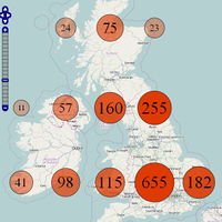
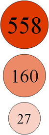
Circled numbers: These are displayed for zoom levels 3-11. The values are updated daily (see Historische Objekte#Update) and stored on the server as a csv file. The values are recalculated for every zoom level for square areas. The position of the circles on the map is predetermined by the location of the square areas. The size of the circles is dynamically adjusted to match the values. For a zero value, no circle is created. Zoom levels 1 and 2 are not supported.
Symbols for Monuments: ![]() These will be shown from zoom level 12 upwards. The data are current, since they are instantly obtained via the Overpass API. For each symbol, more information can be displayed in a popup (see Historische Objekte#Popup).
These will be shown from zoom level 12 upwards. The data are current, since they are instantly obtained via the Overpass API. For each symbol, more information can be displayed in a popup (see Historische Objekte#Popup).
Link functions
Show Monuments in JOSM
All monuments contained in the map are directly passed on to JOSM using the Overpass API.
Edit *** area
This link will launch the editor (iD or Potlatch2) with the display area.
Historic objects map
Opens Historische-Objekte-Karte in a new window.


