Circular and widened road features

|
| Description |
| Circular and widened road features |
| Group |
| Tags |
In OpenStreetMap we have several tags that describe different circular and widened road features.
junction=roundaboutfor roundabouts;highway=mini_roundaboutfor mini-roundabouts;junction=circularfor rotaries (traffic circles) and other circular traffic that is not a roundabout;highway=turning_circlefor turning circles;highway=turning_loopfor turning loops;highway=passing_placefor road passing places; andtraffic_calming=islandfor islands meant to calm traffic.
The major differences between the first four are:
- A roundabout is a one-way street with right-of-way and a non-traversable centre island. There can be traffic light, as long as the circular road has right-of-way when the lights are off.
- A mini-roundabout is a one-way street with right-of-way and a traversable centre island. In particular, large vehicles are allowed to drive across the centre island if otherwise not possible due to their dimensions, i.e. it might be impossible for a large vehicle to drive through a roundabout but possible to drive through a mini-roundabout with the same dimensions.
- A circular junction is a one-way street around a non-traversable centre island, however the circular traffic has not always the right-of-way, it has to yield at some or all incoming roads. This includes traffic circles with such yield regulations as perceived in the United States.
- A turning circle is a widened space on a two-way street without any centre island (or at least a fully traversable island). The absence of a centre island allows also large vehicles to turn around.
Why is it important to follow this tagging guideline if the map looks good even when tagged differently?
The map is not everything. There exist a lot more applications which process our data and these tags have different implications e.g. for routers. So if you tag a small roundabout as a mini-roundabout or a loop at the end of a street as a turning circle, it might look ok on the map but will break other applications. So please don't think of this as annoyance and try to use the most fitting tags in each situation.
The following table presents the preferred tagging for the most common situations and also tries to clarify some ambiguities.
| Photo | Tagging | Remarks |
|---|---|---|

|
highway=*junction=roundabout
|
A standard roundabout with a large, non-traversable centre island. |

|
highway=*junction=roundabout
|
Small, but not a mini-roundabout. Although it is preferred to tag this the same way as a large roundabout, for the sake of simplicity it is acceptable to tag this with a single node with junction=roundabout. In this case the tag direction=* should be specified, as its default value is anti-clockwise when used in conjunction with a roundabout.
|
|
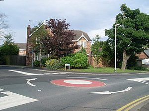
highway=mini_roundaboutdirection=clockwise
|
A classical mini-roundabout where the centre is only a painted circle. The tag direction=* should be specified, as its default value is anti-clockwise when used in conjunction with a mini-roundabout.
|

|
highway=mini_roundabout
|
Large, but a mini-roundabout. The centre island is traversable and without signposts. |
|
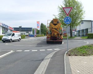
highway=mini_roundabout
|
Also a classical mini-roundabout with a slightly raised but still fully traversable centre island. |

|
junction=circular
|
Traffic routed in a circle, with a large, non-traversable centre island. However the circular traffic must yield for at least one, some or each entering road, thus not a roundabout. |
|
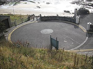
highway=turning_circle
|
This photo shows a round place with a traversable island in the middle, but this is neither a mini-roundabout nor a roundabout, but instead a turning circle, which allows large vehicles to turn around. Please bear in mind that a turning circle can have any shape, but never a non-traversable island. |
|
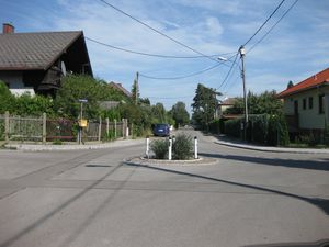
junction=circular
|
There are no indications of right-of-way, so this is a circular junction rather than a roundabout. There are no one-way indications, so the circular way should be tagged oneway=no.
|
|
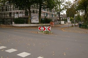
junction=circular
|
This is also a circular junction with traffic calming. Watch the arrows closely to figure out whether to tag the circular way with oneway=yes or oneway=no.
|

|
or alternatively proposed
|
Obviously a place for vehicles to turn around. But because of the island, it is not a turning circle (which must not have an island), so this should be mapped as a loop. For the sake of simplicity the tag highway=turning_loop on a single node is currently under discussion.
|