DE:Openrouteservice
HeiGIT • DE:Openrouteservice • Ohsome
Ohsome API • OSHDB • Ohsome Dashboard • OhsomeHeX • Ohsome quality analyst
Openrouteservice (Webseite – kurz ORS) ist mehr als nur ein Routen-Service für Autos, Fußgänger und Fahrräder, basierend auf offenen Standards und freien Daten. Mehrere Location Based Services (LBS) sind unter Verwendung von OSM-Daten verfügbar, entwickelt vom HeiGIT - Heidelberg Institute for Geoinformation Technology. Zum Beispiel:
- Directions Service
- Matrix Service
- Geocoding Service
- Locations Service
- Isochrones Service
| Openrouteservice | ||||||||||||||||||||||||||||||||||||||||||||||||||||||||||||||||||||||||||||||||||||||||||||||||||||||||||||
|---|---|---|---|---|---|---|---|---|---|---|---|---|---|---|---|---|---|---|---|---|---|---|---|---|---|---|---|---|---|---|---|---|---|---|---|---|---|---|---|---|---|---|---|---|---|---|---|---|---|---|---|---|---|---|---|---|---|---|---|---|---|---|---|---|---|---|---|---|---|---|---|---|---|---|---|---|---|---|---|---|---|---|---|---|---|---|---|---|---|---|---|---|---|---|---|---|---|---|---|---|---|---|---|---|---|---|---|---|
| Autor: | GIScience | |||||||||||||||||||||||||||||||||||||||||||||||||||||||||||||||||||||||||||||||||||||||||||||||||||||||||||
| Lizenz: | Apache License 2.0 | |||||||||||||||||||||||||||||||||||||||||||||||||||||||||||||||||||||||||||||||||||||||||||||||||||||||||||
| Plattformen: | API und Web | |||||||||||||||||||||||||||||||||||||||||||||||||||||||||||||||||||||||||||||||||||||||||||||||||||||||||||
| Version: | 4.7.2 | |||||||||||||||||||||||||||||||||||||||||||||||||||||||||||||||||||||||||||||||||||||||||||||||||||||||||||
| Sprachen: | Deutsch, Amerikanisches Englisch, Britisches Englisch, Griechisch, Spanisch, Französisch, Ungarisch, Italienisch, Niederländisch, Polnisch, Portugiesisch, Russisch und Chinesisch
| |||||||||||||||||||||||||||||||||||||||||||||||||||||||||||||||||||||||||||||||||||||||||||||||||||||||||||
| Webseite: | https://maps.openrouteservice.org/ | |||||||||||||||||||||||||||||||||||||||||||||||||||||||||||||||||||||||||||||||||||||||||||||||||||||||||||
| ||||||||||||||||||||||||||||||||||||||||||||||||||||||||||||||||||||||||||||||||||||||||||||||||||||||||||||
Generelle Informationen
| Online seit: | April 2008 |
|---|---|
| entwickelt von: | HeiGIT - Heidelberg Institute for Geoinformation Technology |
| Idee: | Pascal Neis & Alexander Zipf University of Heidelberg GIScience (Geoinformatics) Research Group ([1]) |
| Unterstützte Regionen: | Weltweit
Rollstuhl routing: Europa |
| Unterstützte Sprachen bei den Fahranweisungen (Directions Service): | Deutsch, Englisch, Portugiesisch, Russisch, Ungarisch, Französisch, Italienisch, Holländisch und Chinesisch
Hier können einfach neue Sprachen hinzugefügt werden. |
| API Endpoints | Mehr Infos zu den ORS Services gibt es auf unserer Website. Hier kann man sich ebenfalls für einen API Key registrieren.
|
| Daten Update | zweiwöchentlich |
Kommentare, Fragen, Vorschläge oder Bugs per Email an support[at]openrouteservice.org
Wofür kannst du Openrouteservice nutzen?
Openrouteservice.org ist viel mehr als ein Routen-Service: Die Seite bietet eine Vielzahl von Diensten, die OSM-Daten verwenden und auch in anderem Umfeld und anderen Anwendungen verwendet werden können. Momentan sind, basiernd auf OSM-Daten, die folgenden Dienste auf Openrouteservice.org verfügbar:
- Der Directions Service berechnet Routen- und Navigations-Informationen, abhänging von verschiedenen Kriterien. Realisiert wurden dabei:
- Auto: schnellste, kürzeste, bevorzugt
- Mehrere LKW Profile(Lieferfahrzeug, Forstfahrzeug, Bus ...) mit anpassbaren Größen
- diverse Fahrradoptionen (MTB, Rennrad, Sichere Route ...)
- Fußgänger(Spazieren(normal) und Wandern)
- Rollstuhlrouting
- Der Pois Service ist ein Dienst, der den Zugriff auf ein Online-Verzeichnis bietet. Dabei können über die Angabe einer Position und Distanz alle in der Nähe befindlichen Orte, Produkte oder Dienste gesucht werden.
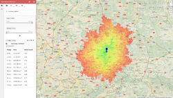
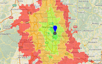
- Der Isochrones Service berechnet ein Polygon, das das innerhalb einer vorgegeben Zeit zu erreichende Gebiet repräsentiert.
- Der Geocode Service bietet Geocodierung/Reverse Geocodierung. Dabei wandelt er eine Adresse in eine Position oder eine Position in eine Adresse um.
- Es können Polygone in der Karte digitalisiert werden, die bei einer anschließenden Routeberechnung vermieden werden.
- Upload and Download von GPS Tracks als Route etc.
- Für die Fahrrad und Fußgänger Profile können Oberflächenbeschaffenheit, Wegtypen, Steigung und Eignung der Wege für das gewählte Profil sowie ein Höhenprofil angezeigt werden.
Openrouteservice API
Detaillierte Informationen zur API findet man auf openrouteservice.org. Die API Dokumentation befindet sich im API Playground.
Verwandte Publikationen
Publikantionen die mit Openrouteservice, OpenLS+OSM in Zusammenhang stehen: cmp.: https://www.geog.uni-heidelberg.de/gis/publikationen_journals.html https://www.geog.uni-heidelberg.de/gis/publikationen_conference.html
- Steiger, E. and Zipf, A.(2015): Enriching OSM road networks with TMC LCL information. RICH-VGI: enRICHment of volunteered geographic information (VGI): Techniques, practices and current state of knowledge. 18th AGILE Conference on Geographic Information Science. Lisbon, Portugal.
- Barron, C., Neis, P. & Zipf, A. (2013): A Comprehensive Framework for Intrinsic OpenStreetMap Quality Analysis. , Transactions in GIS, DOI: 10.1111/tgis.12073.
- Ballatore, A. and Zipf, A. (2015): A Conceptual Quality Framework for Volunteered Geographic Information. COSIT - CONFERENCE ON SPATIAL INFORMATION THEORY XII. October 12-16, 2015. Santa Fe, New Mexico, USA. Lecture Notes in Computer Science, pp. 1-20.
- Neis, A. & Zielstra, D. (2014): Generation of a tailored routing network for disabled people based on collaboratively collected geodata. Applied Geography. Vol. 47, pp. 70–77.
- Neis, P. (2014): Measuring the Reliability of Wheelchair User Route Planning based on Volunteered Geographic Information. Transactions in GIS.
- Goetz, M. & Zipf, A. (2012): Using Crowdsourced Indoor Geodata for Agent-Based Indoor Evacuation Simulations. ISPRS International Journal of Geo-Information. Vol.1(2), pp.186-208. MDPI. DOI:10.3390/ijgi1020186.
- Neis, P. & Zipf, A. (2012): Analyzing the Contributor Activity of a Volunteered Geographic Information Project – The Case of OpenStreetMap. ISPRS International Journal of Geo-Information. Vol.1(2), pp.146-165. MDPI. DOI:10.3390/ijgi1020146 .
- Steiger, E. Zipf, A.(2015): Erstellungs eines OSM Graphen mit TMC LCL Informationen In: Strobl, J., Blaschke, T., Griesebner, G. (Hrsg.): Angewandte Geoinformatik 2015. Berlin
- Neis, P., Zielstra, D. & Zipf, A. (2012): The Street Network Evolution of Crowdsourced Maps - OpenStreetMap in Germany 2007-2011. Future Internet. Special Issue "NeoGeography and WikiPlanning" (Eds: B. Murgante, G. Borruso, M. Gibin), Vol.4, pp.1-21 (DOI 10.3390/fi4010001). ISSN 1999-5903.
- Sun, Y., Fan, H., Bakillah, M. & Zipf, A. (2013): Road-based Travel Recommendation Using Geo-tagged Images. Computers, Environment and Urban Systems (CEUS). Elsevier.
- Neis, P., Zielstra, D. & Zipf, A. (2013): Comparison of Volunteered Geographic Information Data Contributions and Community Development for Selected World Regions. Future Internet. Vol. 5, pp. 282-300.
- Goetz, M. & Zipf, A. (2011): Formal Definition of an User-adaptive and Length-optimal Routing Graph for Complex Indoor Environments. Geo-spatial Information Science (GSIS). Vol.14(2). Springer.
- John, S., Hahmann, S., Zipf, A. (2015): Automatisierte Ableitung des Gefälles von Straßen und Wegen aus OpenStreetMap GPS-Tracks. 59. Deutscher Kongress für Geographie (DKG 2015). Berlin, Germany. (accepted as presentation).
- Neis, P. and Zipf, A. (2008): Generating 3D Focus Maps for the (mobile) Web - an interoperable approach. In: International Journal of Location Based Services (JLBS). Vol. 2, Issue 2.
- Neis, P. and Zipf, A. (2007): Realizing Focus Maps with Landmarks using OpenLS Services. 4th International Symposium on LBS and Telecartography 2007. Hongkong.
- Neis, P., A. Zipf, R. Helsper, Kehl, A. (2007): Webbasierte Erreichbarkeitsanalyse - Vorschläge zur Definition eines Accessibility Analsysis Service (AAS) auf Basis des OpenLS Route Service. REAL CORP 2007. Wien, Austria.
- Schmitz S., Zipf A. and Neis P. (2008): New Applications based on Collaborative Geodata - the Case of Routing. XXVIII INCA International Congress on Collaborative Mapping and SpaceTechnology, Gandhinagar, Gujarat, India
- Zipf, A., Neis, P. und Fellner M. (2008): Wirbelstürmer - Freie Mapping- und Routing-Services mit von Usern erzeugten Karten. In: LINUX Magazin (Professoren-.Ausgabe). 01/09 (erschienen 12/2008). S 34-39. https://www.linux-magazin.de/ausgaben/2009/01/wirbelstuermer/
- Neis P. and A. Zipf (2008): LBS_2.0 - Realisierung von Location Based Services mit user-generated, collaborative erhobenen freien Geodata. In: J. Roth (Hrsg.): 5. GI/ITG KuVS Fachgespräch Ortsbezogene Anwendungen und Dienste, 4.-5. September 2008, Nürnberg. Sonderdruck Schriftenreihe der Georg-Simon-Ohm-Hochschule Nürnberg Nr. 42, ISSN 1867-5433
- Schmitz, S., Zipf, A. and Pascal Neis (2008): Proposal to define common resources for OpenGIS Location Services. 5th International Symposium on LBS & TeleCartography. Salzburg. Austria.
- Haase M., A. Zipf , P. Neis , V. de Camargo (2008): Interoperable Routing Services in the Context of Evacuation Schemes due to Urban Flooding. EnviroInfo 2008 Conference. Environmental Informatics and Industrial Ecology. Lueneburg, Germany.
- Neis, P., Zipf, A (2008): OpenRouteService.org is three times “Open”: Combining OpenSource, OpenLS and OpenStreetMaps. Accepted for: GIS Research UK (GISRUK 08). Manchester.
- Brinkhoff,T., M. BERTLING, J. BIERMANN, T. GERVENS, R. KÖNIG, D. KÜMPER, P. NEIS, B. STOLLBERG, C. ROLFS, A. WEISER, J. WEITKÄMPER, A. ZIPF (2008): Offenes Katastrophenmanagement mit freiem GIS Zur interoperablen Kopplung von Leitstellensystem, mobilen Clienten und GDI mit Prozessierungsdiensten. AGIT 2008. Symposium für angewandte Geoinformatik. Salzburg. Austria.
- Weiser, A., P. Neis, A. Zipf (2006): Orchestrierung von OGC Web Diensten im Katastrophenmanagement - am Beispiel eines Emergency Route Service auf Basis der OpenLS Spezifikation. In: GIS - Zeitschrift für Geoinformatik. 09/2006. pp. 35-41.
- Neis, P. und Zipf, A. (2008): OpenStreetMap – Grundlagen und Potentiale der freien Wiki-Weltkarte. GIS Report 2008/2009. Harzer Verlag. Karlsruhe.
- Neis, P. und Zipf, A. (2008): LBS 2.0 mit OpenRouteService.org - die OpenGIS-konforme Routing-Plattform auf Basis der freien Geodaten von OpenStreetMap. GIS Report 2008/2009. Harzer Verlag. Karlsruhe.
- Neis, P., A. Schilling, A. Zipf (2007): 3D Emergency Route Service (3D-ERS) based on OpenLS Specifications. GI4DM 2007. 3rd International Symposium on Geoinformation for Disaster Management. Toronto, Canada.
- Neis, P., A. Zipf (2007): A Web Accessibility Analysis Service based on the OpenLS Route Service. AGILE 2007. International Conference on Geographic Information Science of the Association of Geograpic Information Laboratories for Europe (AGILE). Aalborg, Denmark.
- Bauer, M., P. Neis, C. Weber, A. Zipf (2007): Kontextabhängige Landmarken für mobile 3D Navigationsanwendungen. In: 4. Fachgespräch: Ortsbezogene Anwendungen und Dienste. LMU München.


