JA:2011 Sendai earthquake and tsunami/Imageries
| 2011 Sendai earthquake and tsunami (メインページ) | Mapping coordination and data sources(マッピングの組織調整の紹介ページ) | Imageries(衛星写真) |
|---|
利用可能な衛星写真 (災害後の画像)
DigitalGlobe Sendai 0312(デジタルグローブ仙台0312)
- DigitalGlobeより、仙台周辺の被災後の画像が提供されています。
- サーバの設備、および広範囲での利用制限のため、同時に20アカウントまでとなります。
- 利用されたい方は、 List_of_DigitalGlobe_Editors を参照ください。
- 災害後画像は 日本の複数のエリア がカバーされています。以下の津波で被害を受けた場所なども含みます。
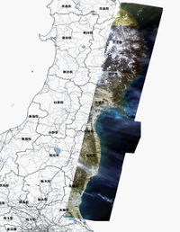
JAXA/ALOS(だいち)による仙台の映像(0314時点)
- NIED(独立行政法人防災科学技術研究所)によって、JAXA(宇宙航空研究開発機構)からの衛星画像(地震後の画像)をトレースすることが許可されました。BOSAI-DRIP/NIEDもご参照ください。
- 2.5m解像度カラーの画像と。10mカラーの中分解能カラーAVNIR2が防災科学技術研究所のホスティングによってWMS配信されています。
| Image set | Boundary | Use in JOSM | Use in Potlatch |
|---|---|---|---|
| ALOS/Pan-Sharpened
Date: 2011-03-12 以下のタグを使ってください。 source=JAXA/ALOS/pan-sharpened, 2011-03-12 |
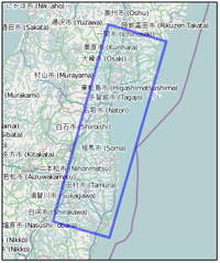
 画像の境界を見る here |
JOSM では、WMS URL として以下のものを使ってください。
GetCapability: http://hazardmap.service-section.com/geoserver/wmscapabilities?id=alpans_0312_1 GetMap: http://hazardmap.service-section.com/cgi-bin/mapserv?map=/map/UserRaster/alpans_0312_1.map&SERVICE=WMS&VERSION=1.1.1&REQUEST=GetMap&LAYERS=alpans_0312_1&STYLES=&EXCEPTIONS=application%2Fvnd.ogc.se_inimage&FORMAT=image/png&SRS=EPSG:4326& |
Potlatch では以下の URL を 'custom' 設定にペーストしてください。
Not available
|
| ALOS/AVNIR-2
Date: 2011-03-12
|
 see image boundary here |
JOSM では WMS URL として次を使ってください。
GetCapability: http://hazardmap.service-section.com/geoserver/wmscapabilities?id=alav2a_0312_1 GetMap: http://hazardmap.service-section.com/cgi-bin/mapserv?map=/map/UserRaster/alav2a_0312_1.map&SERVICE=WMS&VERSION=1.1.1&REQUEST=GetMap&LAYERS=alav2a_0312_1&STYLES=&EXCEPTIONS=application%2Fvnd.ogc.se_inimage&FORMAT=image/png&SRS=EPSG:4326& |
Potlatch では以下の URL を 'custom' 設定にペーストしてください。
Not available
|
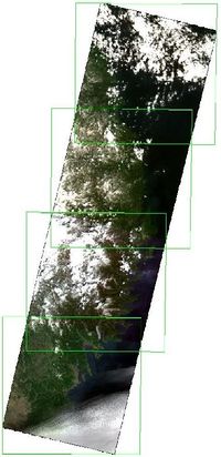
| ALOS/AVNIR-2
Date: 2011-03-14 以下のタグを使ってください。 source=JAXA/ALOS/AVNIR2, 2011-03-14 |
JOSM では、WMS URL として以下のものを使ってください。
GetCapability: http://hazardmap.service-section.com/geoserver/wmscapabilities?id=alav2a_0314_1 GetMap: http://hazardmap.service-section.com/cgi-bin/mapserv?map=/map/UserRaster/alav2a_0314_1.map&SERVICE=WMS&VERSION=1.1.1&REQUEST=GetMap&LAYERS=alav2a_0314_1&STYLES=&EXCEPTIONS=application%2Fvnd.ogc.se_inimage&FORMAT=image/png&SRS=EPSG:4326& |
Potlatch では以下の URL を 'custom' 設定にペーストしてください。
Not available |
MapQuest Open Aerial
- MapQuest(supported by NIED)によって、JAXA(Japan Aerospace Exploration Agency)の持つ地震後の衛星写真をトレースすることが許可されました。
| Image set | Boundary | Use in JOSM | Use in Potlatch |
|---|---|---|---|
| ALOS/Pan-Sharpened
Date: 2011-03-12 以下のタグを使ってください。 source=JAXA/ALOS/pan-sharpened, 2011-03-12 |
JOSM では MapQuest Open Aerial を使う。
こちらも参照くださいJOSM  画像の輪郭を見る here |
Potlatch 2 1. http://open.mapquest.com/ または他の Open Beta ドメインを開き、地図のズーム制御の上の編集 (Edit) ボタンを押して Potlatch 2 を開きます。 |
Bing による災害後の画像
- Bing は既に一部地域の災害後の画像を提供しています。
- この図の上と下を見比べてみてください(仙台のパッチの境界付近)。
- bing image analyzerは、これらのパッチを見るのに役立ちません。
bing image analyzerは、利用可能な解像度を示すだけです(including weird blotches over blue where people have zoomed to super-high-res)。
- 震災後の情報がある地域に関しても、トップのズームレベルは古いです。
- カバーされている地域(原文:area of coverage)を調べるには、見えているシームにそって調べるか(原文:following around the visible seam)、 日付が見えるバージョンの地図をズームして、日付で確認できます。
- 震災後の画像があるのは石巻近辺および、山元町から南相馬市、大熊町付近です。
- 災害後の Bing 画像を元に作図した場合は、source タグに'Bing 2011-03-1' などと記入してください。
Cnes / SpotImage Sendai 03-12
Spot imagery over Sendai available through UNOSAT charter. Spot Image agrees that OpenStreetMap contributors use this SPOT image and the corresponding online WMS service provided that each contributor acknowledge the following license : http://www.youmapps.org/licenses/EULA-OSM-en.html This is briefly what is required by the license :
- The SPOT imagery is provided to you, the final user, only to extract information that will be stored in the OpenStreetMap database under a CC-by-SA 2.0 and/or OpenDbL licence.
- Please, fill the source tag with source = “Cnes / Spot Image”
- Do not use, download or redistribute the imagery for any other purposes than what is authorized here.
| Image set | Boundary | Use in JOSM | Use in Potlatch |
|---|---|---|---|
| SPOT 5
Resolution: 2.5m Use the tag: source=Cnes / Spot Image 2011-03-12 |
Use the following WMS URL in JOSM :
GetCapability: http://cernunosat05.cern.ch/arcgis/services/Japan/SendaiMosaic/ImageServer/WMSServer? GetMap: wms:http://cernunosat05.cern.ch/ArcGIS/services/Japan/SendaiMosaic/ImageServer/WMSServer?FORMAT=image/jpeg&VERSION=1.1.1&SERVICE=WMS&REQUEST=GetMap&Layers=0& |
Not allowed | |
| SPOT 5
Resolution: 2.5m (pan-sharpened "natural colors") Use the tag: source=Cnes / Spot Image 2011-03-13 |
Use the following WMS URL in JOSM :
GetCapability: http://cernunosat05.cern.ch/ArcGIS/services/Japan/Japan_earthquake_Tsunami_area/MapServer/WMSServer? GetMap: wms:http://cernunosat05.cern.ch/ArcGIS/services/Japan/Japan_earthquake_Tsunami_area/MapServer/WMSServer?FORMAT=image/jpeg&VERSION=1.1.1&SERVICE=WMS&REQUEST=GetMap&Layers=0&Styles=default& |
Not allowed | |
| SPOT 5
Resolution: 2.5m (panchromatic) Use the tag: source=Cnes / Spot Image 2011-03-13 |
Use the following WMS URL in JOSM :
GetCapability: http://osm.arkemie.org/cgi-bin/osm_wms?map=/mapsite/japan.map& GetMap: wms:http://osm.arkemie.org/cgi-bin/osm_wms?map=/mapsite/japan.map&FORMAT=image/jpeg&VERSION=1.1.1&SERVICE=WMS&REQUEST=GetMap&Layers=tohokucoast20110313& This imagery was not tied to ground control points (level 2A). Adjust offset based on GPS tracks or existing data before use. For better visibility, contrast is scaled for each WMS request (you can change displayed resolution to have contrast adjusted on different window size). |
Not allowed | |
| SPOT 5
Resolution: 10m (multispectral) Use the tag: source=Cnes / Spot Image 2011-03-13 |
Use the following WMS URL in JOSM :
GetCapability: http://osm.arkemie.org/cgi-bin/osm_wms?map=/mapsite/japan.map& GetMap: wms:http://osm.arkemie.org/cgi-bin/osm_wms?map=/mapsite/japan.map&FORMAT=image/jpeg&VERSION=1.1.1&SERVICE=WMS&REQUEST=GetMap&Layers=tohokucoast20110313xs& This imagery was not tied to ground control points (level 2A). Adjust offset based on GPS tracks or existing data before use. |
Not allowed |
Telascience: EO-1 03-13, Landsat 03-12, 03-13, etc.
Telascience は衛星画像をいくつか提供しており、増える予定です:
there. Right-click on a layer to zoom to its extent, or to get a WMS link for it - (twice if your browser pop-up menu hides it).
- EO-1, 2011-03-13 (10 m resolution)
- image boundary
- WMS link
- Use the tag: source=EO-1, USGS, 2011-03-13
- A Landsat ETM image taken on 2011-03-12 is available (30 m resolution, layer LANDSAT_ETM_USGS_gaps_interpolated_20110312).
- It is available in WMS (for JOSM, for example) with this link.
- (Image boundary)
- Use the tag: source=Landsat ETM, USGS, 2011-03-12
- (Another, pre-disaster (2011-02-24),
- Landsat image is also available in WMS with this link
- Image boundary
- Use the tag: source=Landsat ETM, USGS, 2011-02-24 )
その他の衛星画像
- ドイツの DLR/ZKI は、DigitalGlobeのWorldView-2衛星からの映像で衛星地図を公開しました [1]。なお、道路データはOSMのものを使っています。こちらの 他の製品も見てください。以下の他のリンクのセクション には他の情報源についても記述しています。
利用可能な衛星写真(災害前の画像)
- Bingの画像はエディタで使うのも簡単ですし、上記の震災後の画像に比べるとずっと解像度が高いですが、震災前のデータです。(注:3/13頃より震災後の画像に置き換わり始めています)
- 上記の震災後画像で確認して、変わってしまったものをトレースしていないか確認しつつ、Bingのデータを使えば正確な作業に役立つでしょう。
- この地域(Bing imagery coverage) では、日本の北部に奇妙な短冊状の区域が見えます。これらの部分については災害後の画像に置き換わっています。


