JA:Key:postal_code
英語版の記事の内容が分かる方は、翻訳の完成にご協力ください。このウィキの翻訳方法についての説明をお読みください。
現時点では、誰もこの記事の翻訳に取り組んでいないようですので、あなたが取り組めます。
| 説明 |
|---|
| 道路やエリアの郵便番号のタグ付けに使用します。 |
| グループ: 場所 |
| 適用できる要素 |
| 状態:使用中 |
| ツール |
ウェイやエリアに postal_code=* でタグ付けすると、地域または通りの郵便番号を記述することができます。
他のタグ付け方法
建物とノードについては・・・
この postal_code キーは建物とノードにも適用できますが、 Karlsruhe scheme がより確立されています(addr=* を参照)。建物やノードの住所を設定する中で addr:postcode=* タグを使用してください。
’’’通りについては、通りの両側が同じ郵便番号である場合、この postal_code=* が有効で広く使われています。
郵便番号区域の境界線については・・・
この postal_code=* が有効で広く使われていますが・・・
boundary=postal_code をウェイまたはリレーション(おそらく type=boundary を持つ)に使用してください。
郵便番号体系
郵便番号の Take a look at Wikipedia to read more about the different postal code-systems! (Choose language: de - en - es - fr - nl).
( ) = 任意
| 国 | 体系 | 例 | Kosmos レンダリング規則 |
|---|---|---|---|
| Australia | 0000 (4 digits) |
6797 | Kosmos postal code rendering rules/au |
| Austria | 0000 (4 digits) |
6797 | Kosmos postal code rendering rules/at |
| Germany | 00000 (5 digits) |
06797 | Kosmos postal code rendering rules/de |
| India | 000000 (6 digits) |
572216 | |
| Romania | 000000 (6 digits) |
147202 | Kosmos postal code rendering rules/ro |
| Spain | 00000 (5 digits) |
99096 | Kosmos postal code rendering rules/sp |
| Switzerland | 0000 (4 digits) |
6797 | Kosmos postal code rendering rules/ch |
| The Netherlands | 0000 (4 digits) |
6797 | Kosmos postal code rendering rules/nl |
| UK | A(A)0(0) |
W1, SW20 | Kosmos postal code rendering rules/uk |
This feature is not rendered in Mapnik or Osmarender at the moment.
郵便番号の情報源
In an ideal world a databases of postal codes (and the locations they represent) would be managed by a government organisation, and they would share this freely without charges or restrictive licensing, because of the obvious economic benefits. Sadly this is not the case in most countries, and so we follow the same approach as with all of the other types of geo-data. We generally collect and build the data from scratch without copying from other sources. We also avoid using google maps to position things, and avoid copying from any other website/source which does so.
Postcodes from scratch?
Postcodes from scratch? Does this mean knocking on people's doors and asking what their postcode is?
Yes... That's the way we build our map. We survey and discover information on-the-ground. Postcodes are particularly tricky because you can't see them. They have poor verifiability, which in sense means they are not suitable for OpenStreetMap, but they have always been a type of geodata people were interested in releasing for free.
You can also discover postcodes on an individual basis without knocking on doors, by looking out for them on till receipts, restaurant menus. You can even look them up on the official website of the place. There is a slippery slope to watch out for with that. We don't want to systematically copy lots of postcodes from somebody's database.
Government sources
We can use government or other mapping agency sources where they have taken the sensible step of releasing the data openly, however "use" of such data might be thought about in terms of an import, i.e. converting the data and using it to set postal_code=* tags in an automated way in the OpenStreetMap database. Imports require that we are very sure about the compatibility of the license and various other caveats. Import guidelines must be followed. A good alternative might be to devise ways of combining datasets while keeping them separate. For many end uses this can work well, although it will mean that some OpenStreetMap benefits such as Nominatim search matching will not come to pass.
Free the postcode
There is a separate but related project called Free The Postcode which coordinates such efforts as a more focused database. When you add a postal_code tag to a node in OpenStreetMap, it does not automatically get added to Free The Postcode (currently at least). Free the postcode has seen less activity and interest in recent times. There was always a UK focus, but in the UK the postcode situation has changed with the release of CodePoint (See Free The Postcode#UK for details) Free the postcode may still be useful and relevant elsewhere though.
レンダリング例
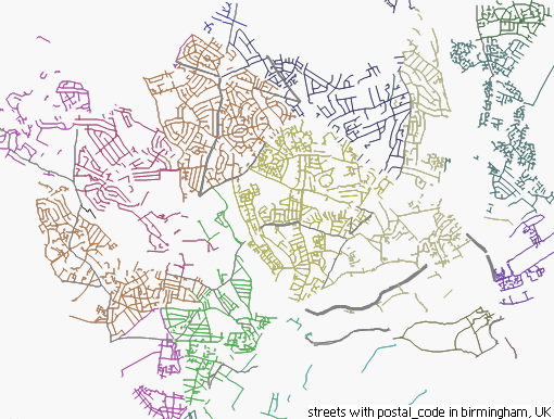
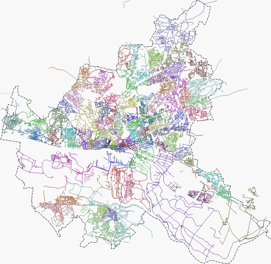
These examples show data where mappers have followed the approach of adding this postal_code=* onto every street.
 Birmingham, UK
 Hamburg, Germany
