Jungle Bus mobile app
| Jungle Bus | ||||||||||||||||||||||||||||||||||||||||||||||||||||||||||||||||||||||||||||||||||||||||||||||||||||||||||||||||||||||||||||||||||||||||||||||||
|---|---|---|---|---|---|---|---|---|---|---|---|---|---|---|---|---|---|---|---|---|---|---|---|---|---|---|---|---|---|---|---|---|---|---|---|---|---|---|---|---|---|---|---|---|---|---|---|---|---|---|---|---|---|---|---|---|---|---|---|---|---|---|---|---|---|---|---|---|---|---|---|---|---|---|---|---|---|---|---|---|---|---|---|---|---|---|---|---|---|---|---|---|---|---|---|---|---|---|---|---|---|---|---|---|---|---|---|---|---|---|---|---|---|---|---|---|---|---|---|---|---|---|---|---|---|---|---|---|---|---|---|---|---|---|---|---|---|---|---|---|---|---|---|---|
| Author: | Jungle Bus association | |||||||||||||||||||||||||||||||||||||||||||||||||||||||||||||||||||||||||||||||||||||||||||||||||||||||||||||||||||||||||||||||||||||||||||||||
| License: | GNU GPL v3 (free of charge) | |||||||||||||||||||||||||||||||||||||||||||||||||||||||||||||||||||||||||||||||||||||||||||||||||||||||||||||||||||||||||||||||||||||||||||||||
| Platform: | Android | |||||||||||||||||||||||||||||||||||||||||||||||||||||||||||||||||||||||||||||||||||||||||||||||||||||||||||||||||||||||||||||||||||||||||||||||
| Status: | Unmaintained | |||||||||||||||||||||||||||||||||||||||||||||||||||||||||||||||||||||||||||||||||||||||||||||||||||||||||||||||||||||||||||||||||||||||||||||||
| Version: | 3.0.23 (2018-07-10) | |||||||||||||||||||||||||||||||||||||||||||||||||||||||||||||||||||||||||||||||||||||||||||||||||||||||||||||||||||||||||||||||||||||||||||||||
| Languages: | French and English
| |||||||||||||||||||||||||||||||||||||||||||||||||||||||||||||||||||||||||||||||||||||||||||||||||||||||||||||||||||||||||||||||||||||||||||||||
| Website: | https://junglebus.io/ | |||||||||||||||||||||||||||||||||||||||||||||||||||||||||||||||||||||||||||||||||||||||||||||||||||||||||||||||||||||||||||||||||||||||||||||||
| Source code: | https://github.com/mapsquare/osm-contributor | |||||||||||||||||||||||||||||||||||||||||||||||||||||||||||||||||||||||||||||||||||||||||||||||||||||||||||||||||||||||||||||||||||||||||||||||
| Programming language: | Java | |||||||||||||||||||||||||||||||||||||||||||||||||||||||||||||||||||||||||||||||||||||||||||||||||||||||||||||||||||||||||||||||||||||||||||||||
|
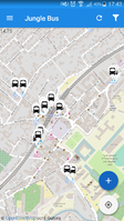
Jungle Bus Mapping Tool. Latest Material Design, add/edit/delete features for bus stops only. |
||||||||||||||||||||||||||||||||||||||||||||||||||||||||||||||||||||||||||||||||||||||||||||||||||||||||||||||||||||||||||||||||||||||||||||||||
| ||||||||||||||||||||||||||||||||||||||||||||||||||||||||||||||||||||||||||||||||||||||||||||||||||||||||||||||||||||||||||||||||||||||||||||||||
Jungle Bus was an Android app for on-site bus stop collection. It is no longer available nor under active development.
It's dedicated to a new generation of users that don't have the patience to learn complicated tools. It's simple, straightforward and efficient.
This java-based app is a fork of OSM Contributor edited by the company Jawg Maps for the Jungle Bus project.
Goal
The main goal is to allow a small group of contributors to simply collect all bus stops within a city to create a transport map.
It's based on the Nicaraguan successful Mapanica project that produced the first Transport map of Managua, the capital of Nicaragua. It's the first transport map of central America.
The Jungle Bus project produces tools to lower the entry barriers for such a project, such as (but not limited to) the Jungle Bus mobile app.
Key features
Available since mid-2017:
- Display bus stops all over the world
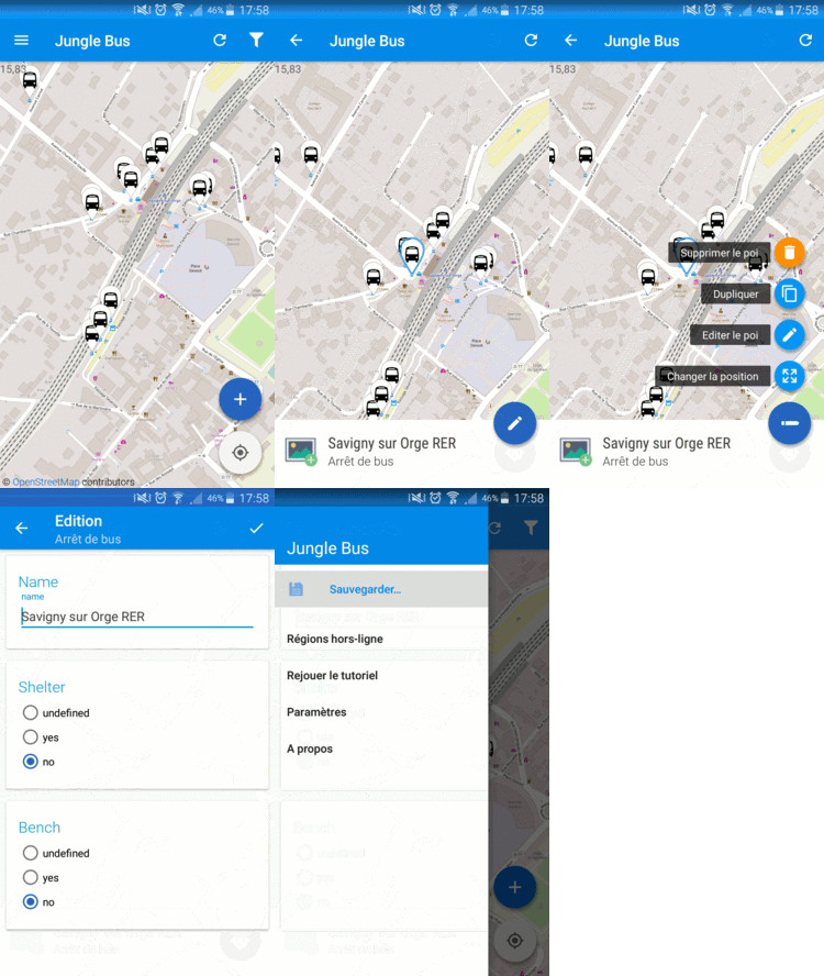
- Easy to create/move/delete bus stops
- Edit details of bus stops such as presence of a shelter or a bench
- Download a zone to work offline: works even in the jungle
- Introduction tutorial for beginners
- Contribute with your own OSM account. Create an OSM account with your Google account if needed
Translation
The app is currently available in French, English, Spanish, German, Russian, Polish, Portuguese and Japanese.
Please help us translate it in your own language.
Released in 2017
- Support public_transport V2 model
- Even simpler forms
- Several bug stability fixes
- Automatic loading of the data while zooming-in on the map
- translation in Japanese
Upcoming features
Soon to be released (in 2018):
- Automatic upload of the data
- Simpler Log-in screen
- Data to be loaded and stored in vectorial format: quicker UI, quicker data loading and less space used to store local data
- Relation edit: add bus relations to bus stops
- Take a bus_stop picture and upload it automatically to Mapillary / possible to use your own Mapillary account / add a Mapillary=* tag to the bus stop
- GPS tracking / upload the GPS trace in OSM
- More translations
Download
Links
- Jungle Bus website
- OSM Contributor mobile app
- Jawg company
- The Github of the app (the OSM Contributor mobile app is the upstream project of the Jungle Bus app)
- Mapanica project


