KAP-charts from OpenSeaMap
KAP-chart bundles are primarily inteded to be used with OpenCPN. They are currently only tested with OpenCPN.
Description
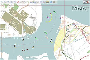
KAP-charts are raster navigational charts (RNC), used for OpenCPN
and other navigation programs and apps like WinNav, SeaClear, etc.
Each chart bundle contains several hundred charts in different scales from overview to harbour charts.
To provide an easy way of use, we prepare these chart bundles and provide a single download link for each bundle. The bundles are packed as .7z and can be unpacked with several tools, but naturally best with SevenZIP. (Link to : http://7-zip.org/download.html)
Download
Actual KAP-chart 2020-10:
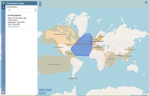
- Click in the Download-Layer the suitable chart and download it
- Alternatively: use the list for the suitable chart
See the Forum for infos, questions and problems already solved. Please share your experiences there, so others can profit and do not fall into the same traps you fell.
Installation
- Unzip: The bundles are packed as .7z and can be unpacked with several tools, but naturally best with SevenZIP. (Link to : http://7-zip.org/download.html). Please use version 15.XX. We had reports of problems with v9.20.
- In OpenCPN register the charts as usual. Our experience is that is is easiest to have a directory containing all your chart bundles, BUT register each bundles directory separately. Then you can rebuild the database partly, change a single bundle etc.
Alternative
- MBTiles are better than KAP charts.


