Key:addr:streetnumber
Jump to navigation
Jump to search


| Description |
|---|
| Secondary house number known as "číslo orientační" in the Czech Republic. |
| Group: addresses |
| Used on these elements |
| Useful combination |
| Status: de facto |
| Tools for this tag |
|
This key contains house numbers, which are known in the Czech Republic as "Číslo orientační"(cs) or in Slovakia as "Číslo orientačné"(sk).
This key is accepted as a part of widely used address tagging system in Czechia and Slovakia.
Usage in Czechia

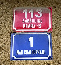
A sign from Brno, 280 is the addr:conscriptionnumber in the Staré Brno district, 39 is the addr:streetnumber on Hybešova street
For instructions on tagging addresses in the Czech Republic see Czech address system(cs).
Usage in Slovakia

A curious case from Levoča where addr:conscriptionnumber (black) and addr:streetnumber (red) are the same number (65/65 in this case)
A page in Slovak documents the current practice in Slovakia.
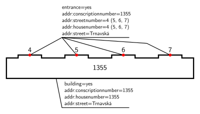
One of the possible ways to tag a building with multiple entrances sharing the same conscription number:

