Key:irrigated
Jump to navigation
Jump to search
| Description |
|---|
| Specifies whether an area of agricultural land is irrigated. |
| Group: agriculture |
| Used on these elements |
| Useful combination |
| See also |
| Status: in use |
| Tools for this tag |
|
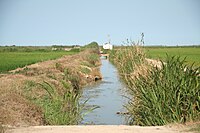
The key irrigated=* is added to an area, usually landuse=farmland, to specify that it is irrigated land. To irrigate is to water plants by bringing in water from pipes, canals, sprinklers, or other man-made means, rather than relying on rainfall alone.
- irrigated=yes is used when the feature is irrigated.
- irrigated=no can be used with an area which is not irrigated, when this would usually be expected (for example, an area used to grown dryland rice instead of a flooded rice paddy).
See also irrigation=pivot which is also used to specify that an area of landuse=farmland or landuse=orchard is irrigated via a center-pivot irrigation system with sprinklers.
