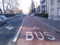
Key:psv:lanes
Jump to navigation
Jump to search
| Description |
|---|
| For describing the legal accessibility by Public Service Vehicles per lane. |
| Group: restrictions |
| Used on these elements |
| See also |
| Status: de facto |
| Tools for this tag |
|
psv:lanes=* - For describing the legal accessibility per lane (Example value: yes|yes|designated). See *:lanes=* and Lanes for the tagging system.
See lanes:psv=* for a different and independent tagging for total number of lanes marked on the way as reserved for Public Service Vehicles (buses, taxis etc.)
Indicated psv:lanes by direction
The direction suffixes can be combined to define the indicated psv:lanes in a specific direction for a way: psv:lanes:backward=* and psv:lanes:forward=*
| psv:lanes=* | psv:lanes:forward=* | psv:lanes:backward=* |
Possible mix-up option
|
psv:lanes="which_includes_numeric_lane_count_information" |
