Key:rapids
 |
| Description |
|---|
| Presence and grade of rapids. |
| Group: waterways |
| Used on these elements |
| Requires |
| Useful combination |
|
| Status: de facto |
| Tools for this tag |
|
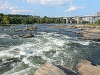
rapids=* is used on water features such as waterway=river or natural=water to indicate the presence and grade of ![]() rapids. It can also be used on
rapids. It can also be used on waterway=rapids or water=rapids features to specify their grades.
Background
Rapids are sections of rivers and streams that flow down steep gradients, causing turbulence. These are a critical concern for the safety and comfort of river paddlers. Even small rapids can pose danger to an unprepared canoeist or kayaker. Clear and comprehensive mapping of rapids can help data users make decisions about whether to paddle a given waterway.
The key is rapids rather than rapid for consistency with waterway=rapids, and since rapids typically occur in groups.
Values
The presence of rapids may be given as a boolean. These values should never be used on waterway=rapids.
If known, the intensity or grade of the rapids should be given using the ![]() international scale of river difficulty. Use Arabic numerals rather than Roman numerals. For example:
international scale of river difficulty. Use Arabic numerals rather than Roman numerals. For example:
rapids=1– easyrapids=2– novicerapids=3– intermediaterapids=4– advancedrapids=5– expertrapids=5.1,rapids=5.2, etc. – orders of magnitude above class 5rapids=6– extreme and exploratory
By extension, some mappers might use zero:
Some rapids may have a plus or minus modifier within their class. Use a hyphen character to represent minuses. For example:
Multiple values may be given if a segment of river has variable conditions over space or time. Use a semicolon to separate values in order of frequency. For example:
rapids=0;2– the rapids range from flatwater to class 2rapids=2;0– the rapids range from flatwater to class 2, with class 2 being more commonrapids=1;0;2– the rapids are mostly class 1, but range from flatwater to class 2
Unrunnable rapids may be given by an X as borrowed from the German river difficulty scale. This should be paired with canoe=no.
rapids=X– not runnable under any conditions
How to map
Tagging features
For watercourses such as waterway=river and waterway=stream, split the way at the points where sections of rapids start and end. Tag each section with the appropriate rapids=* value.
For features that represent rapids, namely waterway=rapids, water=rapids, waterway=waterfall, and waterway=weir, simply add a rapids=* value matching the difficulty grade of the feature. Do not add rapids=yes or rapids=no to these.
Identifying rapids
Determining rapids vs. flatwater in aerial imagery is sometimes easy. However, rapids may appear, disappear, or change intensity depending on the water level. Wind can create the appearance of rapids on actual flatwater. Review multiple aerial imagery sources before making a determination. Use ground-level surveys or imagery where possible. If you cannot be sure if rapids exist, omit the rapids=* tag entirely.
Determining the grade
Rapid difficulty can only be properly determined by experts with experience paddling a river. License-compatible guidebooks and paddling websites are helpful sources. Use the source:rapids=* tag to specify where you found the information (see key:source for syntax). Never guess the grade of a river based on aerial imagery or incomplete knowledge; you can always leave rapids=yes for someone to expand on later.
Useful combinations
The rapids=* tag alone is not sufficient to determine the allowed access of a waterway. An appropriate canoe=* tag should also be present on all waterway segments. Generally you should not assume the proficiency of paddlers when tagging canoe access, though rapids=X would necessitate canoe=no.
Details about rapids on a waterway=* segment can be given with namespaced tags. For example, rapids:name=Haldeman Riffles or rapids:description=Best run in early spring.
Details on waterway=rapids or water=rapids can be given with regular tags, like name=Haldeman Riffles.
Examples
- 1255098697
 1255098697 – Haldeman Riffles on the Susquehanna River
 - 1254502199
 1254502199 – Moshannon Falls on the West Branch Susquehanna River
 - 434097943
 434097943 – rapids node in the Boulder Whitewater Park
 - 667058760
 667058760 – tidal Delaware River with no rapids
Alternative tagging
The rapids=* tag is intended for clarity, brevity, and ease-of-use for both mappers and data consumers. Historically, mappers have used tags under the whitewater namespace to specify the presence and grade of rapids. rapids=* serves as a full replacement for whitewater:rapid_grade=*, whitewater:section_grade=*, and whitewater:grade=*, as well as the use of whitewater=rapid and whitewater=rapids on river segments.
The rapids=* tag can be used alongside whitewater tags, but makes the latter redundant.