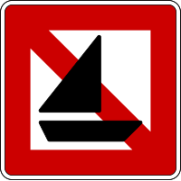
Key:sailboat
Jump to navigation
Jump to search
| Description |
|---|
| Access permission for sailboats |
| Group: restrictions |
| Used on these elements |
| Useful combination |
| See also |
| Status: in use |
| Tools for this tag |
|
sailboat=* specifies whether a waterway (rivers, canals and lakes) is open to inland navigation by vessels under sail. Sailboats under motor are referred as motorboat=*.
Usually the key will extend elements such as:
The value can be defined to 'yes'. On waterways where sailboats cannot navigate, the key can be omitted.
Common values
The waterway is ![]() navigable if one of these tags are used:
navigable if one of these tags are used:
Navigable waterways are rendered in dark green on the OpenRiverBoat map.
