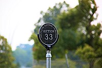
Key:sector:name
Jump to navigation
Jump to search
| Description |
|---|
| Numbered/named part of the cemetery. |
| Used on these elements |
| Status: in use |
| Tools for this tag |
|
This article or section contains questionable, contentious or controversial information. See the talk page for more information.
The details on this page do not reflect actual usage.
sector:name=* - numbered/named part of the cemetery.
Description
Many cemeteries are very big, so they are divided into sectors (sections, blocks, etc). Each sector has hundreds of graves.
Cemetery section usually have an identifier, but can have a dedicated name.sector:name=*.
Mapowanie
Draw the outline of the area ![]() of the sector and add:
of the sector and add:
Additional tags
- ref=* - if the sector has a reference number.
